8 m away
Passage du Dérochoire
A stunning loop taking in some of the best Mont Blanc views you'll find
Difficult Hiking
- Distance
- 14 km
- Ascent
- 1.2 km
- Descent
- 1.2 km
Beautiful loop with enough alternatives to fit any hiker's taste and endurance
Hiking Severe

Although the Tour des Fiz ranks among the must-do hikes of this part of the Alps, the number of alternative trails to choose from along the way means it can take many shapes, depending on your goals, fitness level, and time constraints. A bare-bones (but still amazing) tour can be done in a day, but it can easily be extended to last a week for those less in a hurry. The route presented here tries to strike a middle ground by offering a route that can easily be completed by a decent hiker over a weekend (Friday afternoon start, Sunday finish) while also providing suggestions for those looking to extend their hike.
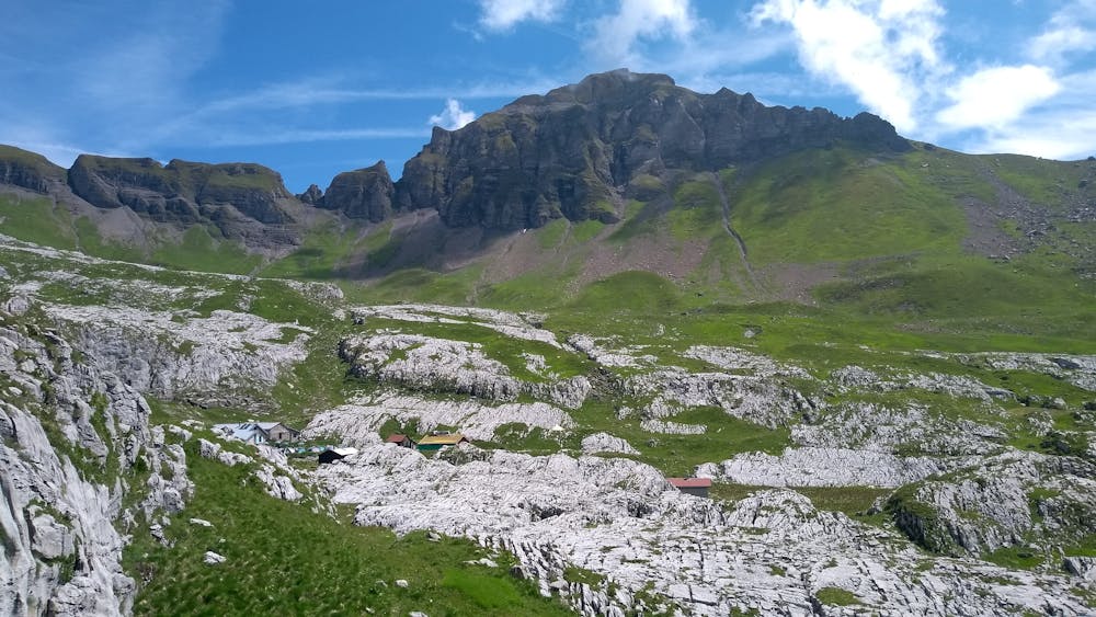
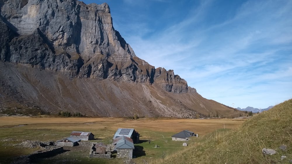
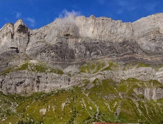
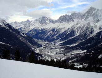
The Tour starts in Plaine Joux where you will have to briefly follow the road to connect with the trail that leads to Refuge de Platé. The climb is steep and will require your full attention for the short, more exposed bit just below les Egratz, before getting gentler as you reach the refuge, which sits at the bottom of the Désert de Platé. Although you’ll have plenty of opportunities to see limestone pavements during the Tour, the most beautiful ones are found in the Désert, so you may want to go have a look, especially if you’re spending the night at the refuge.
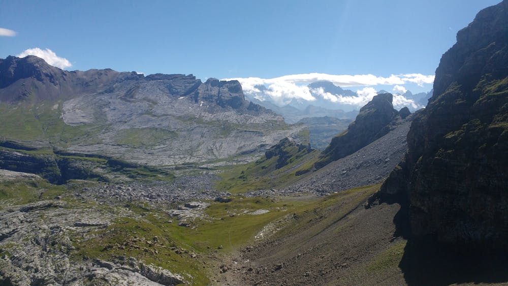
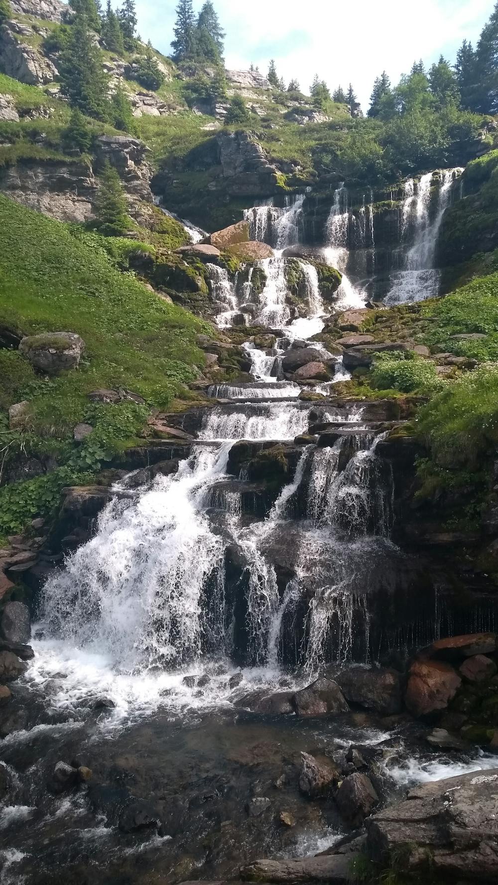
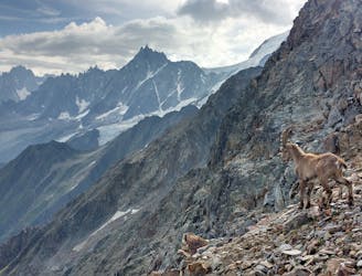
Otherwise, make your way to col de la Portette where, after another steep but thankfully short climb, you will have your first good look at the Fiz mountain range. From there, a long descent will take you first to refuge de Sales and then follow the Torrent de Sales until you get to the Sauffaz and Pleureuse waterfalls (watch out for the smaller ones that you’ll also pass along the way).
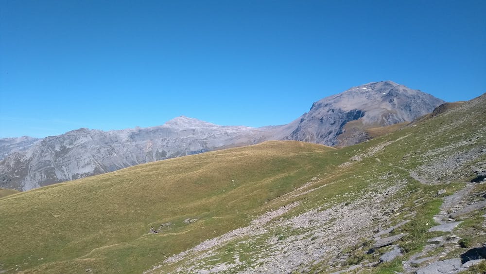
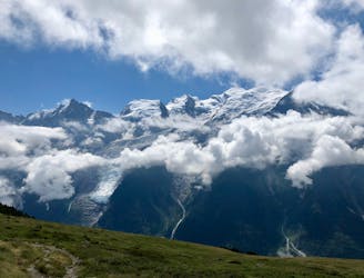
Once you’ve reached them, the second major climb of the Tour starts but is overall easier than the first one, as it’s longer but less steep. The first part, until Collet d’Anterne, offers limited views, but the panorama opens up impressively afterwards, showing you the Buet and the west face of the Fiz range, with the Alfred Wills refuge in the distance, that you will reach quickly after a short descent, a river crossing, and another short climb.
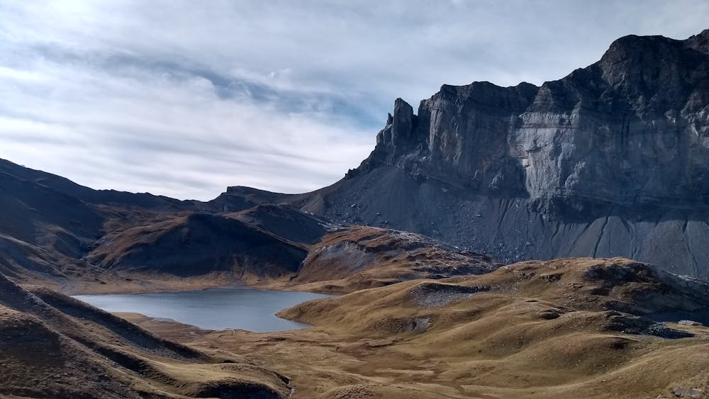
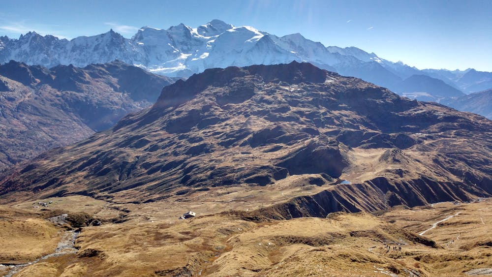
There, don’t take the direct route to lac d’Anterne but instead make your way to petit col d’Anterne; although it’s slightly longer, it’s less steep, less crowded, and more scenic. Pass the lake on the right bank before getting on with the last part of the climb to col d’Anterne, where you will be rewarded with a beautiful view of the Mont-Blanc range.
The descent to refuge de Moede Anterne can be at times steep and technical but is thankfully rather short. Another leisurely 30 minutes is all you need to get to the lac de Pormenaz, which should be less busy than Anterne, in case you want to relax a bit in a quiet place.
This itinerary has you retracing your steps in order to take the easiest option to descend to the Souay huts, but feel free to keep going to descend along La Chorde if you’re interested in a more technical and exposed alternative (steep, fixed chains and steps in the most dangerous parts).
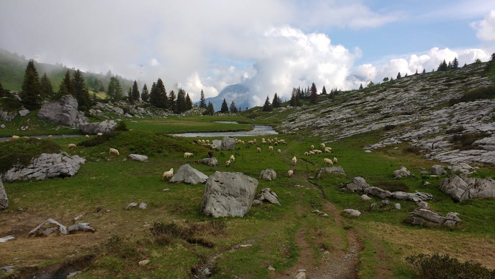
From the huts, follow the gravel road and easy trails until you get to the last lake of the hike, the lac vert, a popular destination for families (there’s a restaurant nearby). Afterward, one last short climb will have you back at the car park.
Severe
Hiking challenging trails where simple scrambling, with the occasional use of the hands, is a distinct possibility. The trails are often filled with all manner of obstacles both small and large, and the hills are very steep. Obstacles and challenges are often unexpected and can be unpredictable.

The trail contains some obstacles such as outcroppings and rock which could cause injury.
Away from help but easily accessed.
8 m away
A stunning loop taking in some of the best Mont Blanc views you'll find
Difficult Hiking
1.5 km away
Discover Europe's largest limestone pavement formation ("désert de Platé")
Severe Hiking
7.5 km away
A pleasant hike with views of the Mont Blanc Massif
Moderate Hiking
7.6 km away
Easy hike to the statue du Christ-Roi.
Moderate Hiking
7.8 km away

Circumnavigate the iconic Mont Blanc massif on this epic multi-day route.
Severe Hiking
7.8 km away

Day 1: A gentle downhill day on the sun-kissed south-facing slopes of the Brévent peak.
Moderate Hiking
7.9 km away

While one of the less interesting sections of the TMB, this stretch still offers a few hidden trail gems.
Moderate Hiking
8.2 km away
A challenging loop showcasing the diversity of the Mont Blanc mountain range.
Severe Hiking
8.9 km away

Escape the crowds at Lac Blanc by hiking to Lac Cornu instead.
Severe Hiking
9.1 km away
Day 2: An excellent day taking in a huge variety of views, from alpine meadows to hanging glaciers and rocky ridges.
Difficult Hiking

6 routes · Hiking

14 routes · Hiking

5 routes · Hiking

12 routes · Hiking