2.7 km away
Willis Lake
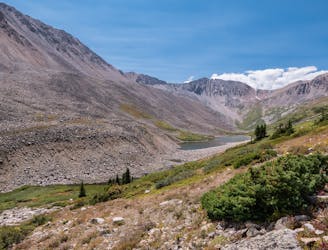
A rugged backcountry hike to a beautiful alpine lake.
Difficult Hiking
- Distance
- 17 km
- Ascent
- 896 m
- Descent
- 896 m
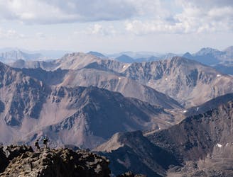
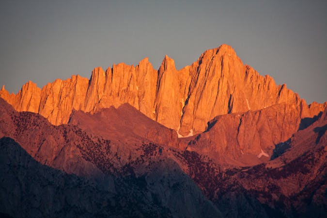
At 14,433', Mt. Elbert is the tallest mountain in Colorado, and second tallest in the lower 48 states, making its summit a much sought-after destination.
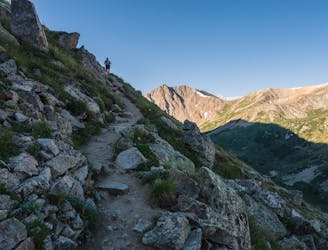
Hiking Severe

Mt. Elbert's lofty stature is both attractive and off-putting; standing at the highest point in Colorado, of course, draws a whole lot of hikers. The dilemma is figuring out how to stand on that notable summit while avoiding the masses en route. The solution is to hike the Southeast Ridge route from the Black Cloud trailhead!
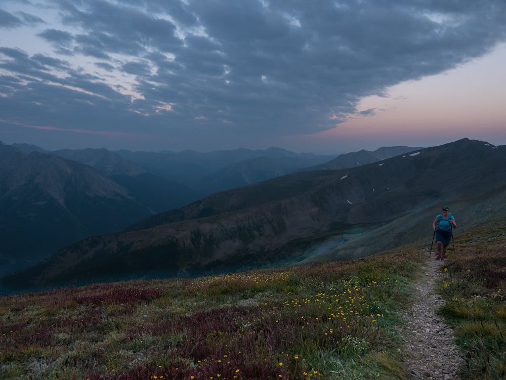
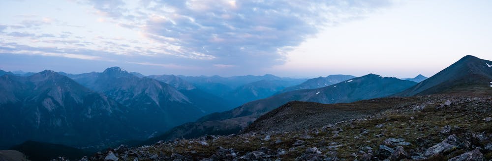
In addition to dodging the crowds, the advantages include summitting 14,134' “South Elbert” along the way and vastly different views than the more popular East Ridge standard route. That being said, know that the Black Cloud Trail is much steeper than the standard Elbert route, climbing nearly 4,000' in the first 3 miles... with 2 miles on Elbert's long ridge still left to go!
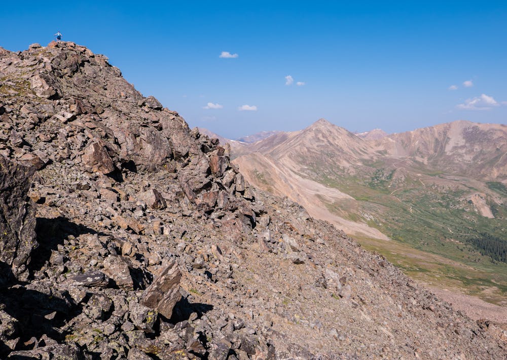
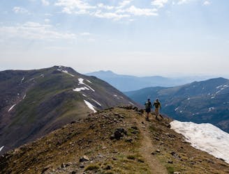
For super energetic hikers, once gaining Elbert's ridge, and before beginning the trek up and over “South Elbert”, it is possible to dash a third of a mile in the opposite direction to tag 13,588' Mt. Cosgriff. While there, take a few more steps to get a great view of the Twin Lakes way down below.
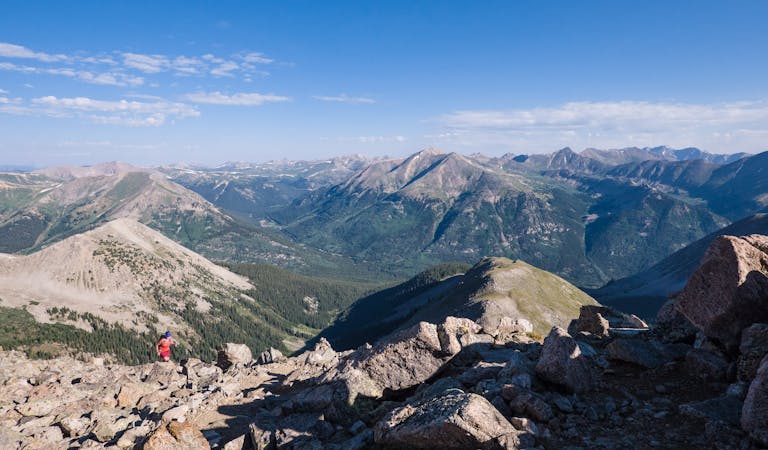
The remaining hike is not at all technically difficult, but does require a strong mindset; the summit of Mighty Mt. Elbert is still a significant distance away. Have a snack, take a breather, and get to it.
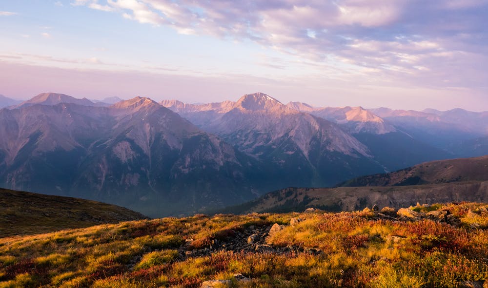
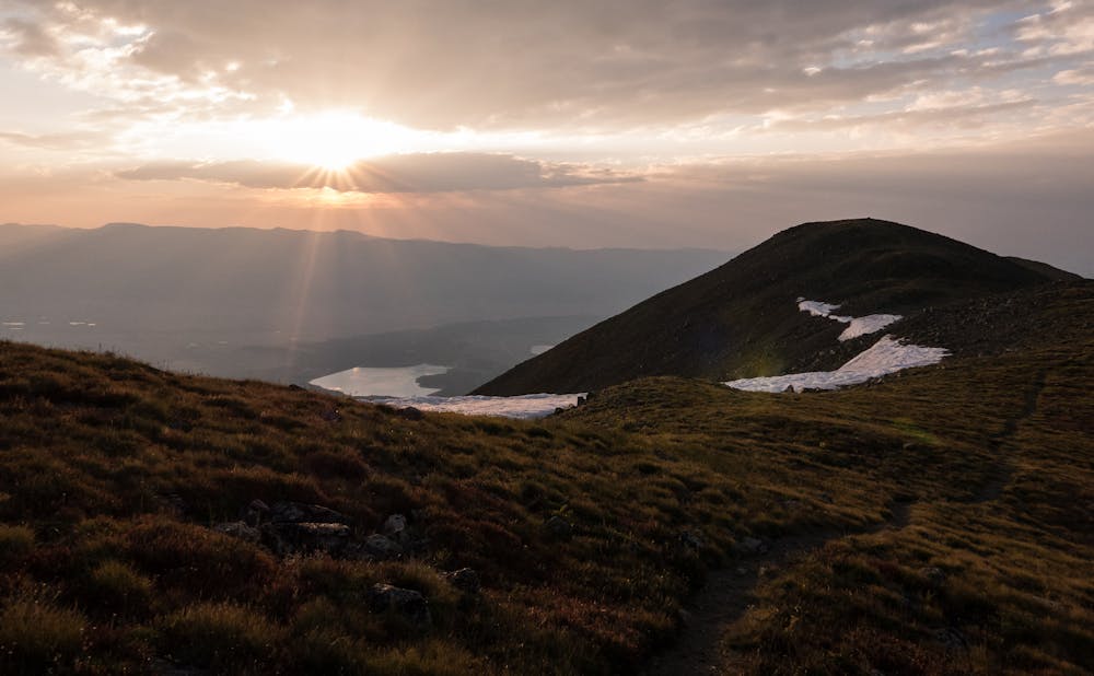
Be sure to appreciate the summit of 14,134' “South Elbert”, though it may not be “official”, since it lacks the requisite 300' elevation loss between it and Mt. Elbert. That, however, feels like semantics when the hike starts at 9,700' and gains 4,434' to the 14,134' summit. In fact, making “South Elbert” the destination is a worthy goal on its own, particularly when you have the summit to yourself as you gaze over at the throng 2 miles away on Mt. Elbert.
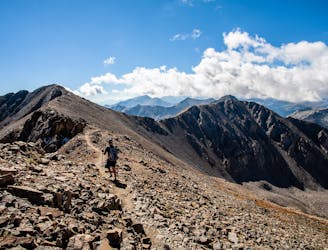
After time to reflect on the beauty and solitude, begin the gentle descent of “South Elbert” en route to the remaining talus ascent to the highest point in all of the Rocky Mountains.
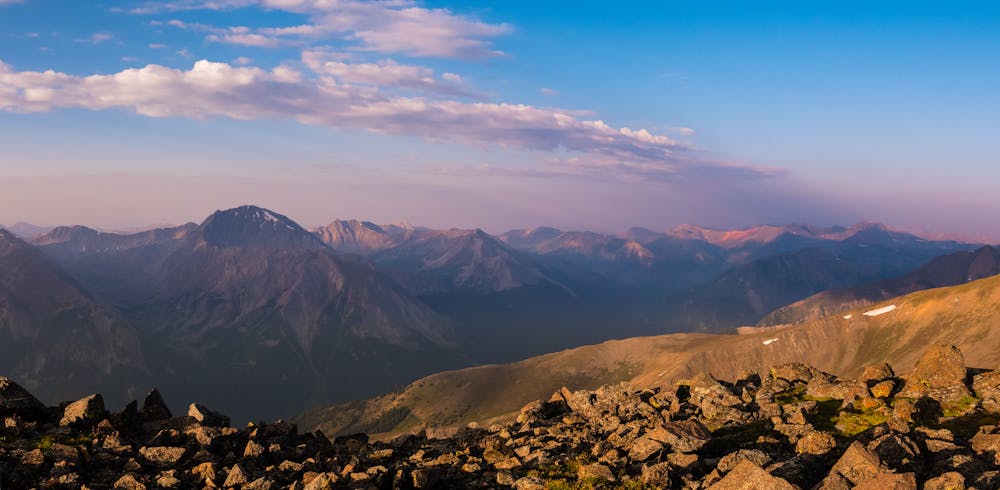
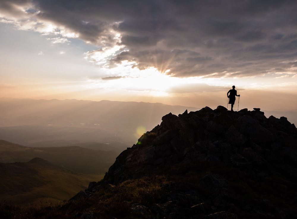
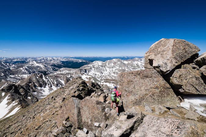
Join the numerous other happy hikers on 14,433' Mt. Elbert, the high point of Colorado, as the expansive view of Leadville and the Arkansas River Valley comes into sight. Relish the knowledge that the only humans in the lower 48 states standing above this point are on California's 14,505' Mt. Whitney.
Be sure to allow ample time for hiking the Southeast Ridge route. There is still 2 miles above 13,000' on the return trip, so getting back to treeline, thus avoiding the afternoon lightning, by noon will take some time!
Severe
Hiking challenging trails where simple scrambling, with the occasional use of the hands, is a distinct possibility. The trails are often filled with all manner of obstacles both small and large, and the hills are very steep. Obstacles and challenges are often unexpected and can be unpredictable.

Some trail sections are extremely exposed where falling will almost certainly result in serious injury or death.

Away from help but easily accessed.
2.7 km away
A rugged backcountry hike to a beautiful alpine lake.
Difficult Hiking
6.2 km away
14,336-foot La Plata Peak's Northwest Ridge Route may be the “standard” route, but it is certainly an above average hike!
Extreme Hiking
6.6 km away
A narrow singletrack passage paralleling US-24 to the west as the CDT circles around Leadville.
Difficult Hiking
9.4 km away
Two 14er summits, a beautiful pass, and 6,146' elevation gain over 12.2 miles is a wonderful way to spend a day in the Sawatch Range.
Severe Hiking
9.4 km away
An autumn backpacking excursion in Missouri Gulch is the best way to experience the splendor of 14,067' Missouri Mountain.
Extreme Hiking
9.7 km away
The Southwest Slopes route is the perfect way to summit 14,421' Mt. Massive: short, steep and secluded.
Severe Hiking
10 routes · Alpine Climbing · Hiking

16 routes · Hiking

7 routes · Alpine Climbing · Hiking
13 routes · Alpine Climbing · Hiking

46 routes · Alpine Climbing · Hiking
5 routes · Alpine Climbing · Hiking
10 routes · Alpine Climbing · Hiking

10 routes · Hiking

40 routes · Hiking