0 m away
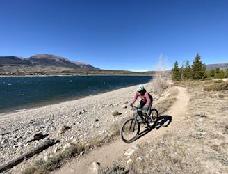
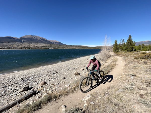
Colorado Trail: Ten Mile Range Bypass
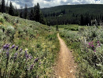
Many Colorado Trail bikepackers opt to bypass around the ultra-steep Ten Mile Range using this route.
Easy Mountain Biking
- Distance
- 19 km
- Ascent
- 285 m
- Descent
- 132 m
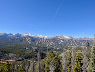
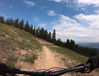
The most well-known mountain bike trail in Breckenridge.
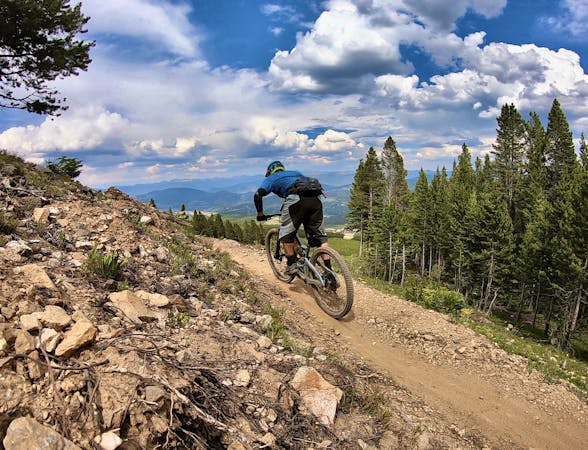
Mountain Biking Difficult

Whether or not the Peaks Trail is the best mountain bike trail in Breckenridge, a ride worth checking out once, or not worth your time and a route that you should just skip over, depends entirely upon who you ask.
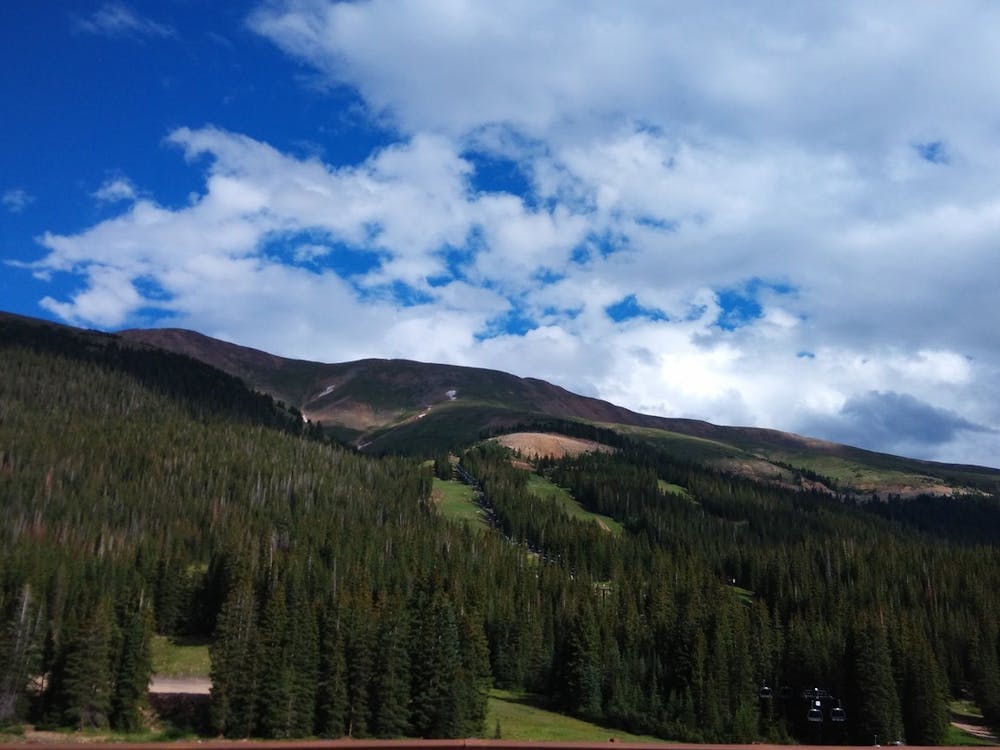
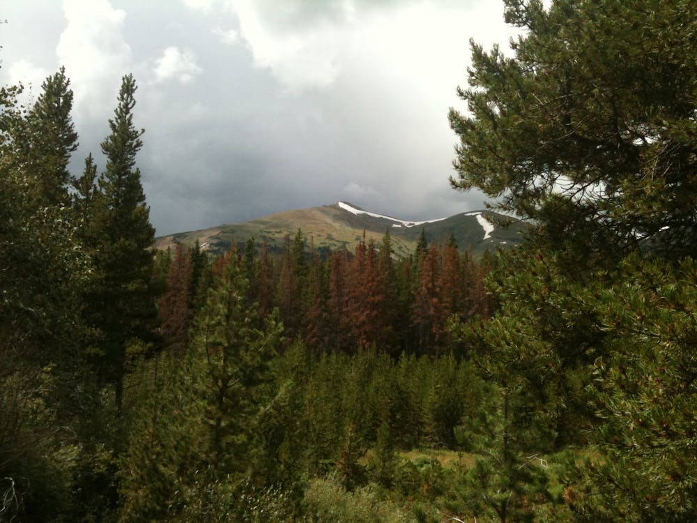
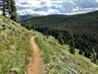
In a nut shell, the Peaks Trail is a cross country mountain bike trail that is constantly climbing or descending. The “trail follows an old mining road from the 1800’s and has a section that runs alongside an aqueduct that was built by miners to funnel and sift water containing precious gold and silver,” according to Mark Grattan on BestOfBreck.com. As you can imagine from such a description, this 9-mile route isn’t a ripping descent, which automatically causes some enduro-oriented mountain bikers to check out and skip over it.
That said, if you’re willing to pedal up repeated climbs, the Peaks Trail will reward you with a high-caliber sub alpine mountain bike ride through the Colorado High Country! As the Peaks Trail makes it’s way across the flanks of the Tenmile Range from Peak 1 to Peak 10, the trail stays "mostly in the lodgepole pine forest along with some aspen, spruce and fir forests,” according to the US Forest Service. This moderate altitude (by Colorado standards) makes this trail very approachable for intermediate riders who may be scared off by the big climbs and serious exposure of the above-treeline trails in the area. Also, while it’s always good to be aware of the weather and the danger of lightning and thunderstorms in the high country, staying down in the trees reduces your exposure to danger.
Despite being characterized as an up-and-down cross country trail, don’t expect the trail tread to be buttery smooth. SummitDaily.com characterizes the Peaks Trail as "a rocky, rooty, adrenaline-pumping route that connects Breckenridge to Frisco, with diverse singletrack on flowy terrain.”
Prepare for climbs and prepare for chunk, but most of all, prepare to have a good time!
Sources: https://www.bestofbreck.com/peaks-trail-overview/ https://www.summitdaily.com/news/sports/summit-daily-bike-guide-peaks-trail-video/ https://www.fs.usda.gov/recarea/whiteriver/recreation/recarea/?recid=40691&actid=24
Difficult
Mostly stable trail tread with some variability featuring larger and more unavoidable obstacles that may include, but not be limited to: bigger stones, roots, steps, and narrow curves. Compared to lower intermediate, technical difficulty is more advanced and grades of slopes are steeper. Ideal for upper intermediate riders.

The path is on completely flat land and potential injury is limited to falling over.
Close to help in case of emergency.
0 m away
Many Colorado Trail bikepackers opt to bypass around the ultra-steep Ten Mile Range using this route.
Easy Mountain Biking
4.8 km away
A masterfully-built downhill flow trail.
Difficult Mountain Biking
4.9 km away

An excellent beginner loop through the complex Summit County trail system.
Easy Mountain Biking
5.1 km away
Superb early season pedaling on beginner-friendly singletrack.
Easy Mountain Biking
6 km away
An easy out-and-back gravel ride from downtown Breck to the top of Boreas Pass.
Easy Mountain Biking
7.3 km away
A popular intermediate ride in the Breckenridge area combining both new school and old school singletrack.
Difficult Mountain Biking
7.6 km away
A gorgeous cross country ride around a beautiful valley.
Easy Mountain Biking
7.7 km away
As smooth and flat of a beginner mountain bike loop as you'll find just about anywhere in Colorado.
Easy Mountain Biking
8.3 km away
A flowy beginner trail running top-to-bottom in the Breckenridge Bike Park.
Easy Mountain Biking
8.3 km away
A slightly chunkier descent that still only ranks as an intermediate singletrack trail.
Moderate Mountain Biking

26 routes · Mountain Biking
9 routes · Mountain Biking
11 routes · Mountain Biking
5 routes · Mountain Biking