1 m away
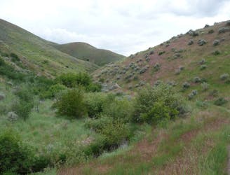
Cottonwood Creek Loop

Short and easy hike among prairie and forest near a little creek.
Easy Hiking
- Distance
- 2.4 km
- Ascent
- 29 m
- Descent
- 29 m
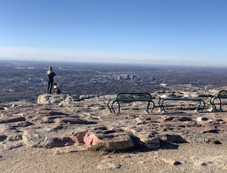
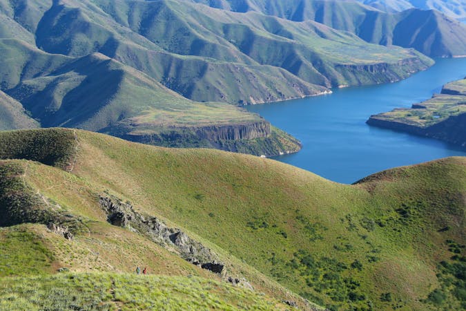
Hike uphill to nice views from both sides of a ridge near downtown Boise.
Hiking Moderate

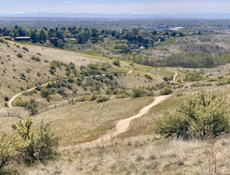
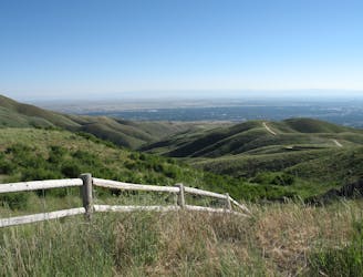
This is one of a few loop variations you can do on Eagle Ridge, which is part of the Military Reserve trail system. This loop finds nice views from a few different overlooks on two sides of the ridge: On one side is the wooded gulch of Cottonwood creek, and on the other is downtown Boise, with a picturesque perch on a rocky outcrop.
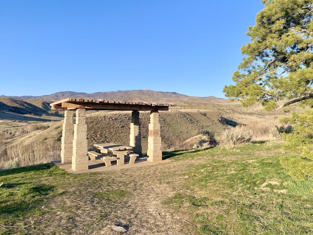
Start from the Cottonwood Creek trailhead and walk through the woods to reach a steep staircase on the hillside. At the top of the stairs, you'll join an old paved road, which twists farther up the hill to a junction with more dirt trails. A left turn here will take you to a little picnic pavilion overlooking the creek and the foothills. A right turn leads to the outcrop above the city. Go to either one first, then keep walking around the top of the ridge to see the other and complete the loop.
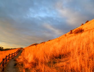
These trails can be good at any time of year, but are best avoided when they might be icy or muddy because of the steepness. It's also not the best place on a hot day because the ridge gets full sun and offers no shade.
Moderate
Hiking along trails with some uneven terrain and small hills. Small rocks and roots may be present.

The path is on completely flat land and potential injury is limited to falling over.
Close to help in case of emergency.
1 m away
Short and easy hike among prairie and forest near a little creek.
Easy Hiking
1 m away
A loop with some elevation gain and varied scenery, using Ridge Crest and Central Ridge trails
Moderate Hiking
2.3 km away

A short loop with a lot of variety, and different sights for every season.
Easy Hiking
2.4 km away
Scenic loop with steep hills and shady forest in the North End of Boise.
Moderate Hiking
2.4 km away
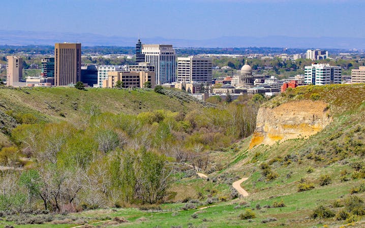
Quick hike in the foothills near downtown, with striking geology and sweeping views of the city.
Moderate Hiking
2.4 km away
Boise's #1 hike, plus bonus scenery by making the loop.
Difficult Hiking
2.5 km away
A nicely varied loop in the foothills near downtown, through a sheltered creek valley and across panoramic slopes.
Moderate Hiking
2.5 km away
A short and scenic loop with views over the city and some colorful geology.
Easy Hiking
3.4 km away
A scenic jaunt close to downtown, in a network of many popular trails.
Moderate Hiking
4.5 km away
A hiker-only trail with gorgeous views and lessons on nature in the Boise Foothills.
Moderate Hiking
10 routes · Hiking
10 routes · Hiking