3 m away
Quarry Trail and Eagle Rock Loop
Quick hike in the foothills near downtown, with striking geology and sweeping views of the city.
Moderate Hiking
- Distance
- 3 km
- Ascent
- 111 m
- Descent
- 111 m
Boise's #1 hike, plus bonus scenery by making the loop.
Hiking Difficult

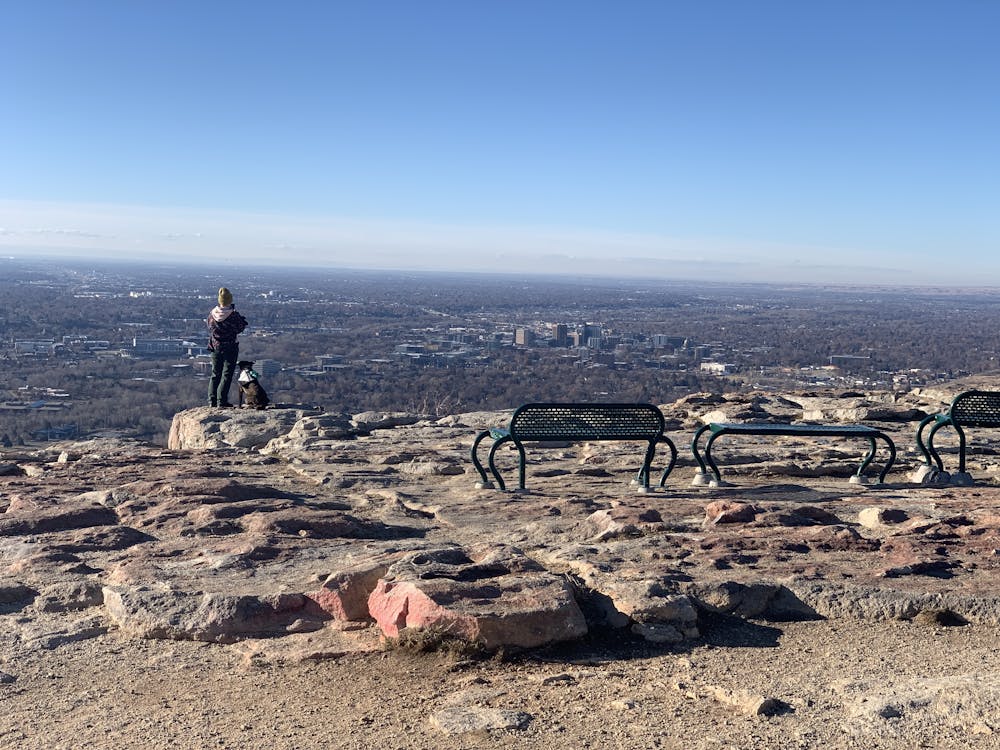
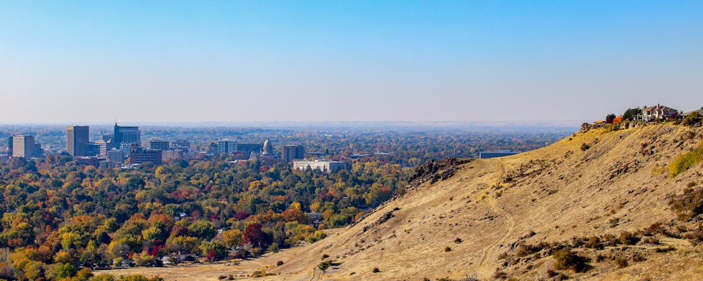
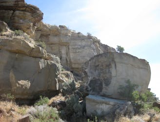
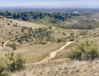
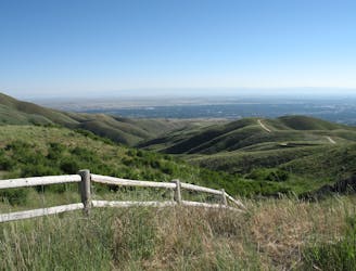
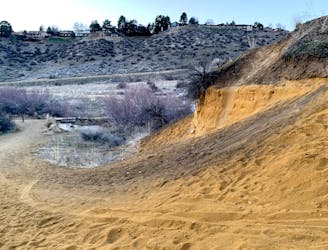
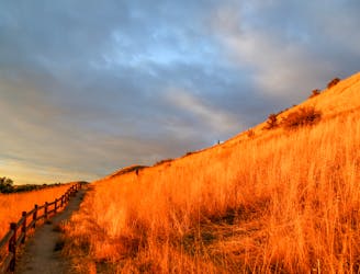
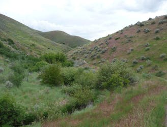
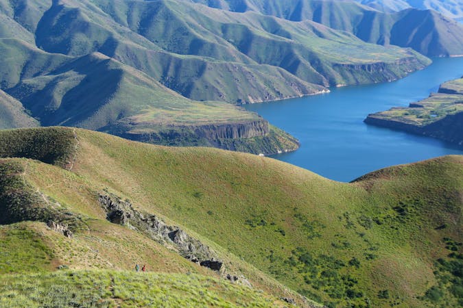
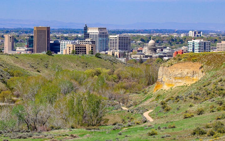
Table Rock is a frontrunner for Boise's most popular hike. It begins close to downtown and climbs to a cliff-top view over the city. Most people go to the overlook and back the same way, but this loop adds a lot more scenery with a little extra distance. On the loop you'll circle the top of the mesa, see an old quarry, and admire Table Rock's cliffs from both above and below.
The Table Rock Trail is quite steep, and can be slippery in places. It's important to only go when the ground is dry–not after rain or while snow is melting–for safety and because the trails are easily damaged when muddy. The steepest parts are near the beginning, so if you can push through the first half mile you can definitely make it the rest of the way. Views are fantastic all along, but reaching the top is definitely worth it.
To complete the loop as mapped, you'll follow the wide trail to the upper parking area, then start The Table Rock Quarry Trail. This trail loops around the old quarry and the far side of the mesa, then makes a panoramic traverse beneath the cliffs to rejoin the main trail.
Difficult
Hiking trails where obstacles such as rocks or roots are prevalent. Some obstacles can require care to step over or around. At times, the trail can be worn and eroded. The grade of the trail is generally quite steep, and can often lead to strenuous hiking.

The trail contains some obstacles such as outcroppings and rock which could cause injury.

Close to help in case of emergency.
3 m away
Quick hike in the foothills near downtown, with striking geology and sweeping views of the city.
Moderate Hiking
2.4 km away
Hike uphill to nice views from both sides of a ridge near downtown Boise.
Moderate Hiking
2.4 km away

Short and easy hike among prairie and forest near a little creek.
Easy Hiking
2.4 km away
A loop with some elevation gain and varied scenery, using Ridge Crest and Central Ridge trails
Moderate Hiking
4.7 km away
A nicely varied loop in the foothills near downtown, through a sheltered creek valley and across panoramic slopes.
Moderate Hiking
4.7 km away
A short and scenic loop with views over the city and some colorful geology.
Easy Hiking
4.7 km away

A short loop with a lot of variety, and different sights for every season.
Easy Hiking
4.7 km away
Scenic loop with steep hills and shady forest in the North End of Boise.
Moderate Hiking
5.2 km away

A steep hike through prime wildlife habitat, and with exceptional wildflowers in spring.
Moderate Hiking
5.4 km away
A hiker-only trail with gorgeous views and lessons on nature in the Boise Foothills.
Moderate Hiking
10 routes · Hiking
10 routes · Hiking