8 m away
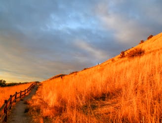
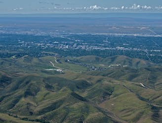
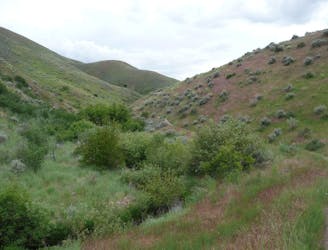
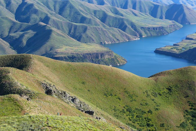
Lower Hulls Gulch and Red Cliffs Loop
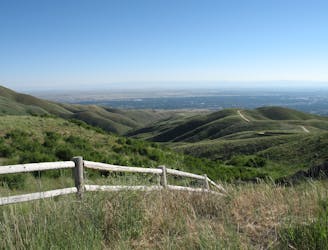
A nicely varied loop in the foothills near downtown, through a sheltered creek valley and across panoramic slopes.
Moderate Hiking
- Distance
- 8.6 km
- Ascent
- 207 m
- Descent
- 207 m
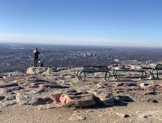
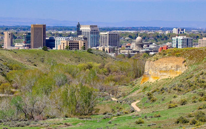
A short and scenic loop with views over the city and some colorful geology.
Hiking Easy

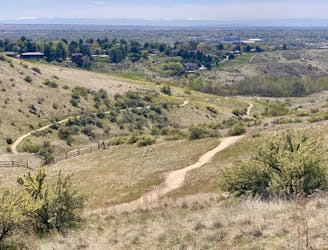
This is one loop in the popular Hulls Gulch trail network, just outside of downtown Boise. Though it's only one possibility of many here for a short hike or jog, this loop with Red Cliffs and Kestrel trails is particularly good. It has just the right amount of elevation gain and distance to make a quick workout, but there's also plenty of scenery you could choose to slow down and enjoy.
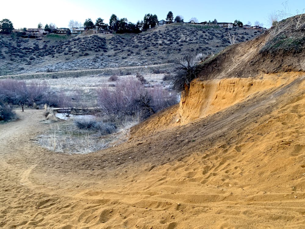
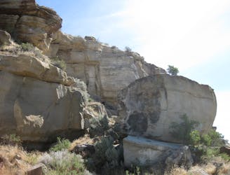
The Red Cliffs trail goes up a little canyon between two strikingly red outcrops of sandstone. This is a visibly soft rock layer, eroding into sand that partially covers the trail. From there, Red Cliffs climbs onto a ridge with scattered sagebrush bushes, and excellent views over the city. A flatter section curves along the ridge crest before descending quickly on Kestrel trail and returning to the parking lot.
Easy
Walking along a well-kept trail that’s mostly flat. No obstacles are present.

The path is on completely flat land and potential injury is limited to falling over.
Close to help in case of emergency.
8 m away
A nicely varied loop in the foothills near downtown, through a sheltered creek valley and across panoramic slopes.
Moderate Hiking
840 m away
Scenic loop with steep hills and shady forest in the North End of Boise.
Moderate Hiking
852 m away

A short loop with a lot of variety, and different sights for every season.
Easy Hiking
1.9 km away
A scenic jaunt close to downtown, in a network of many popular trails.
Moderate Hiking
2.5 km away

Short and easy hike among prairie and forest near a little creek.
Easy Hiking
2.5 km away
A loop with some elevation gain and varied scenery, using Ridge Crest and Central Ridge trails
Moderate Hiking
2.5 km away
Hike uphill to nice views from both sides of a ridge near downtown Boise.
Moderate Hiking
3.2 km away
A hiker-only trail with gorgeous views and lessons on nature in the Boise Foothills.
Moderate Hiking
4.7 km away
Quick hike in the foothills near downtown, with striking geology and sweeping views of the city.
Moderate Hiking
4.7 km away
Boise's #1 hike, plus bonus scenery by making the loop.
Difficult Hiking
10 routes · Hiking
10 routes · Hiking