3 m away
Table Rock Loop
Boise's #1 hike, plus bonus scenery by making the loop.
Difficult Hiking
- Distance
- 6.2 km
- Ascent
- 275 m
- Descent
- 275 m
Quick hike in the foothills near downtown, with striking geology and sweeping views of the city.
Hiking Moderate

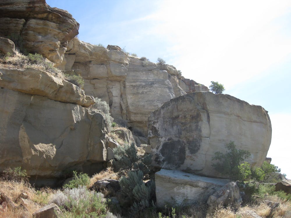
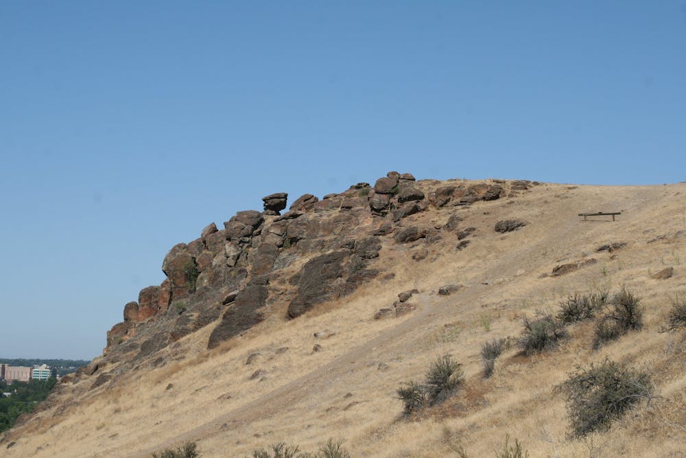
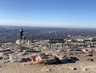
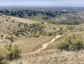
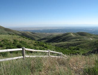
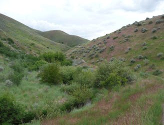
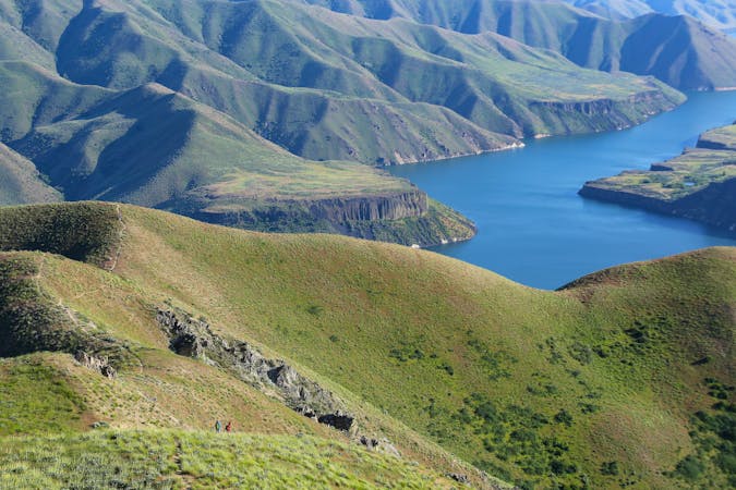
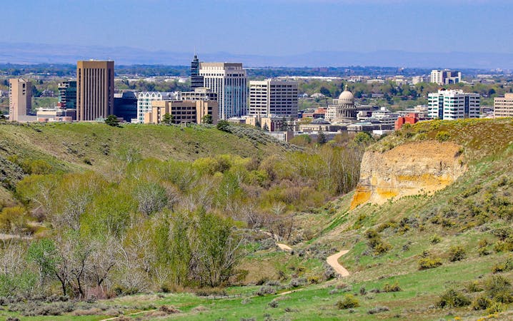
Eagle Rock (also known as Castle Rock) is a volcanic outcrop above Boise’s East End, forming a dramatic balcony in the foothills overlooking the city. It’s part of an urban recreation area called Chief Eagle Eye Reserve, named after a leader of Northern Shoshone people who once lived nearby, but were forced to reservations in the 19th century. Eagle Rock is the translated name they gave to this stand-out formation. The Eagle Rock Loop is a great hike for families or for anyone seeking a quick outing near the city, and it grants a tantalizing preview of the many hiking opportunities near Boise.
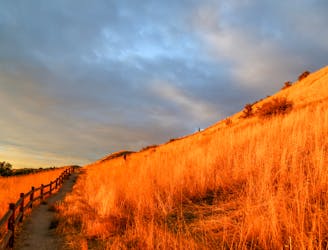
Eagle Rock is close to Boise’s better-known Table Rock, and these popular hikes begin from the same trailhead at the Old Penitentiary. Abundant trails provide various options for loops. The one mapped here utilizes Quarry Trail plus two trails named after Native tribes of the region. The hike is not long, but has some steep and rocky sections. An aerobic climb takes you rapidly up a grassy ridgeline, dotted with sagebrush and juniper, and studded with boulders. You’ll pass by some houses and share their grand view over the city, then reach the promontory of Eagle Rock. Complete the loop by following the trail down to the edge of the city, and returning to the parking lot.
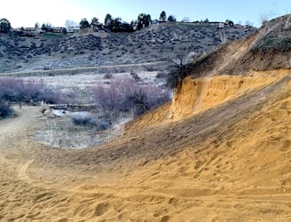
Note: The clay-rich soils here are highly erodible, so the trails are easily damaged when muddy. The city may actually close these trails at certain times, but you should always avoid them when wet conditions make the surface unstable. Save this hike for a clear and dry day, when you’ll get maximum enjoyment from firm trails and vast views.
Sources: https://www.idahostatesman.com/outdoors/hiking/article229319274.html https://www.ridgetorivers.org/trails/detailed-area-descriptions/table-rock-area/
Moderate
Hiking along trails with some uneven terrain and small hills. Small rocks and roots may be present.

The trail contains some obstacles such as outcroppings and rock which could cause injury.

Close to help in case of emergency.
3 m away
Boise's #1 hike, plus bonus scenery by making the loop.
Difficult Hiking
2.4 km away
Hike uphill to nice views from both sides of a ridge near downtown Boise.
Moderate Hiking
2.4 km away

Short and easy hike among prairie and forest near a little creek.
Easy Hiking
2.4 km away
A loop with some elevation gain and varied scenery, using Ridge Crest and Central Ridge trails
Moderate Hiking
4.7 km away
A nicely varied loop in the foothills near downtown, through a sheltered creek valley and across panoramic slopes.
Moderate Hiking
4.7 km away
A short and scenic loop with views over the city and some colorful geology.
Easy Hiking
4.7 km away

A short loop with a lot of variety, and different sights for every season.
Easy Hiking
4.7 km away
Scenic loop with steep hills and shady forest in the North End of Boise.
Moderate Hiking
5.2 km away

A steep hike through prime wildlife habitat, and with exceptional wildflowers in spring.
Moderate Hiking
5.4 km away
A hiker-only trail with gorgeous views and lessons on nature in the Boise Foothills.
Moderate Hiking
10 routes · Hiking
10 routes · Hiking