6 m away
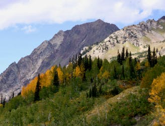
Devils Castle Traverse to Sunset Peak
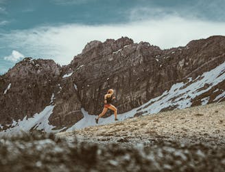
A fun ridgeline traverse over Devils Castle to Sunset Peak at Alta Ski Area.
Extreme Hiking
- Distance
- 9.3 km
- Ascent
- 690 m
- Descent
- 690 m
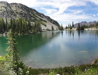
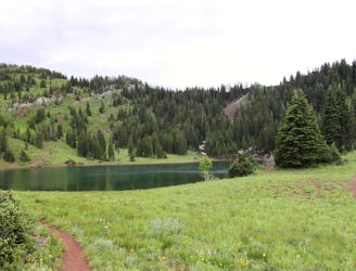
A short and family-friendly hike to a beautiful alpine lake
Hiking Moderate

Easily accessed from Albion Basin Campground (which - due its high altitude location and the famously deep Utah snowpack - is only open from mid-June to mid-September), this is a fantastic hike into a wild-feeling lake in amongst stunning alpine peaks. Even the drive to the trailhead from Salt Lake City is stunning, and takes you through the famous Alta ski area.
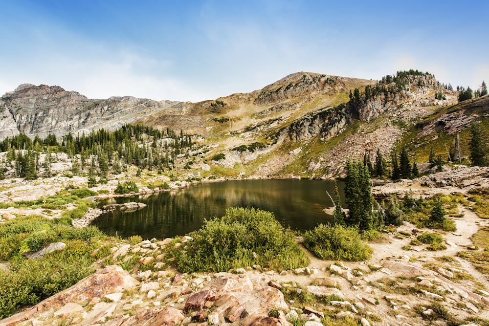
The trail is approximately 1.5 miles long, and is moderately difficult but never technical, making it ideal for younger or less experienced hikers. The path gradually ascends through Albion Basin, offering panoramic views of the surrounding mountains and valleys along the way.
Once you reach the lake, you'll be greeted by crystal-clear waters reflecting the surrounding peaks. The peaceful ambiance and the tranquil atmosphere make it a popular spot for relaxing and soaking in the (pretty epic!) surroundings. You can take a leisurely stroll around the lake, have a picnic on its shores, or simply enjoy the beauty of the surroundings. There are also plenty of detours and add-ons possible, such as climbing Mount Baldy or Sugarloaf Mountain.
It's important to note that the Cecret Lake area is part of the Uinta-Wasatch-Cache National Forest, and it is essential to respect and follow any regulations or guidelines set by the forest service or local authorities. It's always a good idea to check the latest trail conditions and any permit requirements before planning a visit to Cecret Lake.
It's also worth saving this for a bluebird day because bad weather at this altitude feels pretty brutal!
Moderate
Hiking along trails with some uneven terrain and small hills. Small rocks and roots may be present.

The trail contains some obstacles such as outcroppings and rock which could cause injury.

Little chance of being seen or helped in case of an accident.
6 m away
A fun ridgeline traverse over Devils Castle to Sunset Peak at Alta Ski Area.
Extreme Hiking
17 m away
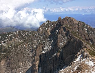
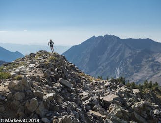
Hiking Devil's Castle is a difficult scramble on an iconic Wasatch peak high above Alta ski area.
Extreme Hiking
18 m away
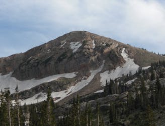
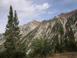
Sugarloaf is a simple and relatively easy hike to the top of one of the Wasatch mountains 11,000 foot peaks.
Moderate Hiking
2.4 km away
The most iconic and well-known peak in the Wasatch Mountains.
Severe Hiking
3.4 km away
A mixed scramble, hike, and trail running loop in Big Cottonwood Canyon featuring Brighton Resort's Major Peaks
Extreme Hiking
5.8 km away
This is a strenuous, but classic hike that contains a mix of shaded forrest and high alpine environments.
Extreme Hiking
5.8 km away
White Pine trail is a classic moderate hike that follows an old jeep road high up into the central Wasatch to enjoy a quiet pristine lake in the rugged alpine landscape
Moderate Hiking
7.5 km away
The Days Fork trail is a little over 7 miles round trip with some good elevation gain through a heavily wooded canyon that opens up into the Alpine as you gain the Little Cottonwood Ridge.
Difficult Hiking
8.5 km away
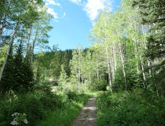
This is a lovely moderate hike through some large aspen groves reaching a quiet little lake.
Moderate Hiking
8.5 km away
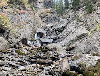
Scenic hike to a small waterfall in a narrow canyon.
Moderate Hiking

10 routes · Hiking

10 routes · Hiking

10 routes · Alpine Climbing · Hiking