3 m away
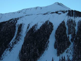
Subsummit of the Third Burroughs
Another great south facing line within Glacier Basin
Difficult Ski Touring
- Distance
- 13 km
- Ascent
- 1.1 km
- Descent
- 1.1 km
Climbing up the Emmons and descending down the Interglacier in powder
Ski Touring Difficult

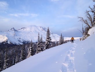
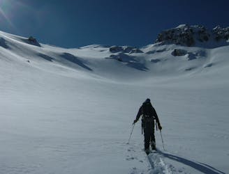
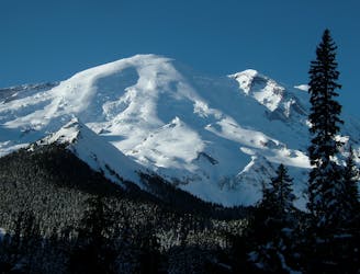
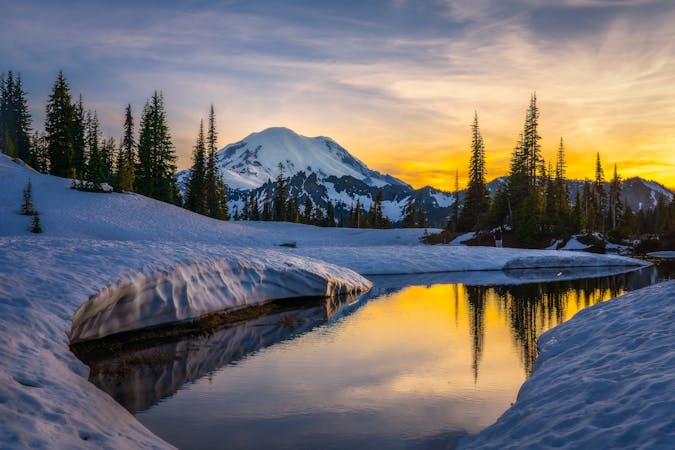
If you’ve spent any time on the Eastern Side of Mount Rainier National Park there is a good chance you’ve seen the Interglacier. Even though it is off of a sub peak it seems to blend into the Glacial landscape up high. While the main way to get to this iconic line is via the Glacier Basin trail I like to think of the Emmons approach as the winter route. Is it faster….no does it make the exit easier…no but climbing wise I think it is a bit easier and way more scenic. Since this ski tour is mainly in the alpine it is critical that you do this trip on a sunny day.
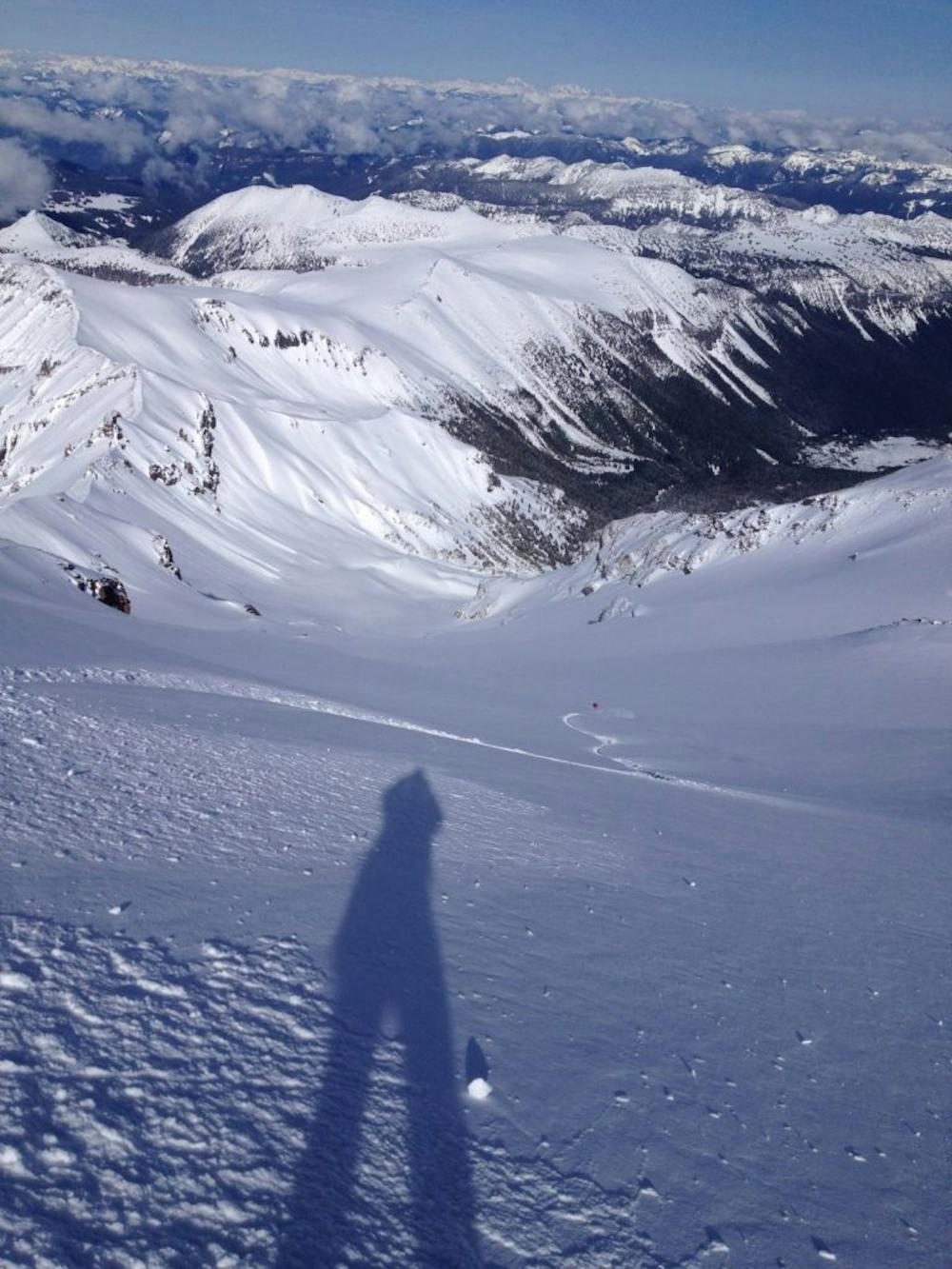
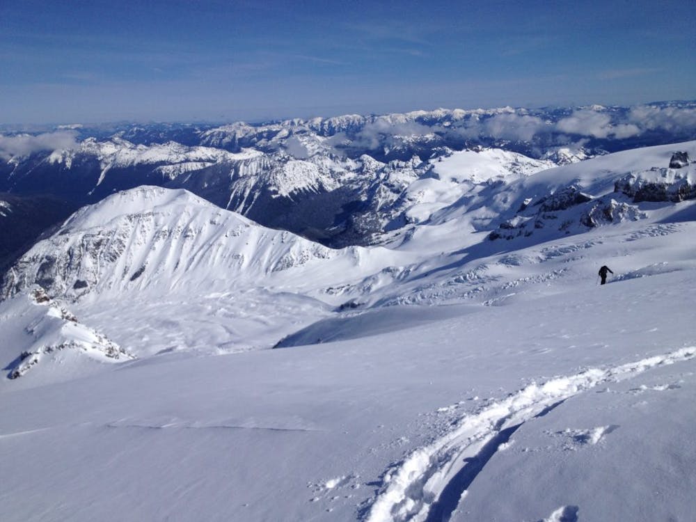
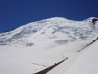
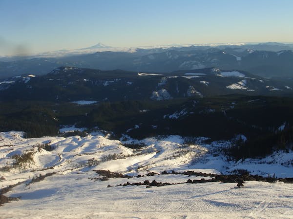
During the winter the only way to access White River Campground is a 16 mile snowmobile ride from Crystal Mountain Boulevard to the White River Campground. Starting the tour you need to start heading up the Glacier Basin trail and just before the first avalanche swath drop down to the creek. During the Summer this is the Emmons Moraine trail but it will be buried under snow. With a few well placed switchbacks make your way up and over the moraine before heading down to Ghost Lake. Heading to the western edge you should have open trees leading up to the Emmons Glacier. Sticking on the lookers right start climbing the glacier but make sure to give space between you and the slopes to your right incase they slide.
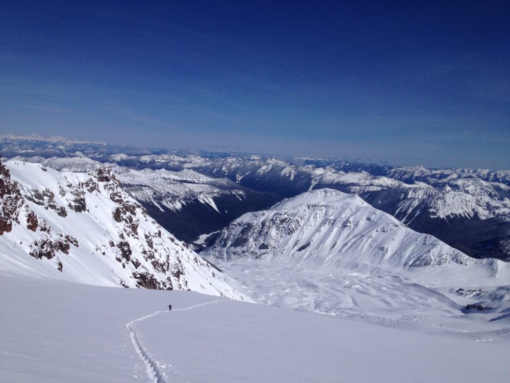
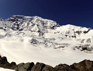
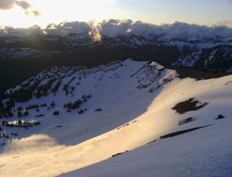
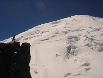
At around 9,200 foot start making a hard traverse lookers right towards the entrance ramp to the Interglacier. From here just keep following the ridge until arriving on top of Steamboat Prow. Now you have a perfect view of the entire northeast side of Mount Rainier National park with the Interglacier directly below you. Drop in and enjoy laying tracks on the blank canvas all the way into the basin. Once the slopes start mellowing out make sure to keep up your speed and with a little bit of luck you can ride down to 5,800 feet. Now you need to switch over to skinning for a few seconds heading north to get onto the Glacier Basin Trail.
Since you climbed up the Emmons Glacier you will be breaking trail down the Glacier Basin Trail. While it is somewhat easy you will have to be careful that you are staying on it. If you have a skier with you it makes life much easier but if just snowboarding you will have to bootpack numerous spots. Soon enough you will be exhausted and arriving back at the White River Campground. I’ve done this trip many times and 90% of which we were snowmobiling back in the dark.
To see my trip in the area and more photos check out this link https://www.whereiskylemiller.com/mt-rainier/interglacier/
Difficult
Serious gradient of 30-38 degrees where a real risk of slipping exists.

As well as the slope itself, there are some obstacles (such as rock outcrops) which could aggravate injury.

Little chance of being seen or helped in case of an accident.
3 m away
Another great south facing line within Glacier Basin
Difficult Ski Touring
11 m away
Making the most out of the alpine terrain within the Sourdough Mountains
Severe Ski Touring
21 m away
A classic ascent and pleasant ski descent!
Severe Ski Touring
36 m away
Heading from the Third Burroughs all the way to 410 through the Sourdough Range
Severe Ski Touring
71 m away
Linking together two great lines during a single ski tour
Difficult Ski Touring
81 m away
Heading up Glacier Basin to Snowboard the Interglacier in powder conditions
Difficult Ski Touring
120 m away
Making the most out of a spring weekend
Difficult Ski Touring
160 m away
Linking together the two nicest lines in Glacier Basin
Difficult Ski Touring
160 m away
Descending down the Emmons Glacier on Mount Rainier
Difficult Ski Touring
164 m away
The amazing and terrifying North Swaths of Goat Island Mountain
Severe Ski Touring

9 routes · Ski Touring
6 routes · Ski Touring
5 routes · Ski Touring