35 m away
A Sufferfest on the Northeast side of Mount Rainier
Heading from the Third Burroughs all the way to 410 through the Sourdough Range
Severe Ski Touring
- Distance
- 43 km
- Ascent
- 3.3 km
- Descent
- 3.8 km
Linking together two great lines during a single ski tour
Ski Touring Difficult

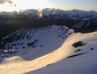
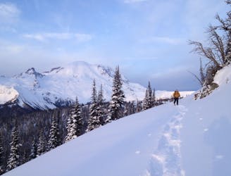
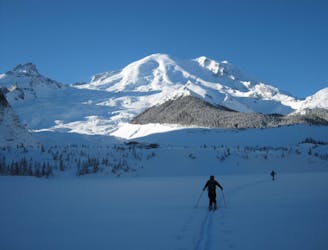
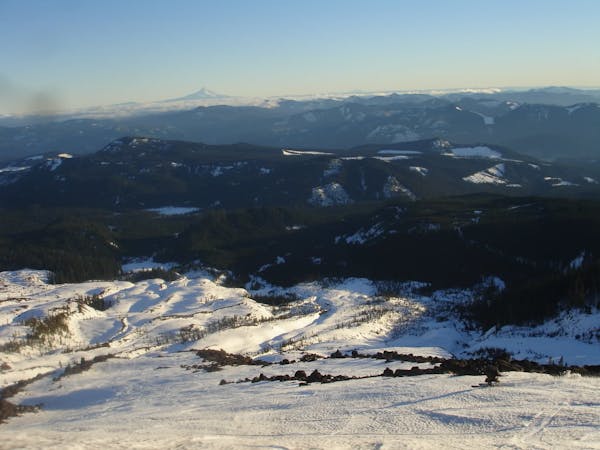
By the time that March came around we were looking at doing a unique tour on the Northeastern Side of Mount Rainier National Park. Scouring both our memories and the maps we came up with the idea to ride both Mount Fremont and Skscraper in a single push. This would be a long tour but knowing that there was fresh snow on North facing slopes it would be both scenic and a powder lovers Paradise. We just needed to make the most out of the daylight and would have to start while it was still dark. If you do decided to make your way on this tour be careful as this slopes would be disastrous if they did slide with trees just under open alpine. Mix that with the isolation and you have a recipe for disaster.
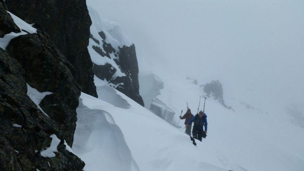
The trip starts by snowmobiling 16 miles from the Crystal Mountain Boulevard Snowpark all the way to the White River Campground. Once there start heading up the Wonderland trail towards Sunrise Visitor Center. The trail waves easily through some beautiful Old Growth forest before heading across a creek on the semi open slopes. Once you cross the creek take off your ski gear and bootpack directly up for a 100 feet until you arrive in the flat basin. From here head west along the Sunrise summer road and once in the basin make your way West towards the col that accesses Frozen Lake.
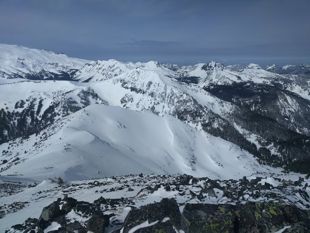
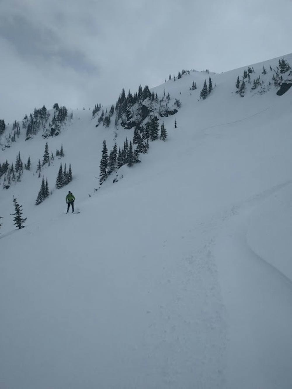
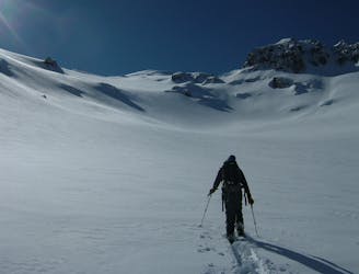
From Frozen Lake skin North up to the ridge and keep following it past the first summit and before long there is a ridge that extends West. It is time for the first descent of the day riding down the West ridge and after a few steps up to the sub summit you can ride the Northeast Bowl all the way down to Lodi Creek.
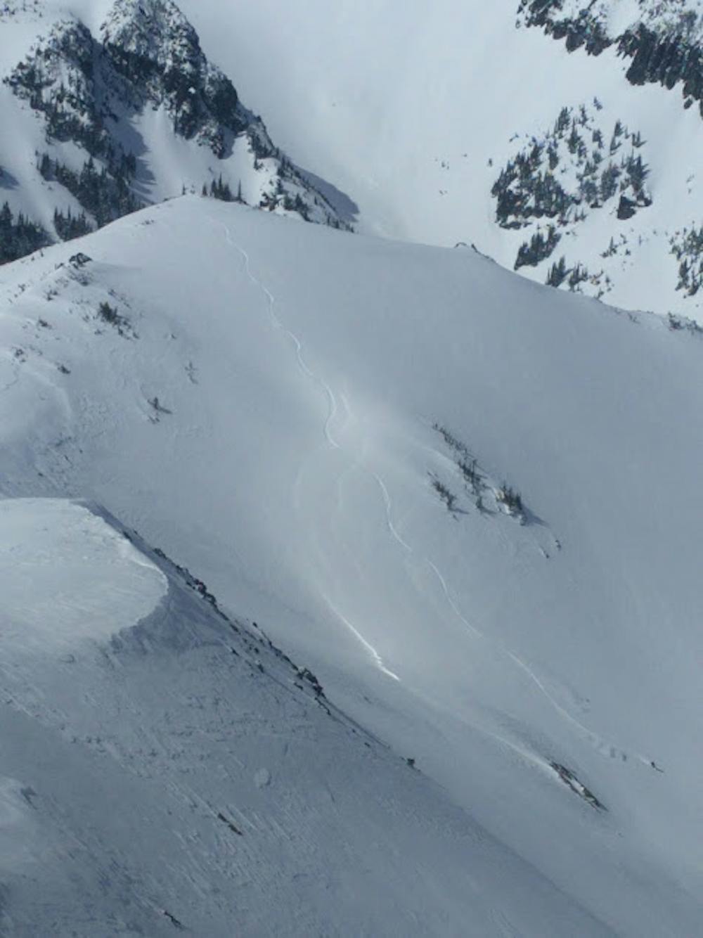
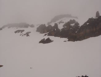
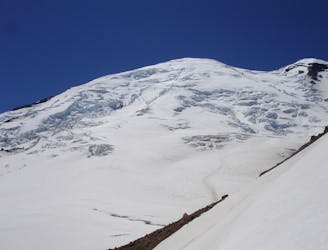
Now it is time to start skinning up valley making it all the way to the upper alpine basin where you can easily wrap to the Southwest heading towards Skyscraper Mountain. Even though the summer trail will be buried deep in the snowpack this is the route you want to follow until it wraps around to a low col. From here start heading North until arriving just below the Summit of Skyscrapper. Now you need to wrap around the summit via the west side until arriving at the high northern point where you will start your descent.
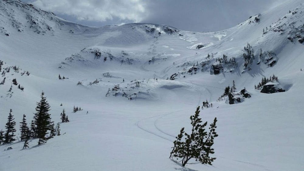
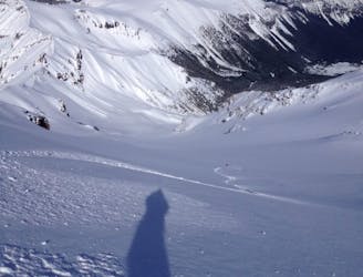
Just like the line of Fremont Peak this is a huge avalanche swath so be cautious while descending and stagger the group out. If a slab did happen you wouldn’t want everyone caught it in. That being said just ride fall line into the valley. Now skin back over to the creek and you should find your old skin track.
Making your way back up Berkley Park the next area you need to head to is the low col Just North of the Second Burroughs which once climbed will put you between the Second and Third Burroughs. Keep following this low basin North and before long the slope will drop dramatically South all the way to the Glacier Basin Trail. Now it is time to ride the trail heading east and if snowboarding you will need to occasional take off the board just to gain a bit of elevation but for the most part it is pretty smooth all the way to the White River Campground.
To see my trip in the area and more photos check out this link https://www.whereiskylemiller.com/mt-rainier/skyscraper-mountain-mount-fremont/
Difficult
Serious gradient of 30-38 degrees where a real risk of slipping exists.

As well as the slope itself, there are some obstacles (such as rock outcrops) which could aggravate injury.

In the high mountains or remote conditions, all individuals must be completely autonomous in every situation.
35 m away
Heading from the Third Burroughs all the way to 410 through the Sourdough Range
Severe Ski Touring
50 m away
Making the most out of a spring weekend
Difficult Ski Touring
50 m away
A classic ascent and pleasant ski descent!
Severe Ski Touring
63 m away
Making the most out of the alpine terrain within the Sourdough Mountains
Severe Ski Touring
68 m away
Another great south facing line within Glacier Basin
Difficult Ski Touring
71 m away
Climbing up the Emmons and descending down the Interglacier in powder
Difficult Ski Touring
151 m away
Heading up Glacier Basin to Snowboard the Interglacier in powder conditions
Difficult Ski Touring
160 m away
Mid Winter trip up the lower slopes of the Emmons Glacier
Moderate Ski Touring
227 m away
Descending down the Emmons Glacier on Mount Rainier
Difficult Ski Touring
229 m away
Linking together the two nicest lines in Glacier Basin
Difficult Ski Touring

9 routes · Ski Touring
6 routes · Ski Touring
5 routes · Ski Touring