1.1 km away
Whitman Crest and Ohanapecosh Basecamp
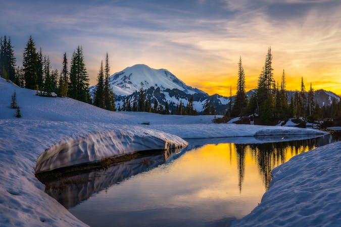
Making the most out of a long weekend exploring the Ohanapecosh area
Difficult Ski Touring
- Distance
- 40 km
- Ascent
- 3.4 km
- Descent
- 3.4 km
Making the most out of the numerous different aspects on Tamanos Mountain
Ski Touring Difficult

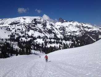
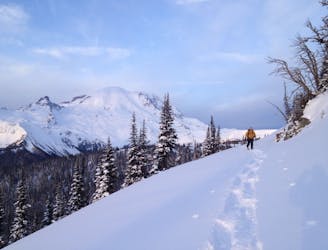
In my opinion Tamanos Mountain is one of the best ski tours within the whole White River Valley. Not only is it relatively easy to climb but it gives you numerous options for ski descents. For a long time this was our go to mountain when we feared that there was too much snow to easily snowmobile up to the White River Camp. This ski tour is a long day making the most out of a single skin track, getting some of if not the best lines this mountain has to offer. If planning this trip remember that each one of these lines is in avalanche terrain and while some aren’t too serious some are very serious, especially the exit.
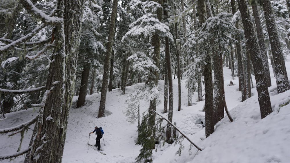
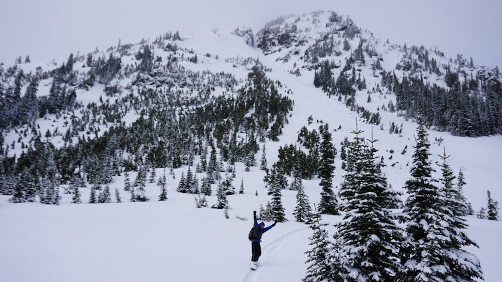
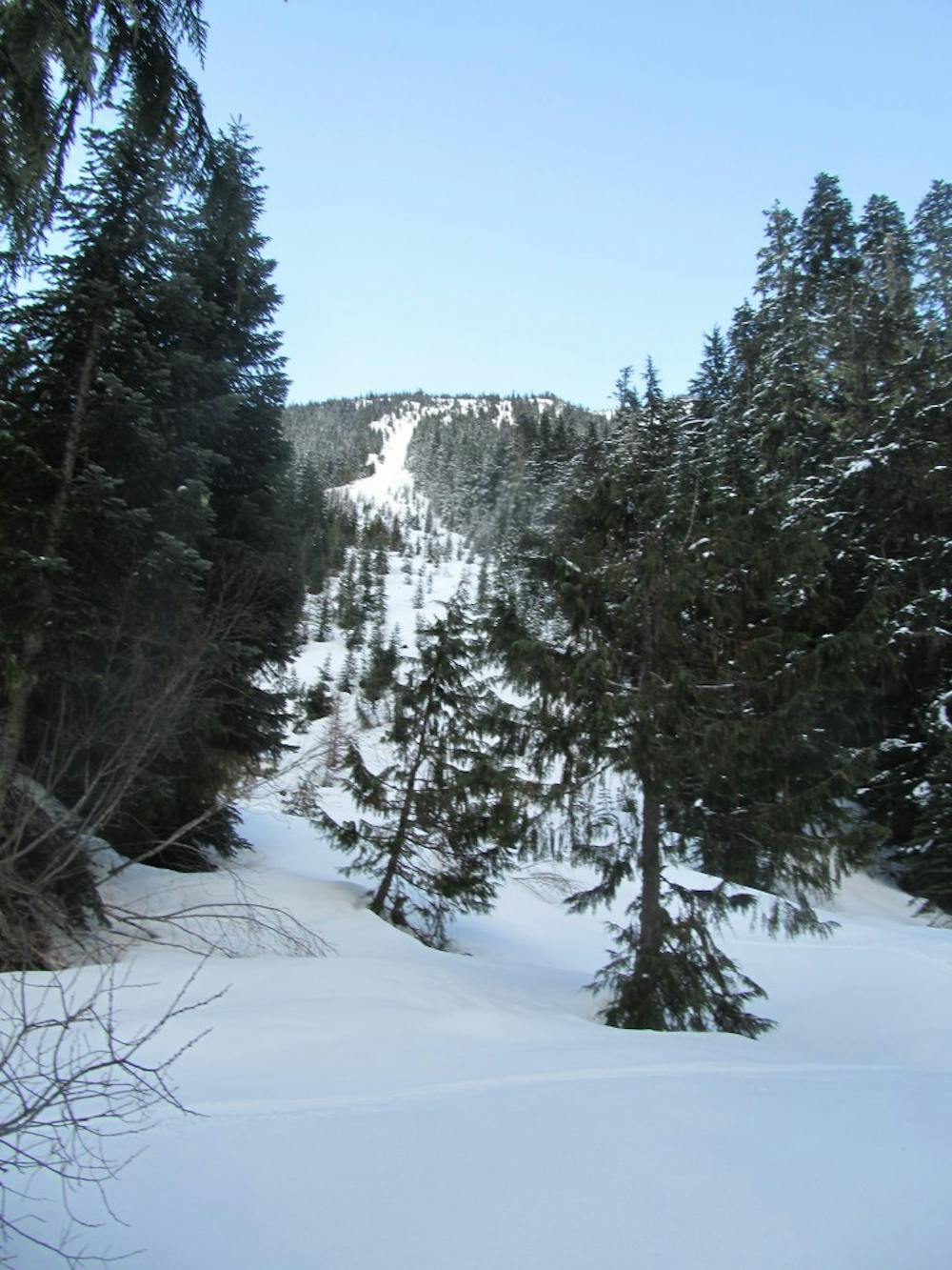
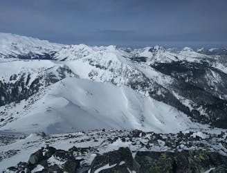
The tour starts off at the Owyhigh lakes trailhead as you follow the obvious path slowly gaining elevation. After the fourth switchback you can ditch the trail and start heading South cutting back onto the trail a bit higher. Soon enough you should reach the base of the Northeast slopes of Tamanos but keep moving southeast dropping a little bit of elevation, you will see why a little bit later in this description. Before long you will be in the flats of Owyhigh basin where you just need to keep heading south. By now you will see trees that go near the top of the Southeast ridge of Tamanos, make your way up this route until arriving on the ridge. Follow the ridge heading North and just as you reach the point where the East ridge breaks off transition for your first ski run.
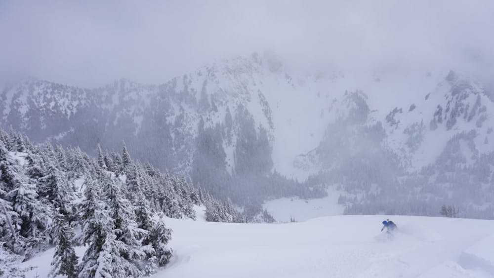
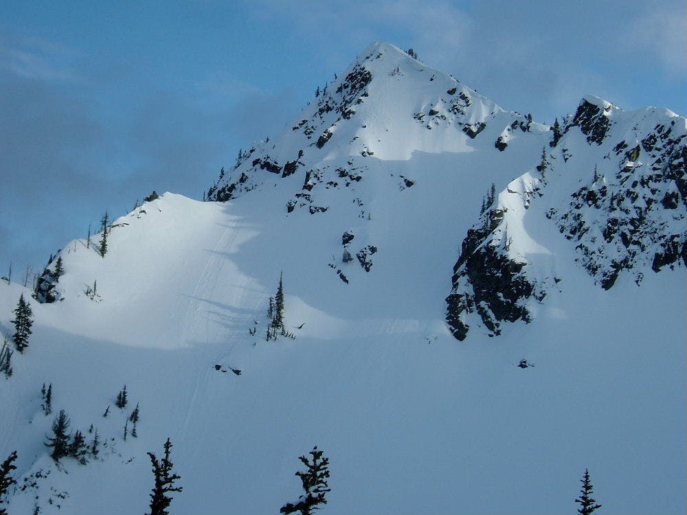
Looking to the East you will notice a nice little gully that runs down the slope. Dropping in this line starts off mellow then goes through a nice choke point. Make sure to ride one at a time traversing off to a safe point and only then have your partner start riding down. As quickly as the choke comes it is soon gone and below is a steep face that goes all the way to the valley floor. With a little bit of speed you will make your way all the way back to the skin track.
While transitioning you have a perfect view of your tracks just climbing back up onto the ridge via the same route. Instead of where you stopped the previous time keep heading north a few more feet than you will spot the northeast chute. This line starts off semi tight and steep but after a few turns it is a glorious apron all the way into the valley. Have the first person drop into said chute then once in the apron traverse off and wait for your partner to descend after you. From here you can ride all the way back down to the skin track which with a little bit of traversing to the skiers right you will be transitioning once again in the Owyhigh Lakes Basin.
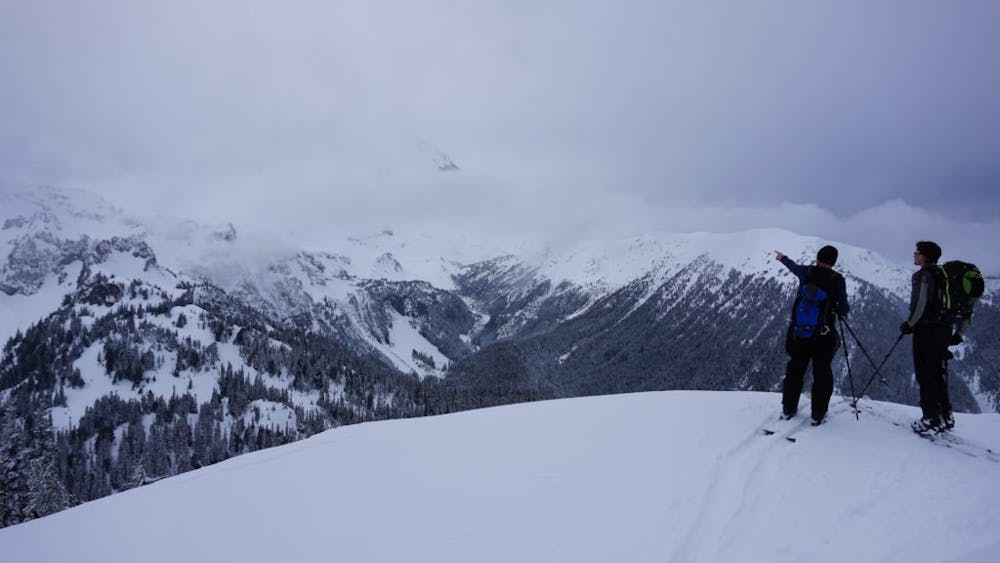
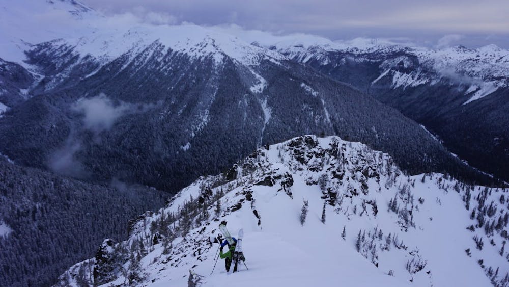
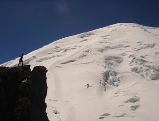
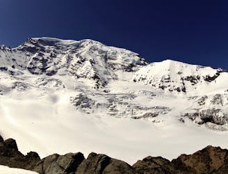
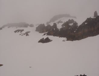
It is time to make your final skin up the now well beaten in skin track getting back onto the ridge like the previous two times. Now head up and over the true summit and dropping a little bit of elevation on the Northwest ridge. Be very cautious while down climbing as this area can have a huge cornice so give a bit of space between you and the edge. Before long you will see a nice and open ramp that allows access to the North face, drop in here and ride down to the flat basin below.
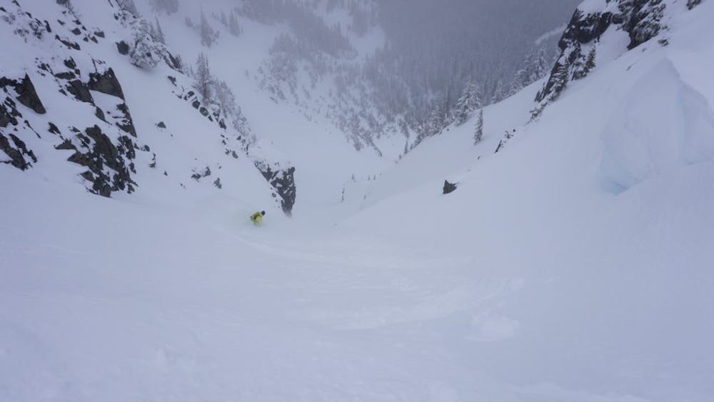
Now it is time for the exit. If you have any question about stability just head back east towards the trail but if you are almost certain that the slopes are stable start climbing up the small ridge to the west. Standing up top you will find two big slide paths all the way into the valley. Make your choice between either of them as they are steep and go directly down to Fryingpan Creek. After riding down it is time to look for a spot to cross Fryingpan Creek. With a bit of luck you should find a downed tree causing a bridge or a spot where the water is quite shallow. Once you are back on the Western side make your way up to the Fryingpan Creek trail then skin back down to the Owyhigh Lakes Trailhead.
Now that you have read this I hope you understand why I call this tour a classic. To see my trip in the area and more photos check out this link https://www.whereiskylemiller.com/mt-rainier/tamanos-mountain/
Difficult
Serious gradient of 30-38 degrees where a real risk of slipping exists.

As well as the slope itself, there are some obstacles (such as rock outcrops) which could aggravate injury.

Little chance of being seen or helped in case of an accident.
1.1 km away
Making the most out of a long weekend exploring the Ohanapecosh area
Difficult Ski Touring
1.1 km away
Riding the Banshee Couloir, Cowlitz Chimney and Tamanos Mountain in a single day
Difficult Ski Touring
1.1 km away
Exploring the east side of Mount Rainier in winter
Difficult Ski Touring
3.6 km away
Mid Winter trip up the lower slopes of the Emmons Glacier
Moderate Ski Touring
3.7 km away
Making the most out of a spring weekend
Difficult Ski Touring
3.8 km away
Linking together two great lines during a single ski tour
Difficult Ski Touring
3.8 km away
Heading from the Third Burroughs all the way to 410 through the Sourdough Range
Severe Ski Touring
3.8 km away
A classic ascent and pleasant ski descent!
Severe Ski Touring
3.8 km away
Making the most out of the alpine terrain within the Sourdough Mountains
Severe Ski Touring
3.8 km away
Another great south facing line within Glacier Basin
Difficult Ski Touring

9 routes · Ski Touring
6 routes · Ski Touring