6 m away
Whitman Crest and Ohanapecosh Basecamp
Making the most out of a long weekend exploring the Ohanapecosh area
Difficult Ski Touring
- Distance
- 40 km
- Ascent
- 3.4 km
- Descent
- 3.4 km
Riding the Banshee Couloir, Cowlitz Chimney and Tamanos Mountain in a single day
Ski Touring Difficult

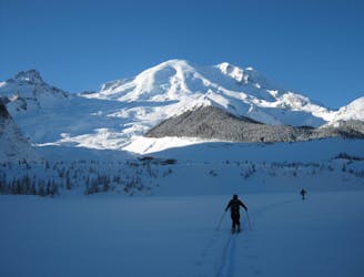
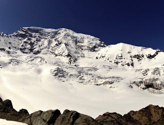
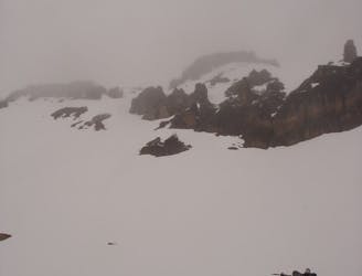
The Fryingpan Loop is a trip we came up with to make the most out of the terrain within the Eastern Side of Mount Rainier. This is a long and isolated tour but if everything goes according to plan it is hard to beat. Linking together lines like the Banshee Couloir, the Cowlitz Chimney and Tamanos Mountain this route is both simple and complicated at the same time. While we were a bit unfortunate with the weather this loop should only be done on a clear day as you are mostly in alpine.
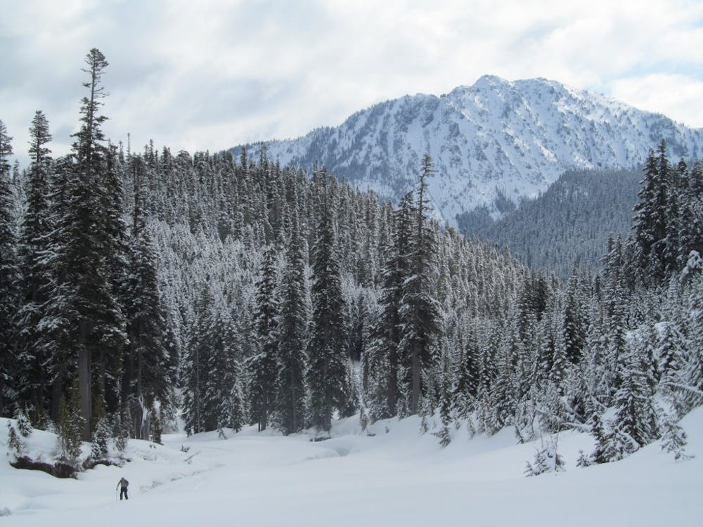
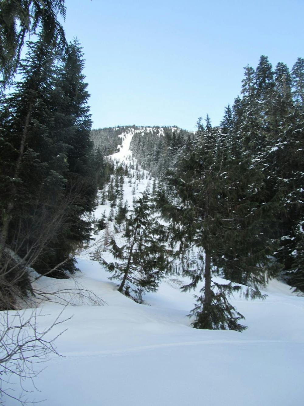
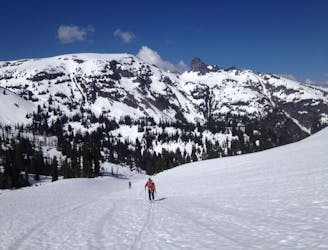
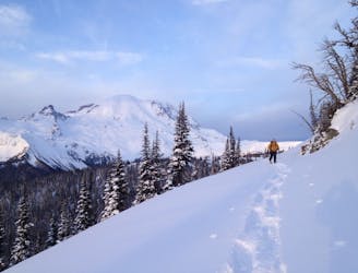
Staring off at the Fryingpan Creek trailhead make your way southwest along the main trail heading through some of the best forests in the park. Once in the upper area we were able to cross the creek and climb the drainage right before Summerland but in retrospective it may be easier just to head up into Summerland. Make your way up into the alpine as if you were following the summer trail with a high traverse to the East heading up to Fryingpan Gap.
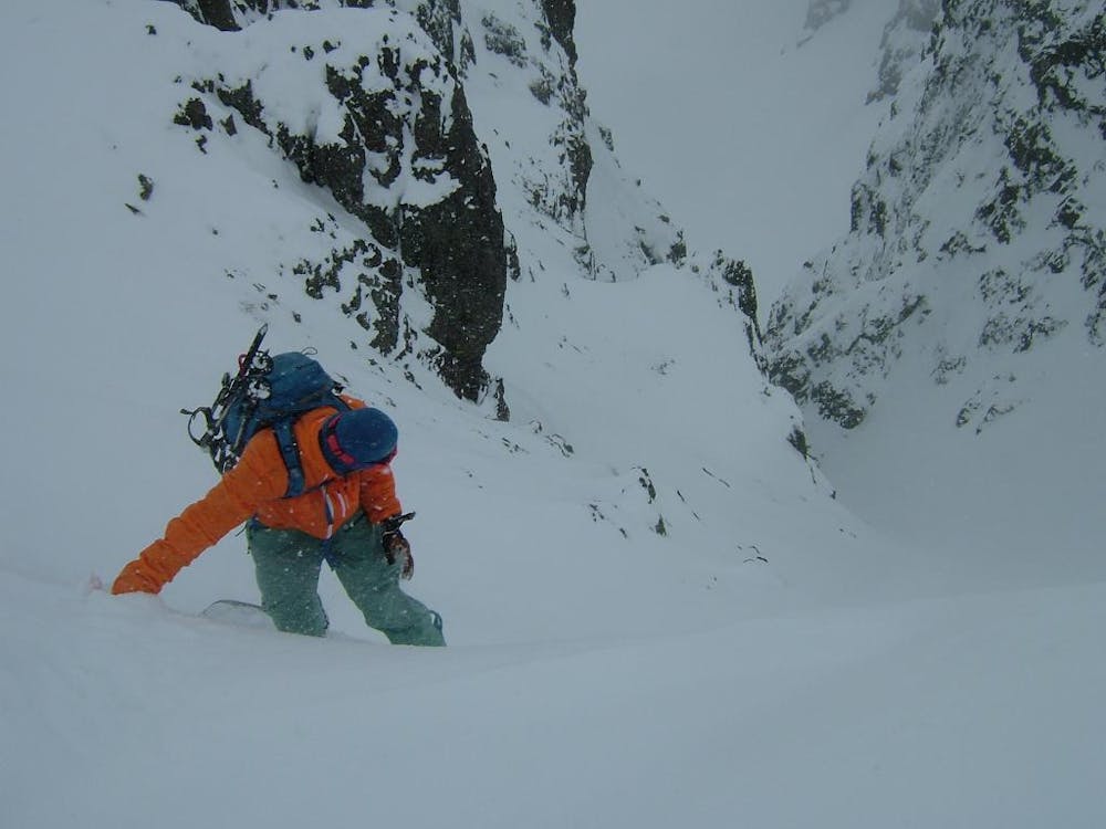
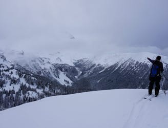
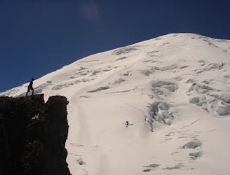
Once on the Eastern Ridge start heading East climbing towards Banshee Mountain. Standing on the high ridge start heading south and before long you will spot the obvious entrance to the Banshee Couloir which starts tight then opens up onto the Sarvant Glacier. Ride down a little ways before skinning directly north where a small notch allows you to get onto the high ridge. From here you need to drop a few feet heading east then up to another obvious col which gives you access to the Cowlitz Chimneys.
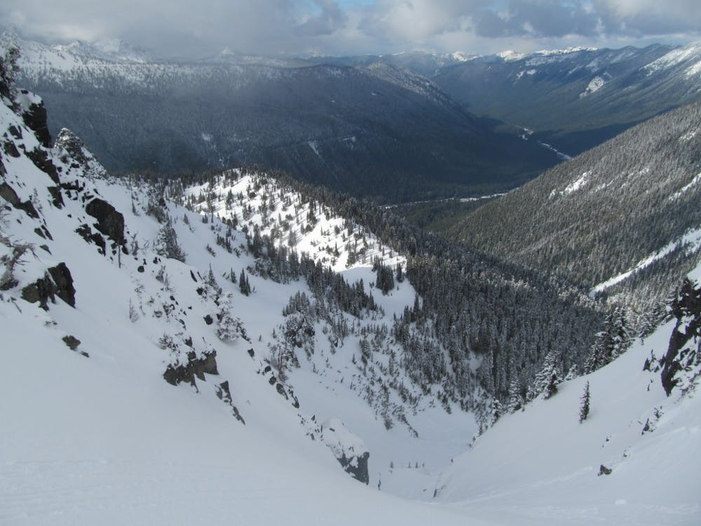
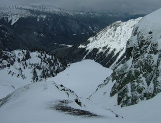
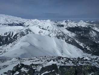
Looking to the East this line drops directly into the valley and is one of the better lower elevation lines within the park. Ride down until you arrive in the flats of the basin then start skinning north up and over a small ridge which gives you access to Owyhigh Lakes basin. Keep heading north until you notice an obvious route to the west which will take you up through to the South ridge of Tamanos Mountain.
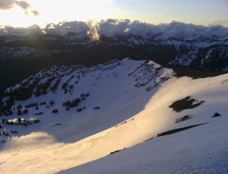
Once on Tamanos Mountain start heading up the ridge and just before the summit you will spot a nice Northeast facing chute. Drop into the line and once in the apron make a hard traverse to the skiers left. If you did it high enough you are able to ride into the north basin where you start skinning west to a small ridge. Once on top of here you have a clear view down to the Fryingpan Creek with two different avalanche chutes to choose from. Both of these lines are incredibly dangerous in unstable conditions but amazing if it is stable. If confident in the snowpack ride down either one (If not head down the Owyhigh Lakes Trail) and after a few minutes of fall line turns you will be on the edge of Fryingpan Creek.
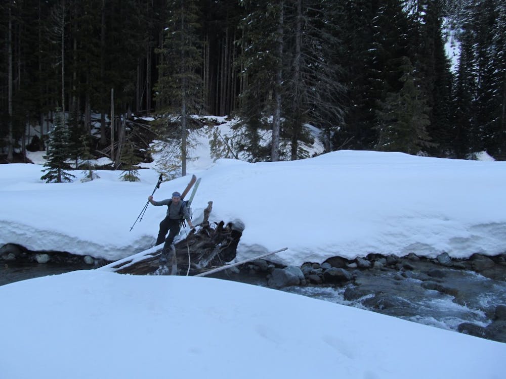
Standing on the east side of Fryingpan Creek take your time to spot a section where you can easily cross. A lot of times there are downed trees which make for perfect bridges but this changes from year to year. With a little bit of luck you can make it over to the western side with dry boots and make your way through the woods back to the Fryingpan Creek trail where you just follow it back to the trailhead.
To see my trip in the area and more photos check out this link https://www.whereiskylemiller.com/mt-rainier/fryingpan-creek/
Difficult
Serious gradient of 30-38 degrees where a real risk of slipping exists.

As well as the slope itself, there are some obstacles (such as rock outcrops) which could aggravate injury.

Little chance of being seen or helped in case of an accident.
6 m away
Making the most out of a long weekend exploring the Ohanapecosh area
Difficult Ski Touring
31 m away
Exploring the east side of Mount Rainier in winter
Difficult Ski Touring
1.1 km away
Making the most out of the numerous different aspects on Tamanos Mountain
Difficult Ski Touring
2.8 km away
Mid Winter trip up the lower slopes of the Emmons Glacier
Moderate Ski Touring
2.9 km away
Making the most out of a spring weekend
Difficult Ski Touring
2.9 km away
Linking together two great lines during a single ski tour
Difficult Ski Touring
3 km away
Heading from the Third Burroughs all the way to 410 through the Sourdough Range
Severe Ski Touring
3 km away
A classic ascent and pleasant ski descent!
Severe Ski Touring
3 km away
Making the most out of the alpine terrain within the Sourdough Mountains
Severe Ski Touring
3 km away
Another great south facing line within Glacier Basin
Difficult Ski Touring

9 routes · Ski Touring
6 routes · Ski Touring