3 m away
Hafelekar to the Pfeisshütte and Thaurer Alm
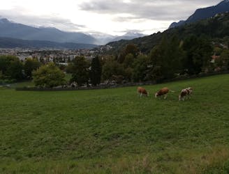
A long and beautiful trip which is almost all downhill and stops at 2 traditional mountain huts.
Difficult Hiking
- Distance
- 15 km
- Ascent
- 440 m
- Descent
- 2.1 km
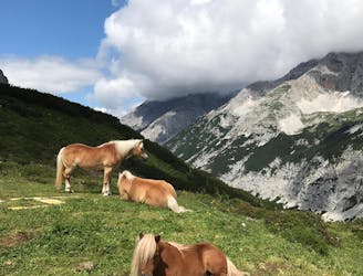
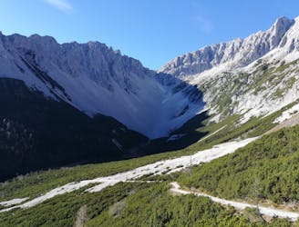
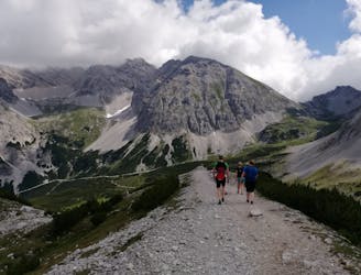
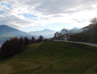
A wild-feeling journey which takes you along a beautiful ridge, high above the Inn valley, and then into the heart of the unspoilt Karwendel mountains.
Hiking Moderate

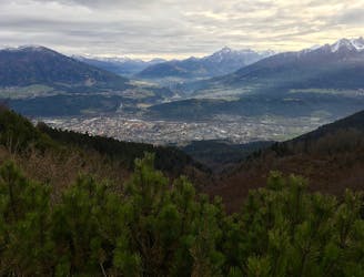
The route starts at the top of the Hafelekarbahn cable car, which is reached by taking the Hungerburgbahn tram from Innsbruck city centre, followed by the Seegrubbebahn cable car and finally the Hafelekarbahn itself. This all sounds very complicated but it's simple really - each lift starts where the last one finishes so once you've located the start of the Hungerburgbahn (which lies on the junction between Rennweg and Herzog-Otto Strasse, at the northern end of Innsbruck centre), it should be plain sailing. Once at the Hafelekar the route is well signposted and easy to follow. It begins with a stunning ridge walk, perched high above Innsbruck city and the Inn valley, and then swings into the Karwendel mountains - the largest area in the Alps without any year-round settlements - and slowly down to the beautifully positioned Pfeisshütte.
Moderate
Hiking along trails with some uneven terrain and small hills. Small rocks and roots may be present.
3 m away
A long and beautiful trip which is almost all downhill and stops at 2 traditional mountain huts.
Difficult Hiking
4 m away
A long but incredibly rewarding trip through the Karwendel mountains.
Difficult Hiking
5 m away
A classic Innsbruck hike to a charming mountain hut.
Difficult Hiking
3.1 km away
A lovely, easy traverse to a charming Tirolian town.
Moderate Hiking
3.1 km away
Possibly the most popular hike in Innsbruck and for good reason - this is a lovely little trip.
Moderate Hiking
3.5 km away
A lovely, sunny walk suitable for the whole family.
Moderate Hiking
4.1 km away
A beautiful easy hike to a sunny vantage point above Innsbruck.
Easy Hiking
4.8 km away
A steep and strenuous hike to one of the best situated huts in Tirol.
Difficult Hiking
4.9 km away

Sophisticated alpine hike that offers a great variation of landscapes ending in a ridge with moderate climbing passages.
Severe Hiking
5.5 km away
A gorgeous walk between 2 easily-accessed villages.
Moderate Hiking

8 routes · Hiking

5 routes · Hiking

9 routes · Hiking

6 routes · Hiking

25 routes · Hiking