1.8 km away
Stadtwanderweg 9 - Prater
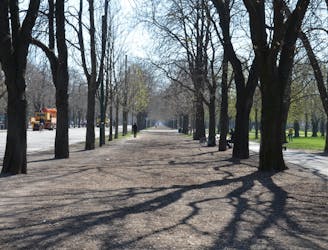
A loop with numerous recreation opportunities and a dose of nature in The Prater, a large public park and green space near the city center.
Easy Hiking
- Distance
- 13 km
- Ascent
- 34 m
- Descent
- 34 m
Rätseltour um den Stephansdom herum
Hiking Easy

Diese kurze Tour führt dich zu den interessantesten Punkten rund um den "Steffl". Zugleich erfährst du einiges über den Bau dieser bedeutendsten Kirche Wiens. Tipps: Gehe im Uhrzeigersinn um den Steffl herum. Du kannst dir vorab Infos zum Stephansdom in der KiwiThek durchlesen: https://kiwithek.wien/index.php/Stephansdom
Der Stephansdom ist eines der wichtigsten Wahrzeichen der Stadt Wien und markiert das Zentrum der Stadt. Sein Namensgeber ist der Heilige Stephanus, der erste christliche Märtyrer.
Diese Tour führt dich zu vielen interessanten Punkten an der Außenseite des "Steffl". An acht Stationen wirst du Interessantes über den Dom und seine Baugeschichte erfahren, aber auch einige Rätsel lösen müssen. Um die Rätsel zu lösen, wirst du dir das Bauwerk genau anschauen müssen. Du kannst Fragen auch überspringen. Insgesamt gibt es 180 Punkte zu erringen. Schaffst du sie alle?
Vor dem Start (kann bereits zu Hause erledigt werden):
Hol dir die Locandy App im Appstore bzw. Playstore https://apps.apple.com/de/app/locandy/id789268894 https://play.google.com/store/apps/details?id=com.locandy.app.locandy&hl=deAT&pli=1
Gehe in der App auf Textsuche, gib einfach 'Rund um den Stephansdom' ein und lade dir den Guide herunter. Oder gelange über diesen Link direkt zum Download. https://www.locandy.com/q/steffl
Starte am besten mit einem vollen Akku, damit du das Spiel bis zum Enden spielen kannst.
Locandy https://cms.locandy.com/
Wir freuen uns über Feedback.
Euer Team von Locandy.
Easy
Walking along a well-kept trail that’s mostly flat. No obstacles are present.

Some trail sections have exposed ledges or steep ascents/descents where falling could cause serious injury.

Close to help in case of emergency.
1.8 km away
A loop with numerous recreation opportunities and a dose of nature in The Prater, a large public park and green space near the city center.
Easy Hiking
4.5 km away
A balance of urban amenities and natural splendor in the diverse district of Ottakring.
Easy Hiking
5.4 km away
A nicely varied path that connects city streets, forest recreation areas, an amusement park, and countryside farms in the southern part of Vienna.
Easy Hiking
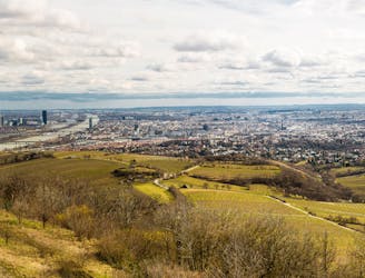
5.7 km away

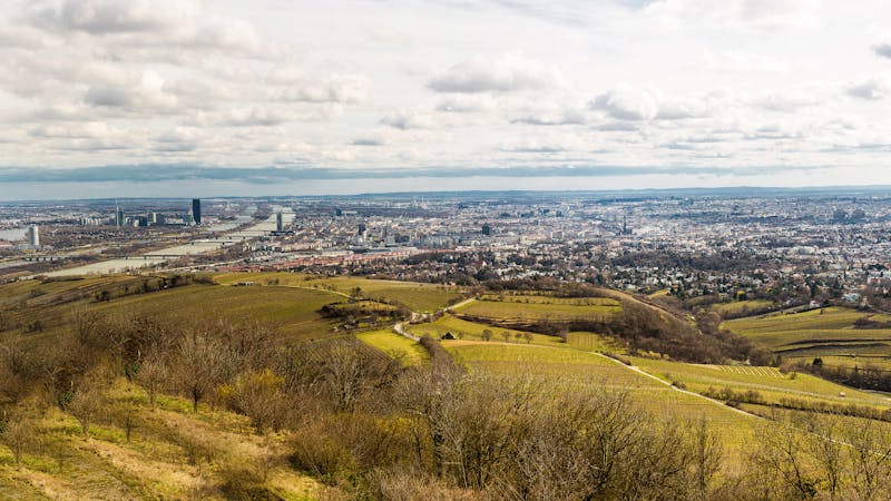
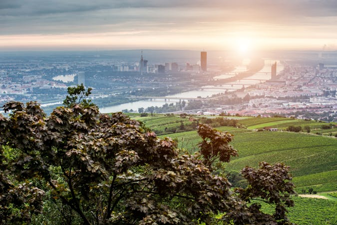
Climb from the Danube waterfront to the best view over Vienna, then continue through forests and fields with opportunities for wine and food tasting.
Moderate Hiking
5.7 km away
Walk through vineyards and forests, to the top of Kahlenberg and back down, with lofty views over Vienna.
Moderate Hiking
5.7 km away

A highlight section of Vienna's "All-Around" hiking trail, climbing from the shore of the Danube to a panorama atop Leopoldsberg.
Difficult Hiking
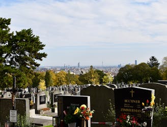
5.9 km away
A walk through the varied environments of Favoriten and Simmering districts, which include forest parks, urban farms, the Central Cemetery, and eventually the Danube.
Easy Hiking
6.5 km away
Countryside stroll at the edge of Vienna’s Woods, with many possibilities for sightseeing, eating, and enjoyment of nature.
Moderate Hiking
6.6 km away
Walk through one of Austria’s oldest garden parks, then up a tall hill in the Vienna Woods.
Moderate Hiking
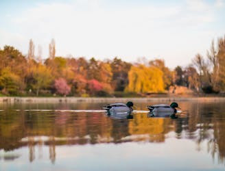
7.2 km away
Hike through Donau-Auen National Park, experiencing Vienna’s native flora and fauna as well as wild swimming spots in the river and forest ponds.
Easy Hiking

3 routes · Hiking
12 routes · Hiking
15 routes · Hiking
7 routes · Hiking