1.1 km away
Rundumadum: Stages 2 and 3
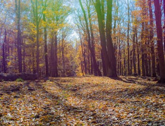
These stages climb over tall hills in the Vienna Woods, including Hermannskogel–the tallest in all of Vienna.
Moderate Hiking
- Distance
- 10 km
- Ascent
- 319 m
- Descent
- 434 m
Countryside stroll at the edge of Vienna’s Woods, with many possibilities for sightseeing, eating, and enjoyment of nature.
Hiking Moderate

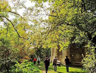
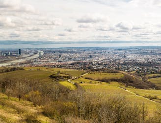
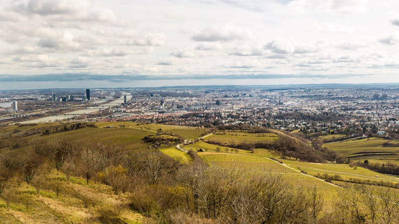
This city hiking trail begins at Sievering, the terminus of Bus 39A. Start by walking along Agnesgasse, then turn soon onto a smaller road that follows the crest of a hill, through an idyllic setting. The path is lined on one side by rows of grapes and on the other by shady forest. You’ll gaze over the vineyards at the town below and green hills beyond.
The path then enters the Wienerwald, which is the expanse of woodlands west of Vienna. You’ll pass a guesthouse then cross a road, and the trail twists downhill for a while before coming to another guesthouse. From there, cross a field and re-enter the wood on a dirt path, which is often shared with mountain bikers and joggers. You’ll climb back uphill, away from the road, as the trees become dense enough to muffle surrounding noise.
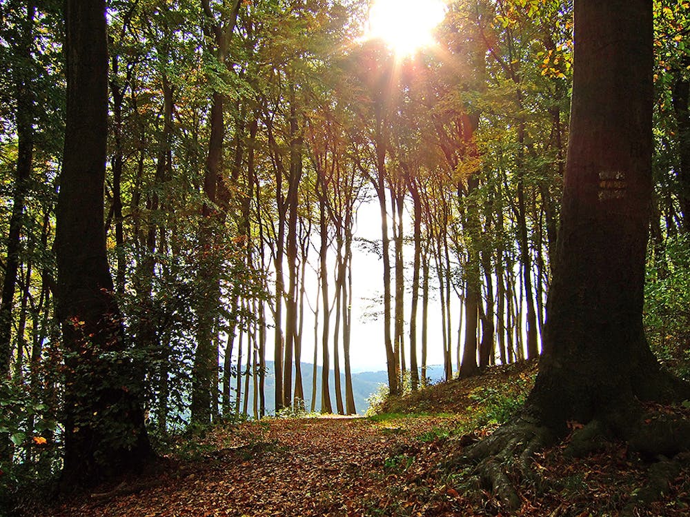
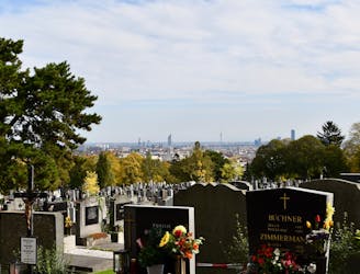
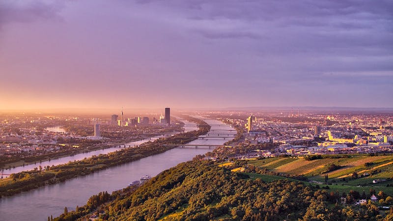
This portion of the trail climbs Hermannskogel, the tallest hill of Vienna. You can take a short detour to the Habsburgwarte landmark on top, but the Stadtwanderweg does not actually pass over the summit. Instead, it wraps around the hill, through a patchwork of regenerating forest, mature trees, and grassy clearings. It descends gradually through this interestingly varied nature, eventually meeting with another road next to the “Tree Circle in the Sky.” This is a nicely landscaped hilltop with a view of distant Vienna. It’s a leisure retreat for the whole family, with a children’s playground, grassy areas for lounging, and restaurants with sunny, outdoor seating.
At this point, you are near the end of the walk, so take time to enjoy the Tree Circle. From there, the route follows a narrow road through a wooded glen, passing a stone grotto with lush vegetation and trickling water. Then it comes to Sieveringer Strasse and soon returns to the starting point.
Sources: https://www.wien.gv.at/umwelt/wald/freizeit/wandern/wege/wanderweg2.html
Moderate
Hiking along trails with some uneven terrain and small hills. Small rocks and roots may be present.

The trail contains some obstacles such as outcroppings and rock which could cause injury.

Close to help in case of emergency.
1.1 km away
These stages climb over tall hills in the Vienna Woods, including Hermannskogel–the tallest in all of Vienna.
Moderate Hiking
3 km away
Walk through one of Austria’s oldest garden parks, then up a tall hill in the Vienna Woods.
Moderate Hiking
3.2 km away
Stage 4 explores more hills in the Wienerwald, one with a lookout tower and another with an equestrian center, then Stage 5 goes through two very green recreation areas at the edge of the city.
Moderate Hiking
3.4 km away
Walk through vineyards and forests, to the top of Kahlenberg and back down, with lofty views over Vienna.
Moderate Hiking
3.8 km away

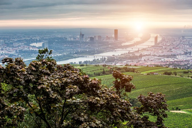
Climb from the Danube waterfront to the best view over Vienna, then continue through forests and fields with opportunities for wine and food tasting.
Moderate Hiking
3.9 km away

A highlight section of Vienna's "All-Around" hiking trail, climbing from the shore of the Danube to a panorama atop Leopoldsberg.
Difficult Hiking
4.6 km away
A balance of urban amenities and natural splendor in the diverse district of Ottakring.
Easy Hiking
7 km away
A loop with numerous recreation opportunities and a dose of nature in The Prater, a large public park and green space near the city center.
Easy Hiking
7.1 km away
A peaceful woodland park and charming hillside suburbs lead to a lookout tower in the forest.
Easy Hiking
7.5 km away
The dog-friendly alternate route to Stage 6.
Easy Hiking
3 routes · Hiking
12 routes · Hiking
15 routes · Hiking
7 routes · Hiking