78 m away
Rundumadum: Stage 1

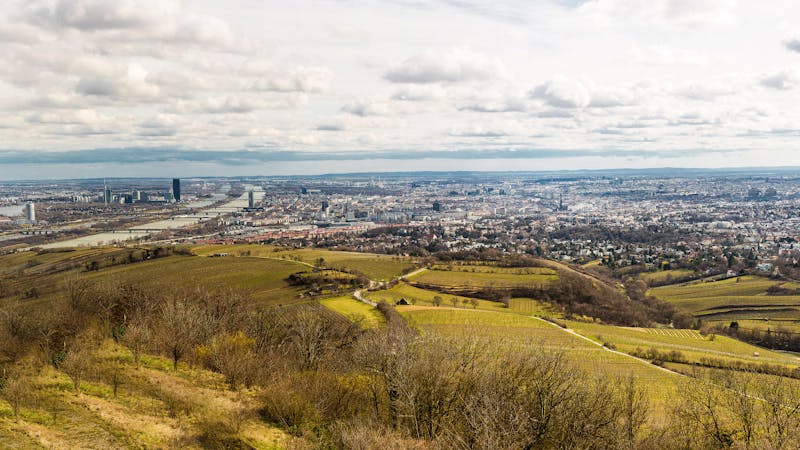
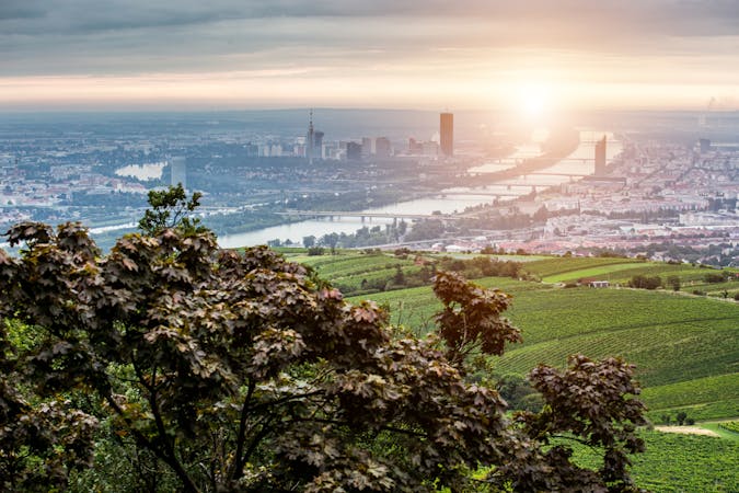
A highlight section of Vienna's "All-Around" hiking trail, climbing from the shore of the Danube to a panorama atop Leopoldsberg.
Difficult Hiking
- Distance
- 9.2 km
- Ascent
- 383 m
- Descent
- 165 m
Climb from the Danube waterfront to the best view over Vienna, then continue through forests and fields with opportunities for wine and food tasting.
Hiking Moderate

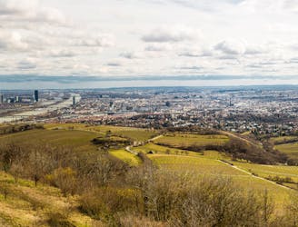
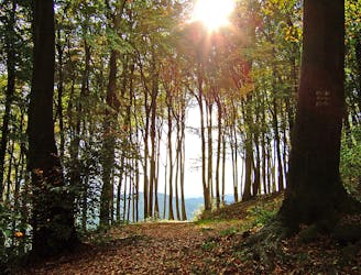
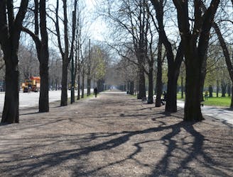
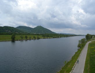
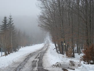
This is one of the most varied and scenic of Vienna’s city hiking paths, featuring views along the Danube, vistas atop two hills outside the city, and a mix of forest and fields in the countryside. Beginning at Nussdorfer Platz, the scenery is rather urban at first but becomes more natural as the path enters a park with trees and grass beside the water. At Kahlenberg Village, you’ll depart from the river and begin an aerobic climb of Leopoldsberg via the Nasenweg. The path snakes upward in a series of ramps and stairs, through leafy forest with intermittent views through gaps in the canopy.

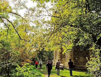
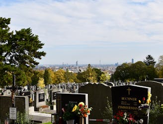
At the top is the famous Leopoldsberg Church, a stately structure that grants a lofty view over Vienna and the river. Linger here as long as you like, then continue alongside Hohenstrasse to Josefinenhütte restaurant, passing a high-ropes adventure course along the way. Here the path merges briefly with Stadtwanderweg 1 to continue to the top of the Kahlenberg, where you’ll encounter another restaurant, historic church, and spectacular view.
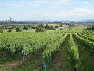
The hike descends on Kahlenberger Strasse, then a forest path, and rejoins the road among hillside vineyards. You can relax at a cozy wine tavern to take in the spectacle and flavors of the fields, then follow a dirt path through rows of grapes and return to the forest at the foot of Leopoldsberg. Wandering through these quiet woods soon brings you back to Kahlenbergerdorf, where you should definitely enjoy a glass of seasonal wine and a bite to eat if you haven’t already.
Sources: https://www.wien.info/en/sightseeing/green-vienna/hiking-in-around https://www.wien.gv.at/umwelt/wald/freizeit/wandern/wege/wanderweg1a.html
Moderate
Hiking along trails with some uneven terrain and small hills. Small rocks and roots may be present.

The trail contains some obstacles such as outcroppings and rock which could cause injury.

Close to help in case of emergency.
78 m away
A highlight section of Vienna's "All-Around" hiking trail, climbing from the shore of the Danube to a panorama atop Leopoldsberg.
Difficult Hiking
391 m away
Walk through vineyards and forests, to the top of Kahlenberg and back down, with lofty views over Vienna.
Moderate Hiking
3.5 km away
These stages climb over tall hills in the Vienna Woods, including Hermannskogel–the tallest in all of Vienna.
Moderate Hiking
3.8 km away
Countryside stroll at the edge of Vienna’s Woods, with many possibilities for sightseeing, eating, and enjoyment of nature.
Moderate Hiking
5.1 km away
A loop with numerous recreation opportunities and a dose of nature in The Prater, a large public park and green space near the city center.
Easy Hiking
5.8 km away
A countryside walk for wine enthusiasts, between inviting heurige and through hillside vineyards overlooking Vienna.
Easy Hiking
6.2 km away
From the wine country down to the Danube, through the interface of city and nature.
Easy Hiking
6.4 km away
Walk through one of Austria’s oldest garden parks, then up a tall hill in the Vienna Woods.
Moderate Hiking
6.7 km away
A balance of urban amenities and natural splendor in the diverse district of Ottakring.
Easy Hiking
6.8 km away
Stage 4 explores more hills in the Wienerwald, one with a lookout tower and another with an equestrian center, then Stage 5 goes through two very green recreation areas at the edge of the city.
Moderate Hiking

3 routes · Hiking
12 routes · Hiking
15 routes · Hiking
7 routes · Hiking