2 m away
Vallée Blanche Traverse
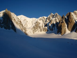
A wonderful high mountain journey through huge, wild mountains
Moderate Alpine Climbing
- Distance
- 5.8 km
- Ascent
- 367 m
- Descent
- 688 m
A truly classic route, which is serious and exposed but not technically difficult.
Alpine Climbing Difficult

This is an easy accessed, low grade alpine route but much of it is staggeringly exposed so don't underestimate it and be prepared for an exciting day!
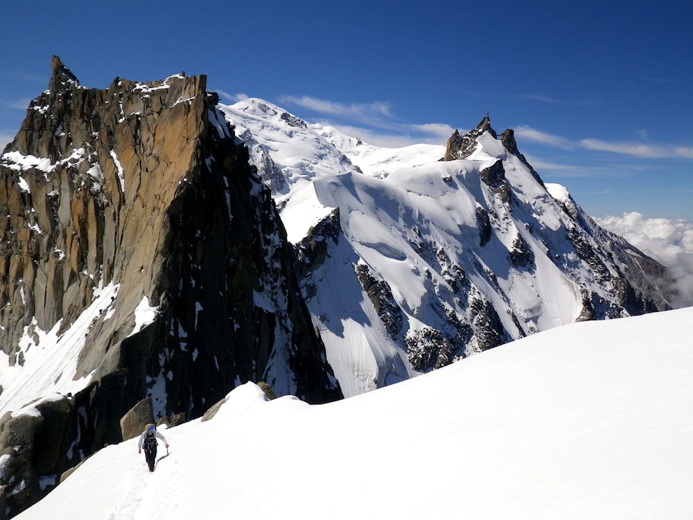
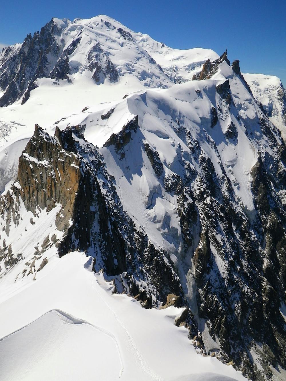
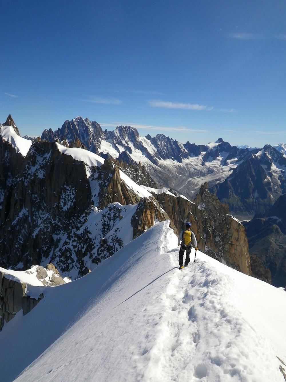
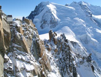
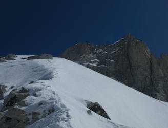
Begin by descending the famous snow arête east of the Aiguille du Midi and follow it as it mellows and widens to a large flat area atop the Aiguille du Midi north face. Carry on along the ridge over 2 small summits and then descend the exposed 40 degree snow slope down to the Col du Plan (3475m). This descent can feel pretty nerve wracking in icy conditions so don't rush, and make each step count.
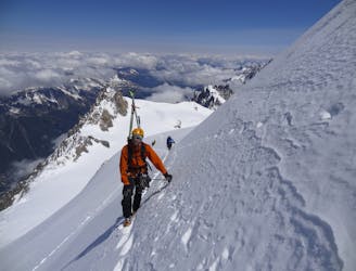
Move onto the north side of the ridge and traverse technically easy but very exposed mixed ground, moving gradually up and east to regain the ridge crest at the foot of a gully. (This exposed traverse is much easier when covered with a solid layer of firm snow, but it's possible when dry.)
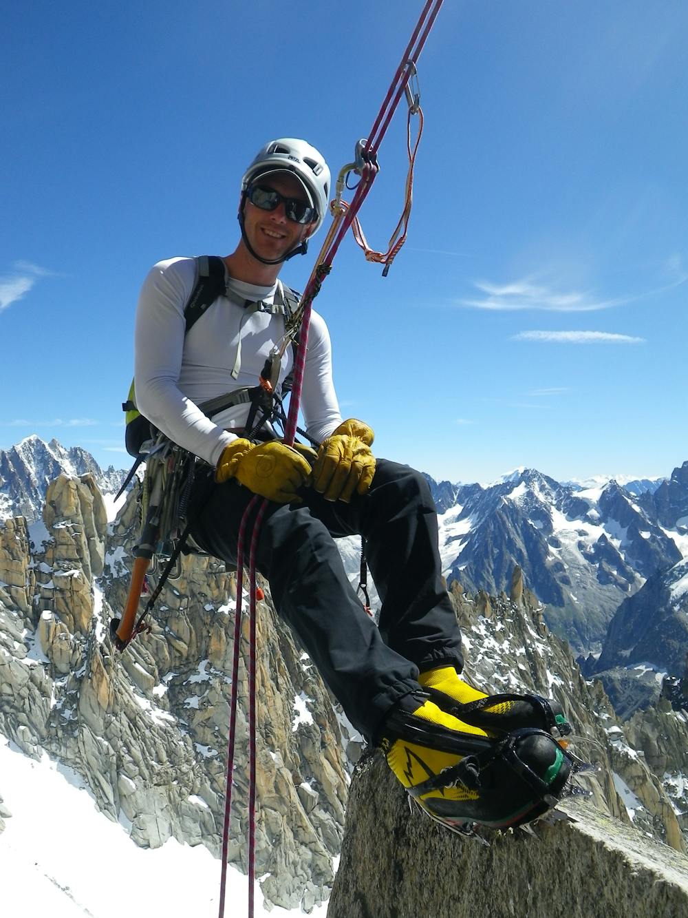
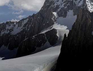
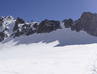
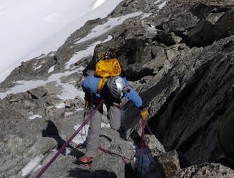
Climb the gully easily to the Rognon du Plan (a rocky buttress) and follow this as it narrows. When it gets very narrow (little more than a metre wide) abseil down the east face via ledges and chimneys using in-situ abseil anchors down to rocky slabs at the top of the Glacier d'Envers du Plan. In good, snowy conditions these slabs will be snow covered and easy to cross but in dry conditions they are tricky and a bit loose but not too treacherous. Cross them to the Glacier d'Envers du Plan proper and follow this easily as it climbs up to the Aiguille du Plan summit tower.
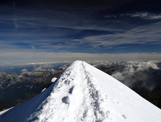
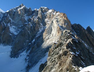
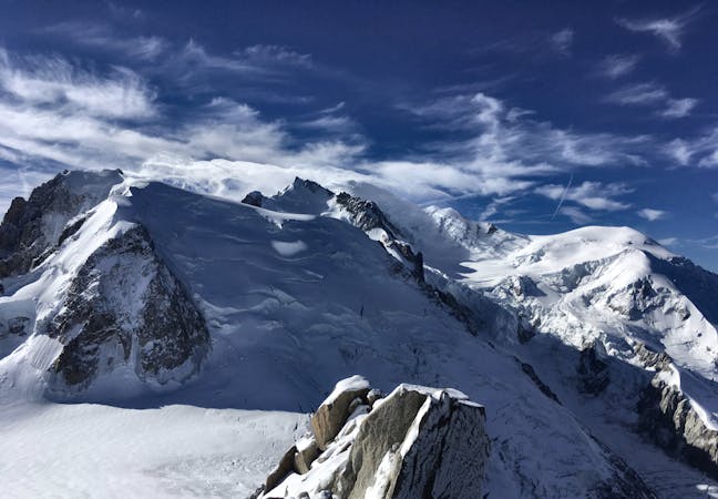
Climb a series of ledges on the north side of the tower and gradually drift right to reach a corner. Head up this (4b) and scramble up over a few more ledges to reach the summit. The views are incroyable, as the locals would say, so drink it in!
Go back the way you came to the Aiguille du Midi or (if you've got confirmation from the Guides Office that it is possible) there is the option of descending the Glacier d'Envers du Plan down to the Refuge du Requin and on to the Montenvers train. This option is rarely in condition and is a serious undertaking, so only attempt it if you are sure it's possible and you have the skills and experience to take it on. If you go back the way you came, the Rognon du Plan is pretty easy (4a/b ish) to climb via the face you abseiled down.
Regardless of how you return to the valley, getting to the summit on this route marks only the halfway point so keep concentrating and don't get distracted by the prospect of a cold beer until you have it in your hand!
Difficult
The beginning of truly technical terrain which might involve pitched climbing on rock and/or ice, exposed terrain and complex route finding in ascent and descent. Equivalent to AD, AD+

Much of the route is difficult to protect and a fall could be disastrous at certain points.
Little chance of being seen or helped in case of an accident.
2 m away
A wonderful high mountain journey through huge, wild mountains
Moderate Alpine Climbing
13 m away
A huge day out through very complicated glacial terrain to the highest peak in Western Europe
Moderate Alpine Climbing
15 m away
A characterful N Face in a wild location, but with relatively easy access.
Difficult Alpine Climbing
24 m away
Though this a normal route it is a relatively steep route up a N Face and is an avalanche black spot
Moderate Alpine Climbing
245 m away
An iconic and accessible route with great and varied climbing, with amazing exposure down to Chamonix
Difficult Alpine Climbing
5 km away
A popular and exposed route to a stunning granite spire, with epic views.
Difficult Alpine Climbing
5.1 km away
A great training route that can be done in either direction, easier N to S as described.
Moderate Alpine Climbing
5.1 km away
A memorable technical mountaineering route up one of the finest ridges of its standard in the Alps, the Frontier Ridge.
Severe Alpine Climbing
5.1 km away
An aesthetic short traverse and a good introduction to steeper snow.
Difficult Alpine Climbing
5.1 km away
An amazingly exposed rocky ridge, but never too hard, with incredible views
Difficult Alpine Climbing
5 routes · Alpine Climbing

12 routes · Alpine Climbing · Hiking

15 routes · Alpine Climbing · Hiking

6 routes · Alpine Climbing · Hiking

9 routes · Alpine Climbing · Hiking

6 routes · Alpine Climbing

9 routes · Alpine Climbing · Hiking

18 routes · Alpine Climbing · Hiking

10 routes · Alpine Climbing