2 m away
Midi - Plan Traverse
A truly classic route, which is serious and exposed but not technically difficult.
Difficult Alpine Climbing
- Distance
- 4.6 km
- Ascent
- 700 m
- Descent
- 700 m
A wonderful high mountain journey through huge, wild mountains
Also in Aoste, Italy
Alpine Climbing Moderate

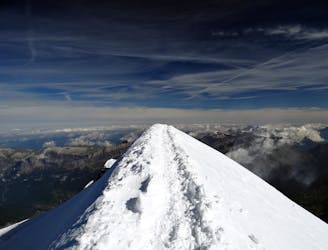
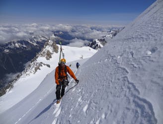
For the low grade alpinist, this is a great way to get into longer glacier routes. Once you've got down the Aiguille du Midi arete, the route is non-technical but you will need to be able to route find through glaciated terrain and, if things don't go to plan, carry out a crevasse rescue. As such, this is an ideal route for people who have the skills required for glacier travel but need to rack up some miles.
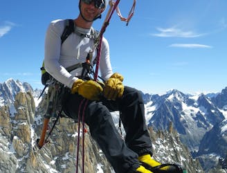
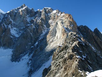
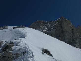
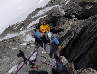
Start by descending the exposed and intimidating East ridge of the Aiguille du Midi. This is certainly the technical crux of the day and feels like quite a shock to the system after you've just got off a cable car! Take your time, watch your step closely and trust in your crampons and your ability.
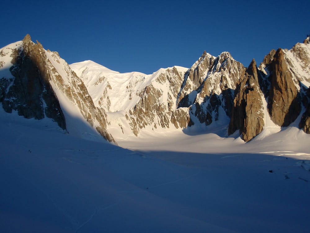
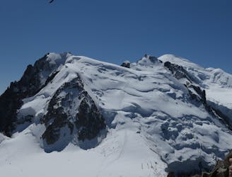
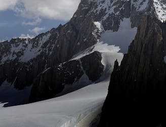
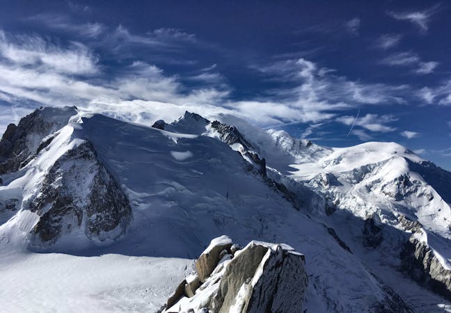
At the foot of the ridge you reach a large, flatter area at the top of the famous icy north face of the Aiguille du Midi. From the flat area, swing around underneath the stunning granite south face of the Midi. Look up and you're likely to see rock climbers making their way up one of the famous routes on the face.
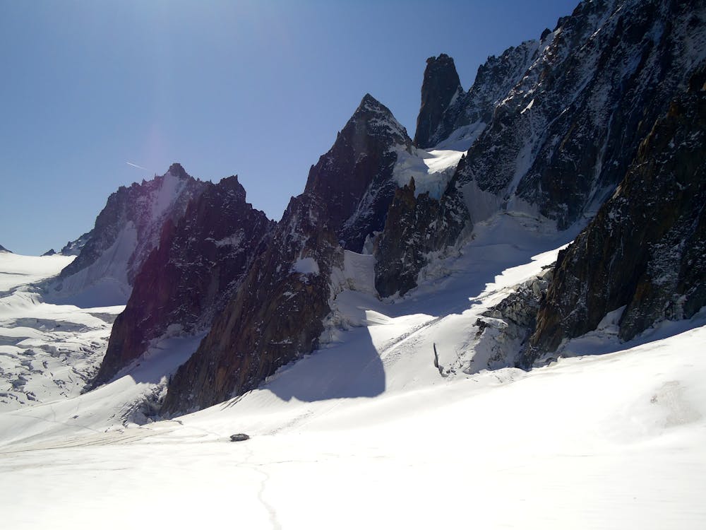
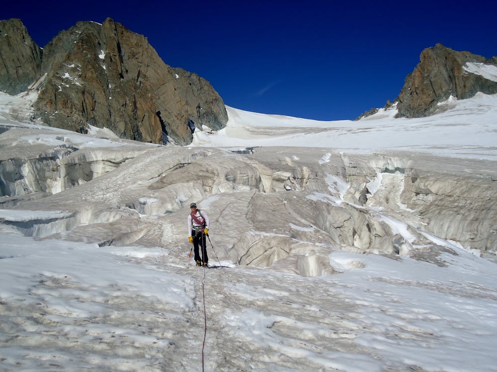
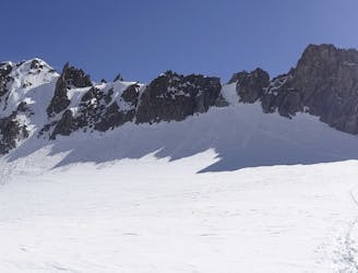
Head south and then head around to the north of the Pointes Lachenal across a flat section of glacier beneath the impressive north-east face of Mont Blanc du Tacul. Go south-east and drop down to the lowest point of the traverse just north of the Pic Adolphe Rey on the Glacier du Géant. Begin climbing towards the Torino Hut through some quite complex and crevassed terrain. Generally there is a track in place but if not, you'll need to pick a good, safe route through a series of fairly sizeable holes.
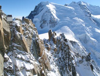
Once through the most complex of the terrain you will be immediately north of the Aiguilles d'Entrèves. Make the long-ish but gentle climb up to the Torino Hut. Grab a drink and enjoy the spectacular view of Mont Blanc's Peuterey ridge before getting on the Panoramique cable car back to the Aiguille du Midi.
This route can be done in either direction but is generally done in the direction described here because there is much less uphill than down!
Moderate
May involve slightly more complex glacier hikes, easy but possibly long rock ridges and steep snow up to 45 degrees. Equivalent to PD, PD+

Much of the route is difficult to protect and a fall could be disastrous at certain points.
Little chance of being seen or helped in case of an accident.
2 m away
A truly classic route, which is serious and exposed but not technically difficult.
Difficult Alpine Climbing
11 m away
A huge day out through very complicated glacial terrain to the highest peak in Western Europe
Moderate Alpine Climbing
13 m away
A characterful N Face in a wild location, but with relatively easy access.
Difficult Alpine Climbing
23 m away
Though this a normal route it is a relatively steep route up a N Face and is an avalanche black spot
Moderate Alpine Climbing
245 m away
An iconic and accessible route with great and varied climbing, with amazing exposure down to Chamonix
Difficult Alpine Climbing
5 km away
A popular and exposed route to a stunning granite spire, with epic views.
Difficult Alpine Climbing
5.1 km away
A great training route that can be done in either direction, easier N to S as described.
Moderate Alpine Climbing
5.1 km away
A memorable technical mountaineering route up one of the finest ridges of its standard in the Alps, the Frontier Ridge.
Severe Alpine Climbing
5.1 km away
An aesthetic short traverse and a good introduction to steeper snow.
Difficult Alpine Climbing
5.1 km away
An amazingly exposed rocky ridge, but never too hard, with incredible views
Difficult Alpine Climbing
5 routes · Alpine Climbing

12 routes · Alpine Climbing · Hiking

15 routes · Alpine Climbing · Hiking

6 routes · Alpine Climbing · Hiking

9 routes · Alpine Climbing · Hiking

6 routes · Alpine Climbing

9 routes · Alpine Climbing · Hiking

18 routes · Alpine Climbing · Hiking

10 routes · Alpine Climbing