2 m away
Mont Blanc du Tacul, 4248m. Contamine Grisolle N Face
A characterful N Face in a wild location, but with relatively easy access.
Difficult Alpine Climbing
- Distance
- 7.2 km
- Ascent
- 975 m
- Descent
- 975 m
A huge day out through very complicated glacial terrain to the highest peak in Western Europe
Alpine Climbing Moderate

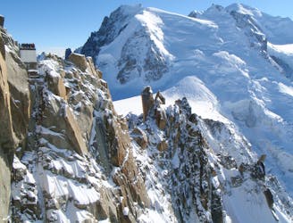
The route as described here starts from the Aiguille du Midi lift. The vast majority of people will make a very short approach day, and spend the night in the Cosmiques Hut, leaving after a 1am breakfast, in order to complete the descent before it gets dangerous. It may also be prudent to stay in the Goûter Hut after the traverse and descend the following day, before the steep slopes below the hut soften and the rockfall starts.
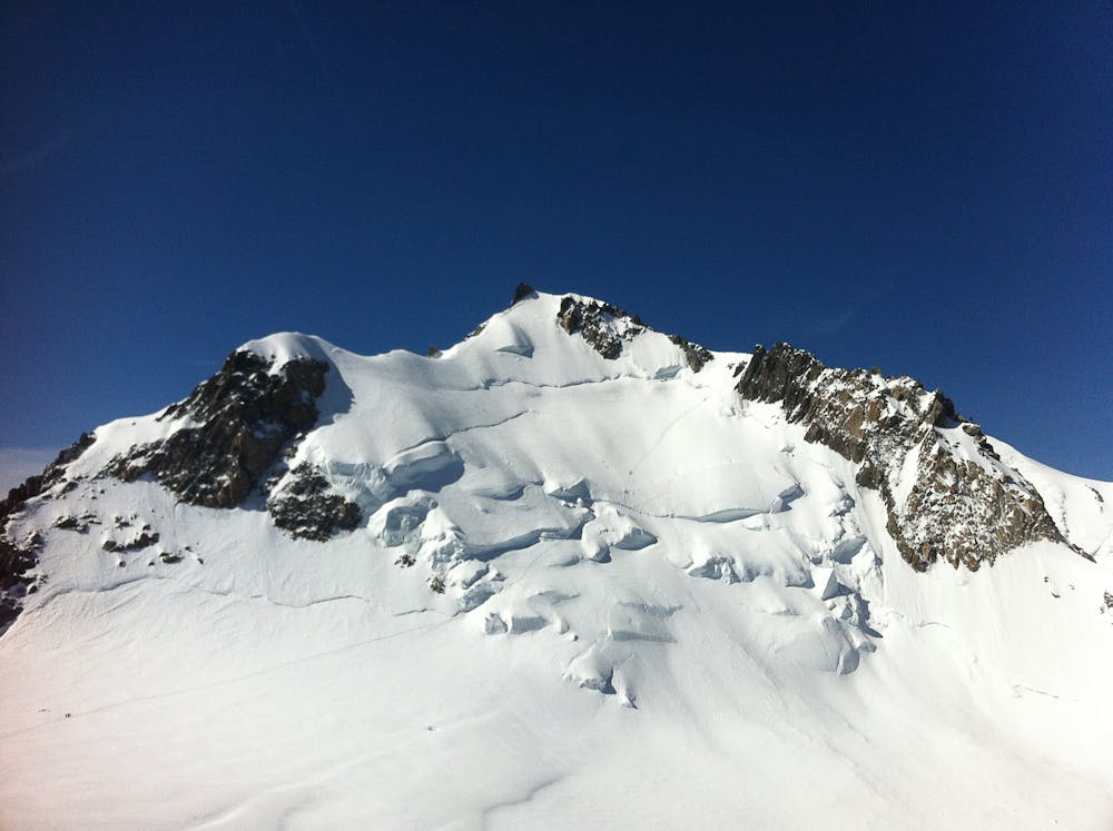
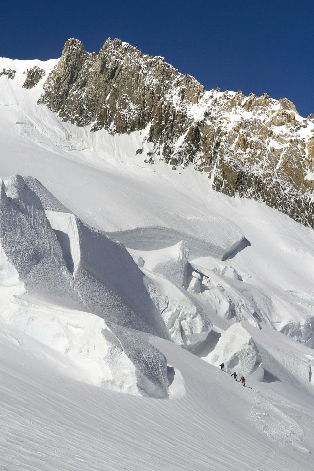
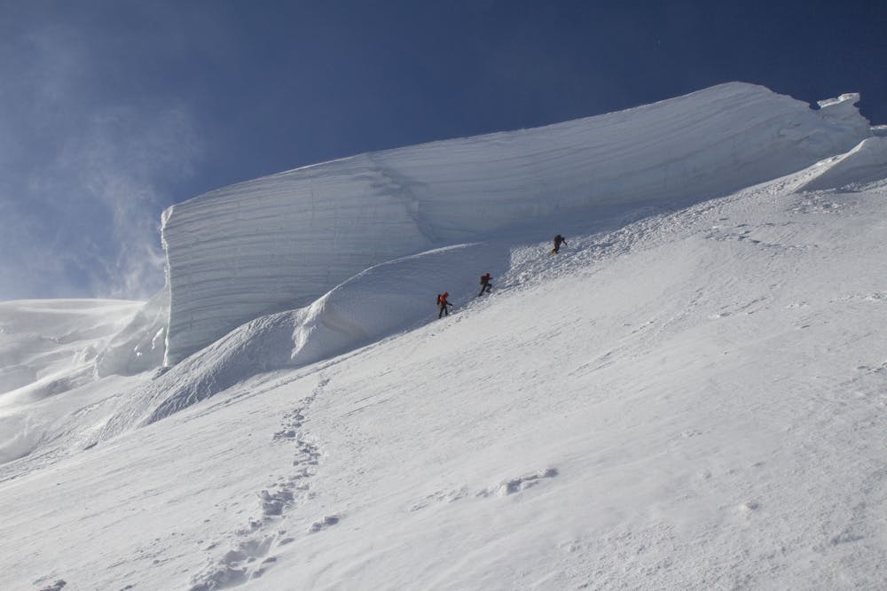
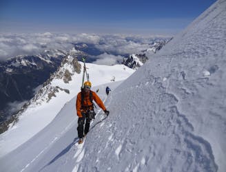
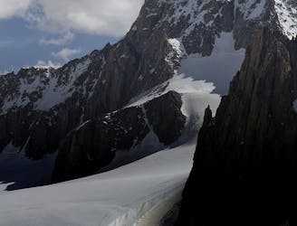
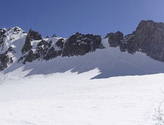
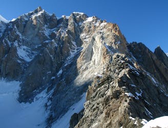
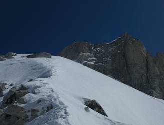
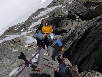
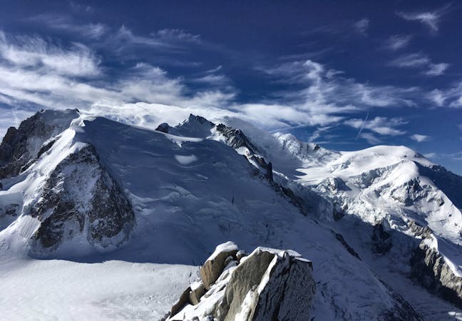
From the Aiguille du Midi take the exposed ridge down, then traverse the flat slopes over the Col du Midi. From here follow the well tracked route up the shoulder of Mont Blanc du Tacul. This varies in position and difficulty. One of the skills is knowing what length of rope to have between you and the others in your group - is the greatest hazard the steepness of the slope, or the crevasse danger? Bypass the summit of Mont Blanc du Tacul by taking a gently descending traverse down to the lowest point below the slope of Mont Maudit. At time of writing (July 2019) the seracs and crevasses on Mont Maudit were in a threatening position, so it is worth seeking bang up to date information from the Guides Office or the guardian of the Cosmiques Hut. Assuming there is a safe way through, negotiate this steep slope, aiming for a weakness on the NW shoulder of Mont Maudit. This is the steepest part of the whole route, but there is a small rock island half way up, which provides intermediate belays if needed. From the shoulder an exposed traverse to the L take you to the flat area of Col Brenva. The final slopes to the summit of Mont Blanc are seemingly endless, as the slope is foreshortened and the altitude will be slowing you down.
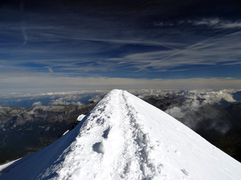
Marvel in the incredible views, as if from a plane you are so high, though most don’t linger long as the slightest breeze will feel Baltic at this height. Also the safety of the descent needs to be foremost in your mind, and a big part of that relates to the time of day. Descend the well-tracked normal route towards the Goûter Hut, initially down the Bosses Ridge. This is exposed near the top, but gets progressively easier as you descend, passing the Vallot Hut at 4300m. From there downwards it is quite straightforward to the Goûter Hut at 3835m. If you are not staying here then do not delay, but continue down the steep mixed slopes to the Tête Rousse Hut. This is festooned with fixed cables for most of its length, which can be held or clipped into as desired. Rockfall is a real problem, particularly once the sun gets on it after midday, but can occur at any time. Some of this is from other climbers but some is natural from spontaneous release. Of particular danger is the crossing of the Grand Couloir at the bottom of the slope, where there is a cable that can be clipped into, though it is debatable if this makes it safer, as it may slow your crossing of the Couloir.
Relax once you are on the far side of it and you should be able to remove crampons now. Get some refreshment at the Tête Rousse hut then follow the footpath down to the Nid d’Aigle at 2360m, where you can get the train down to St Gervais, or train and cable car down to Les Houches. An unforgettable day and a huge effort!
Moderate
May involve slightly more complex glacier hikes, easy but possibly long rock ridges and steep snow up to 45 degrees. Equivalent to PD, PD+

The route features some exposed and/or difficult to protect sections.

Little chance of being seen or helped in case of an accident.
2 m away
A characterful N Face in a wild location, but with relatively easy access.
Difficult Alpine Climbing
11 m away
A wonderful high mountain journey through huge, wild mountains
Moderate Alpine Climbing
12 m away
Though this a normal route it is a relatively steep route up a N Face and is an avalanche black spot
Moderate Alpine Climbing
13 m away
A truly classic route, which is serious and exposed but not technically difficult.
Difficult Alpine Climbing
254 m away
An iconic and accessible route with great and varied climbing, with amazing exposure down to Chamonix
Difficult Alpine Climbing
5 km away
A popular and exposed route to a stunning granite spire, with epic views.
Difficult Alpine Climbing
5.1 km away
A great training route that can be done in either direction, easier N to S as described.
Moderate Alpine Climbing
5.1 km away
A memorable technical mountaineering route up one of the finest ridges of its standard in the Alps, the Frontier Ridge.
Severe Alpine Climbing
5.1 km away
An aesthetic short traverse and a good introduction to steeper snow.
Difficult Alpine Climbing
5.1 km away
An amazingly exposed rocky ridge, but never too hard, with incredible views
Difficult Alpine Climbing
5 routes · Alpine Climbing

12 routes · Alpine Climbing · Hiking

15 routes · Alpine Climbing · Hiking

6 routes · Alpine Climbing · Hiking

9 routes · Alpine Climbing · Hiking

6 routes · Alpine Climbing

9 routes · Alpine Climbing · Hiking

18 routes · Alpine Climbing · Hiking

10 routes · Alpine Climbing