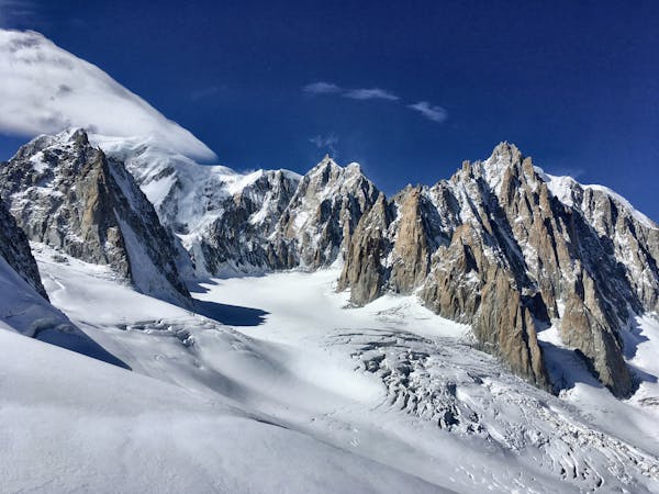
1.7 km away
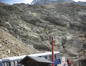
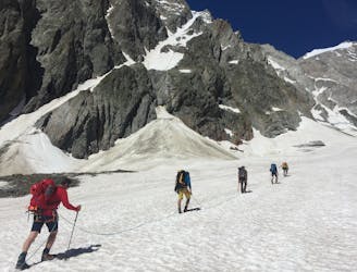
Mont Blanc, 4808m. Pope Route from Gonella Hut.
A fantastic route from the wild Italian side of the mountain traversing to descend into France
Moderate Alpine Climbing
- Distance
- 9.9 km
- Ascent
- 1.8 km
- Descent
- 1.1 km
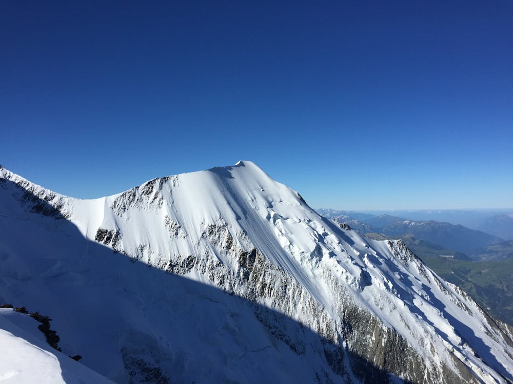
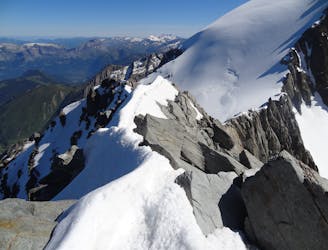
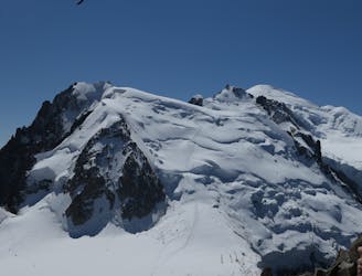
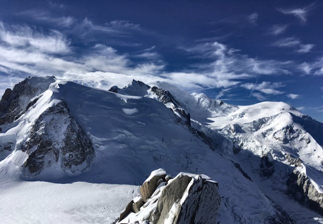
The most amazing traverse of several 4000m peaks including the iconic Aiguille du Bionnassay and Mont Blanc
Also in Aoste, Italy
Alpine Climbing Difficult

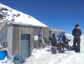
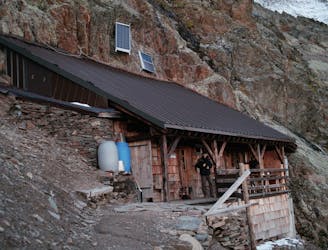
Be sure you are confident of conditions as this traverse has a reputation for cornices and avalanche danger. A high level of fitness and acclimatisation are essential as well as a perfect forecast. The route begins pretty much from the door of the Durier Hut, following snow slopes to the side of the ridge itself.
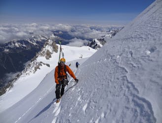
Later in the season many sections of this S facing ridge will be rocky, good in parts, less in others. Take the line of least resistance of the ridge until an unavoidable rocky/mixed section at about 3800m. Here in dry conditions the easiest line is a rocky chimney to the R of the ridge itself, by a few short pitches. Above it is more snowy/icy and you stick close to the crest on one side or the other, taking care to give potential cornices a wide berth.
From the summit of the Bionnassay you descend the very exposed ridge to the Col de Bionnassay at 3888m. Now climb up to the Piton des Italiens at 4002m, where you meet the Pope Route, the normal route up Mont Blanc from the Italian side. Above here there is another very exposed section, but it is short lived, leading to the Dôme du Goûter at 4304m. In the event of bad weather or lack of fitness/acclimatisation there is the option to descend the normal route of Mont Blanc to the Goûter Hut. Described here is the continuation over Mont Blanc.
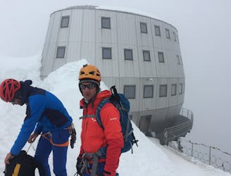
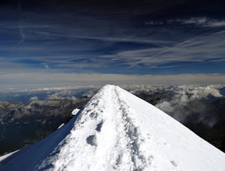
Continue up icy slopes to the Vallot Refuge, where a brief bit of shelter can be sought. The well travelled Arête des Bosses lies above, mostly steady with slightly more exposed sections occasionally, but nothing compared to the Bionnassay. You have really earned your prize of the highest point in Europe, by one of the most aesthetic lines.
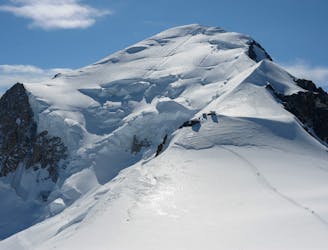
Descending to Col Brenva is straightforward, then follows a slightly exposed traverse to the shoulder of Mont Maudit. The next 80-100m from the shoulder of Mont Maudit is steep and may see you facing in or potentially rappeling if conditions are icy. There is a rock island halfway down with intermediate anchors.
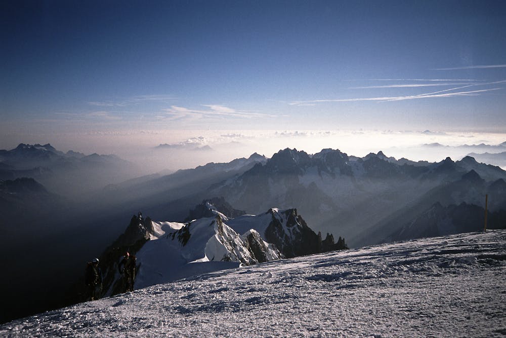
At time of writing (June 2019) the NE slope of Mont Maudit below the steep step is very serac threatened and you are advised to seek local knowledge about the best way to negotiate it from above. Once down to the flat area beneath Mont Maudit there follows a gentle reascent to the shoulder of Mont Blanc du Tacul, then a steep meandering descent of this normal route, usually following a major track. All that remains is the final gruelling climb to the Aiguille du Midi. Well done on completing a massive and committing day you will never forget.
Difficult
The beginning of truly technical terrain which might involve pitched climbing on rock and/or ice, exposed terrain and complex route finding in ascent and descent. Equivalent to AD, AD+

The majority of the route is "no fall" terrain.
In the high mountains or remote conditions, all individuals must be completely autonomous in every situation.
1.7 km away
A fantastic route from the wild Italian side of the mountain traversing to descend into France
Moderate Alpine Climbing
3.2 km away
The most popular route up the highest peak in Western Europe.
Moderate Alpine Climbing
3.8 km away
A significant day itself accessing the highest guardian-ed hut in France.
Moderate Alpine Climbing
5.5 km away
An über classic low grade route which is a perfect introduction to longer alpine climbs.
Moderate Alpine Climbing
5.5 km away
A staggeringly beautiful day of mountaineering through Himalayan-esque scenery
Difficult Alpine Climbing
6.1 km away
A very long and remote day that can be halved by staying in the Plan Glacier Hut
Moderate Alpine Climbing
8 km away
A stunning journey up a really impressive glacier to a remote, modern hut
Easy Alpine Climbing
8.4 km away
Though this a normal route it is a relatively steep route up a N Face and is an avalanche black spot
Moderate Alpine Climbing
8.4 km away
A characterful N Face in a wild location, but with relatively easy access.
Difficult Alpine Climbing
8.4 km away
A huge day out through very complicated glacial terrain to the highest peak in Western Europe
Moderate Alpine Climbing
3 routes · Alpine Climbing · Hiking
5 routes · Alpine Climbing

12 routes · Alpine Climbing · Hiking

15 routes · Alpine Climbing · Hiking

6 routes · Alpine Climbing · Hiking

9 routes · Alpine Climbing · Hiking

6 routes · Alpine Climbing

9 routes · Alpine Climbing · Hiking

18 routes · Alpine Climbing · Hiking

10 routes · Alpine Climbing