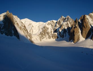
2.6 km away
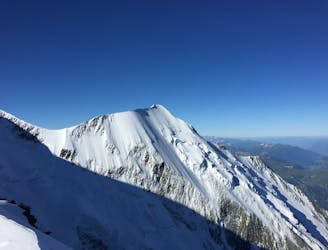
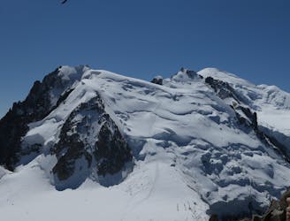
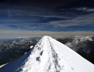
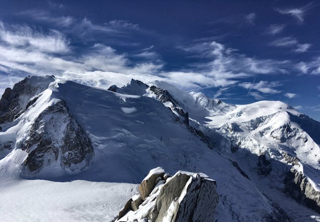
Mont Blanc, 4808m. Goûter Route.
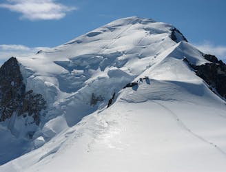
The most popular route up the highest peak in Western Europe.
Moderate Alpine Climbing
- Distance
- 8 km
- Ascent
- 1.1 km
- Descent
- 1.1 km
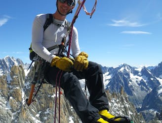
A significant day itself accessing the highest guardian-ed hut in France.
Alpine Climbing Moderate

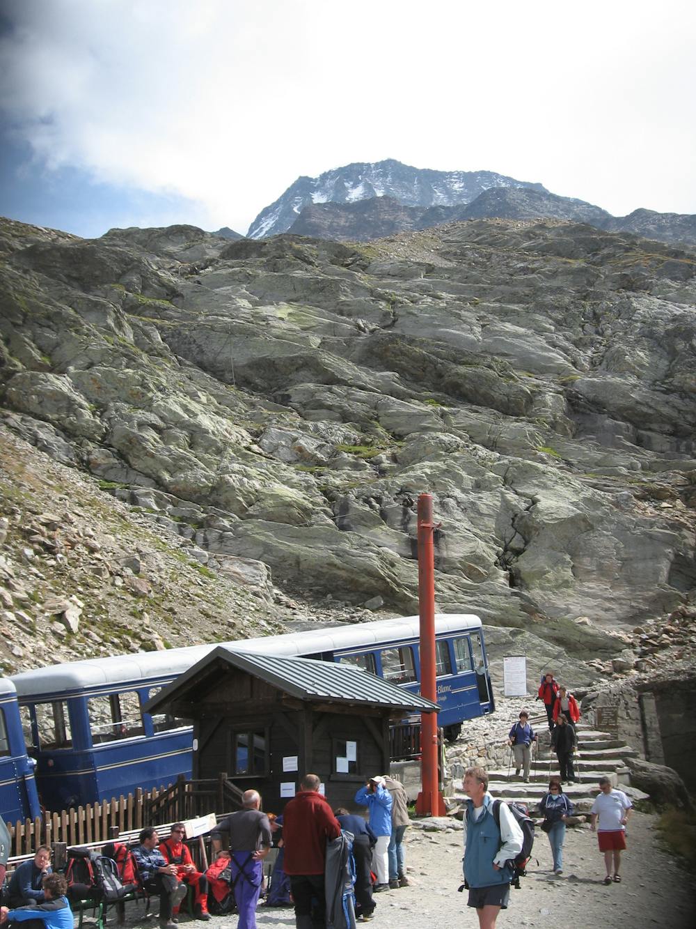
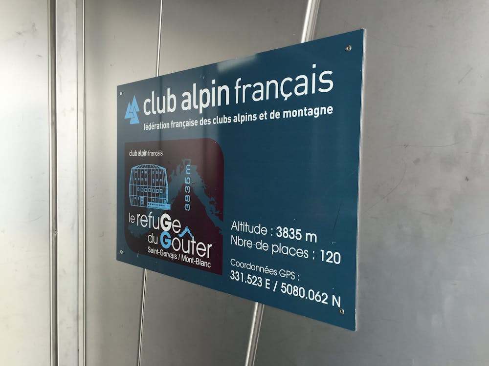
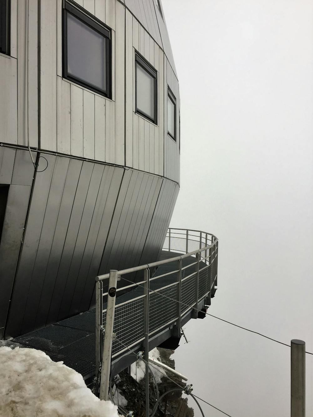
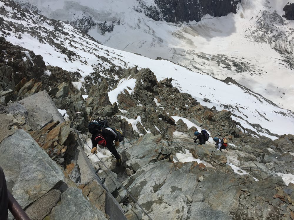
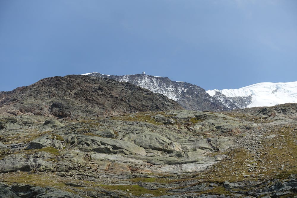
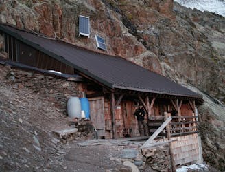
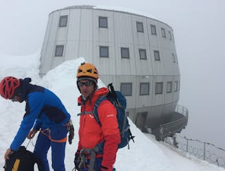
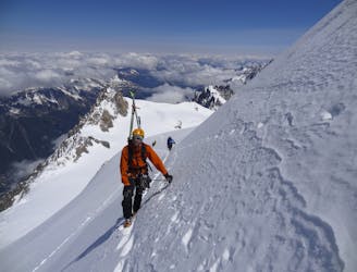
Although this is only the access day for Mont Blanc it is still a big day with significant height gain. Ideally take the first lifts to Nid d’Aigle, arriving at 9.30am (summer 2019). This is either via the train direct from Le Fayet or St Gervais, or cable car from Les Houches, then train from Bellevue. If you want an even earlier start in really hot weather, then an alternative would be to get the first cable car from Les Houches to Bellevue at 7.30am, then take the direct footpath from there to the Tête Rousse Hut. This would only save time for the fittest, as it adds significantly to the height gain. Follow the well-marked footpath from Nid d’Aigle towards the Tête Rousse Hut at 3167m. Bypass the hut in order to save time, as being as early as possible on the next section is advisable. Put your crampons on just above the hut, as on the next slopes you will need them, and you want to minimise the stops from here on up. Ahead lies the infamous crossing of the Grand Couloir, which is a well-known accident blackspot. Indeed from time to time it becomes so dangerous that the Mayor of St Gervais forbids access to the hut, closing this approach. There is a cable that traverses the couloir, which some people clip into, though it is debatable if this makes it safer, as you may be quicker crossing without it. Certainly don’t stop in the couloir but quickly head to the relative safety of the other side. The danger is rockfall, mainly spontaneous from the slopes high above the couloir, but some is from other climbers. From the far side of the couloir is 600m of steep easy scrambling on mixed rock, snow and sometimes a little ice. There are numerous sections of cable to follow and you may also choose to clip into some of them for security. The route itself is self-evident, leading to the ridge of the Aiguille du Goûter, followed by a short snowy walk to the hut itself at 3835m. It is a masterpiece of engineering, built at great expense in 2013, with a commanding position and view, visible from afar.
Moderate
May involve slightly more complex glacier hikes, easy but possibly long rock ridges and steep snow up to 45 degrees. Equivalent to PD, PD+

The route features some exposed and/or difficult to protect sections.

Little chance of being seen or helped in case of an accident.
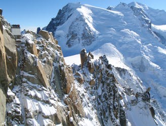
2.6 km away
The most popular route up the highest peak in Western Europe.
Moderate Alpine Climbing
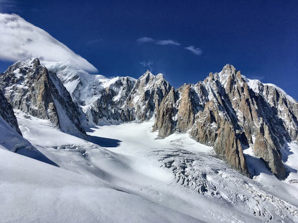
3.8 km away
The most amazing traverse of several 4000m peaks including the iconic Aiguille du Bionnassay and Mont Blanc
Difficult Alpine Climbing
4.8 km away
A very long and remote day that can be halved by staying in the Plan Glacier Hut
Moderate Alpine Climbing
5.1 km away
A fantastic route from the wild Italian side of the mountain traversing to descend into France
Moderate Alpine Climbing
7.3 km away
Though this a normal route it is a relatively steep route up a N Face and is an avalanche black spot
Moderate Alpine Climbing
7.3 km away
A characterful N Face in a wild location, but with relatively easy access.
Difficult Alpine Climbing
7.3 km away
A huge day out through very complicated glacial terrain to the highest peak in Western Europe
Moderate Alpine Climbing
7.3 km away
A wonderful high mountain journey through huge, wild mountains
Moderate Alpine Climbing
7.3 km away
A truly classic route, which is serious and exposed but not technically difficult.
Difficult Alpine Climbing
7.5 km away
An iconic and accessible route with great and varied climbing, with amazing exposure down to Chamonix
Difficult Alpine Climbing
3 routes · Alpine Climbing · Hiking
5 routes · Alpine Climbing

12 routes · Alpine Climbing · Hiking

15 routes · Alpine Climbing · Hiking

6 routes · Alpine Climbing · Hiking

9 routes · Alpine Climbing · Hiking

6 routes · Alpine Climbing

9 routes · Alpine Climbing · Hiking

18 routes · Alpine Climbing · Hiking

10 routes · Alpine Climbing