2.1 km away
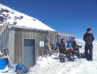
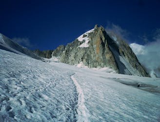
Approach to the Gonella Hut
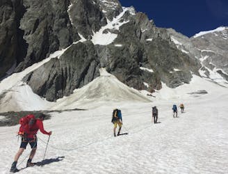
A stunning journey up a really impressive glacier to a remote, modern hut
Easy Alpine Climbing
- Distance
- 9.7 km
- Ascent
- 1.4 km
- Descent
- 50 m
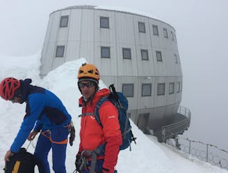
Quiinto Sella refuge on the Tournette Spur route
Alpine Climbing Extreme

eparture from Contine de la Visaille in Italy in the Val Veny .
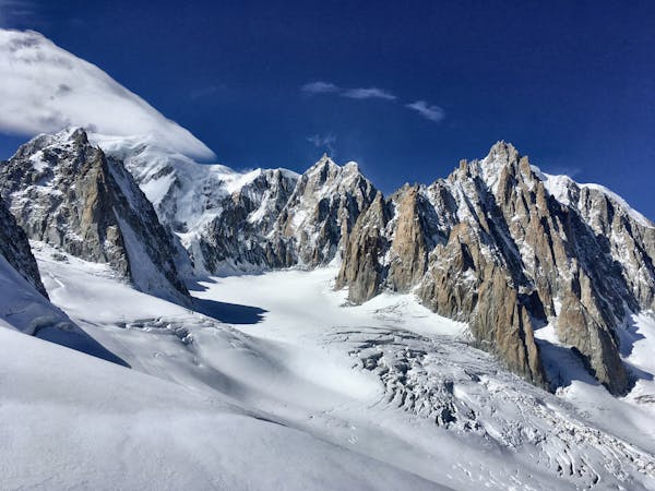
Once at the end of the "trafficable" part of the paved road (barrier), continue the paved road for about 20 minutes after the barrier. Take the uphill path to the right to reach the moraine then the Miage glacier (covered with stones). The path on the moraine of the glacier is rather in the center of it. The path is marked at regular intervals with yellow spots on the stones. After walking 3 km on the glacier, turn right towards the Mont-Blanc glacier. See a topo-photo
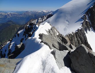
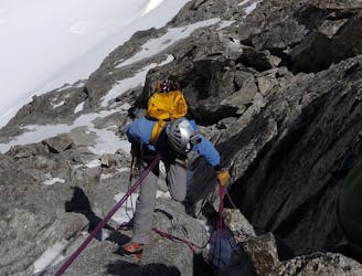
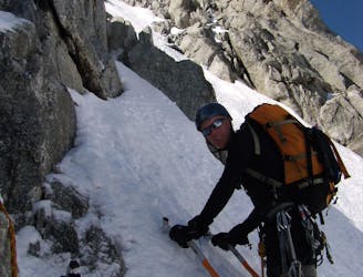
Option 1 at the end of the season when the snow corridor is no longer in condition Climb the first corridor in snow on the left of the glacier (crevasse) or go directly into the rocky buttress to the left of this corridor. (II) At 2/3 of the corridor leave it to the right to reach the grassy slopes. Then attack the wall by a little marked and steep corridor. Be careful not to take the strongly marked corridor which goes to the right. Climb the corridor by an easy climb (II) and thus reach the crest of the wall. Thus reach the remains of the old refuge. Raise your nose and you will see on one of the points 200 m above you the antenna of the new refuge. Continue the rocky ridge with an easy climb to the new refuge (3371 m)
Option 2 at the start of the season when the snow couloir is still in good condition Go up the steep part of the glacier by its right bank (60° to 70° in ice) to leave it in the direction of a snow corridor that you go up to a snowy pass following a snowy ridge. Set foot on the rock ridge that you follow to reach Quintino Sella. This option requires you to leave early to avoid taking stones when going up the corridor.
Extreme
Long, committing and complex routes with difficult and sustained climbing on rock/ice and challenging route finding throughout. TD upwards.

Much of the route is difficult to protect and a fall could be disastrous at certain points.

Away from help but easily accessed.
2.1 km away
A stunning journey up a really impressive glacier to a remote, modern hut
Easy Alpine Climbing
5.7 km away
A fantastic route from the wild Italian side of the mountain traversing to descend into France
Moderate Alpine Climbing
7.2 km away
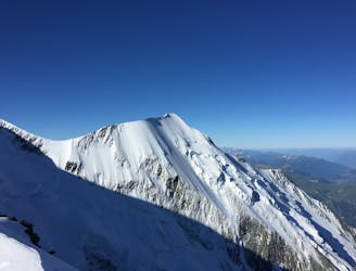
The most amazing traverse of several 4000m peaks including the iconic Aiguille du Bionnassay and Mont Blanc
Difficult Alpine Climbing
8.3 km away
A staggeringly beautiful day of mountaineering through Himalayan-esque scenery
Difficult Alpine Climbing
8.3 km away
An über classic low grade route which is a perfect introduction to longer alpine climbs.
Moderate Alpine Climbing
8.9 km away
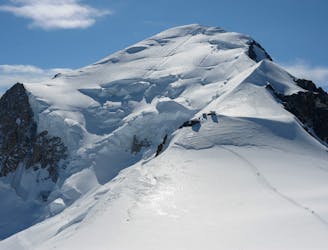
The most popular route up the highest peak in Western Europe.
Moderate Alpine Climbing
9.1 km away
An amazingly exposed rocky ridge, but never too hard, with incredible views
Difficult Alpine Climbing
9.1 km away

A relatively short route to a fantastic summit with breathtaking views of the S side of Mont Blanc
Moderate Alpine Climbing
9.1 km away
A great introduction to one of the more accessible N faces in the area.
Difficult Alpine Climbing
9.1 km away
A megaclassic rite of passage for the budding N Face alpinist.
Severe Alpine Climbing
3 routes · Alpine Climbing · Hiking
5 routes · Alpine Climbing

12 routes · Alpine Climbing · Hiking

15 routes · Alpine Climbing · Hiking

6 routes · Alpine Climbing · Hiking

9 routes · Alpine Climbing · Hiking

6 routes · Alpine Climbing

10 routes · Alpine Climbing