1.2 km away
Nito Ascent S

The most difficult but possibly most rewarding of the three options to ascend Nito.
Moderate Freeride Skiing
- Distance
- 1.9 km
- Ascent
- 436 m
- Descent
- 2 m
The classic route up Chisenupuri. It is not recommended to go higher than the top of the old lift system on storm days.
Freeride Skiing Difficult

Start at old Chisenupuri parking lot. It is the large lot on the left just before the hot springs on your left off of Route 66. You know you have gone too far if you reach the intersection of Route 66 and Route 58.
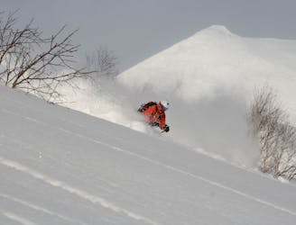
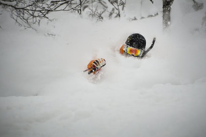
This is a very straightforward ascent that is recommended in fair weather, as the gem of this route is Chisenupuridake itself, rather than the lower terrain that makes up the old ski resort. That said, there is some rather exciting and enjoyable terrain located in the old resort if it is a storm day.
From the parking lot, follow the dominant track up the piste to the climbers left. This will wrap around slowly to the top of the chairlift. One of the nicest things about this route is that it is popular and one will frequently find a skin track that leads through the woods. There is a cat skiing operation in this area, and it is possible to catch a lift with them to the top of the old ski resort, saving a fair bit of effort.
Once on top of the old resort, enter the trees heading N/NE towards the main mountain. You will be climbing the S rib, or the SW face, depending on snow coverage and conditions. Though you will be able to see exactly where you are going, do not be deceived, as the hike is farther and longer than it appears. Budget at least an hour and a half to reach the summit. Be cautious at the top. This peak is close to the ocean, and gets a lot of wind. There is frequently rime and ice on the upper portions of the climb that can make skinning very difficult.
As with many of the other volcanoes in the area, be wary of holes that form due to wind or snowpack creep. Resist the temptation to climb the SE face as this is frequently skied and is prone to wind loading near the top.
Difficult
Serious gradient of 30-38 degrees where a real risk of slipping exists.

Exposure is limited to that of the slope itself. Getting hurt is still likely if the slope is steep and/or the snow is hard.

In the high mountains or remote conditions, all individuals must be completely autonomous in every situation.
1.2 km away
The most difficult but possibly most rewarding of the three options to ascend Nito.
Moderate Freeride Skiing
1.2 km away

The most direct of the three options to ascend Nito.
Difficult Freeride Skiing
1.2 km away

The easiest of the three options to ascend Nito.
Moderate Freeride Skiing
1.7 km away

An exciting storm day run with relative easy access and an easy return.
Difficult Freeride Skiing
1.9 km away

A great storm day touring zone with pleasantly spaced trees and sheltered spots for transitions.
Moderate Freeride Skiing
1.9 km away

An exciting storm day run and great way to return to the trailhead after touring other sections of Nito.
Difficult Freeride Skiing
2.3 km away
A classic line visible from the road.
Difficult Freeride Skiing
2.3 km away

An amazing south-east facing run that requires a short hike after skiing, or some organization to place a second car farther up the road.
Difficult Freeride Skiing
2.3 km away

A steep and playful east facing run that infrequently gets skied and can hold snow days after a storm.
Moderate Freeride Skiing
2.3 km away

A great run on a clear day that takes you from the top of Nito all the way down the S/SE face.
Difficult Freeride Skiing
12 routes · Freeride Skiing