421 m away
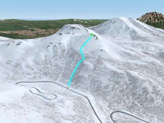
Nito SW Nose

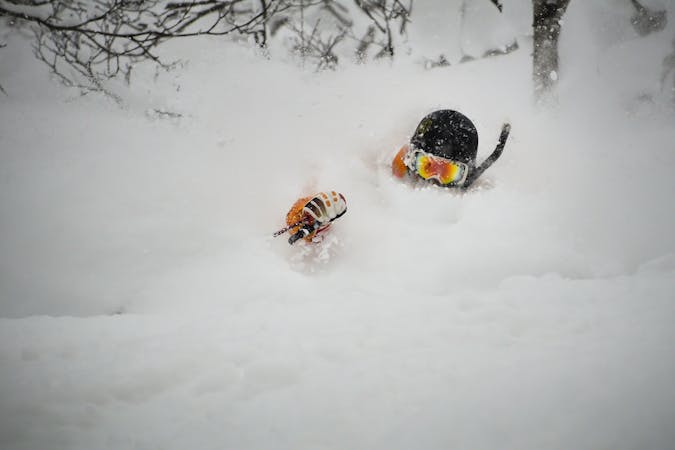
An exciting storm day run and great way to return to the trailhead after touring other sections of Nito.
Difficult Freeride Skiing
- Distance
- 625 m
- Ascent
- 0 m
- Descent
- 225 m
An exciting storm day run with relative easy access and an easy return.
Freeride Skiing Difficult

This is a fun and classic run, particularly on storm days as it gets a lot of sun. It is visible right from the trailhead and is very tempting to ski first thing in the day. It brings you from the main bench on Nito back to Route 66, close to the big blue road sign and the trailhead.
To get to this run, it is easiest to follow the Nito Ascent SW route. Though this is steeper and more difficult than climbing the W facing terrain, it is more direct. Ascend approximately 200-250 m until reaching the bench where the trees begin to thin. From here, drop in back to the S towards Route 66, to the riders right of your uphill track. This is a very simple and straightforward ski tour for beginners or those short on time due to its proximity to the road and the fact that you essentially walk up the face you will ski down.
The slope starts as a convexity, turning into a concavity after the roll. The steep trees at the top are too widely spaced to anchor the slope, and the wind commonly makes this a thin spot in the snowpack that can be easy to trigger due to the terrain's S facing nature. Exercise caution here, then enjoy your run as the terrain rolls away for the next 150 metres. There are playful features to have lots of fun off through here. Going farther to the right will bring you close to the creek that denotes the Nito SW Nose run. The creek can have open water and be a nasty little terrain trap early in the season.
The run begins to level off after 100 metres, and the trees tighten back up. They are fun to cruise through and there are still small stumps and features to jump off.
Ski onto the road slowly, even if following old tracks. There is a large water bar on the uphill side of the road that takes a lot of snow to get covered. Hitting this big dip at full speed would be a bad way to end a great ski day. You will have walked past this on your way out along the road before entering the forest, so it will not be an unfamiliar obstacle. This water bar usually takes until mid January at least to get covered.
Once on the road, follow it back to the trailhead or put your skins on and use your skin track for another lap!
Difficult
Serious gradient of 30-38 degrees where a real risk of slipping exists.

As well as the slope itself, there are some obstacles (such as rock outcrops) which could aggravate injury.

Little chance of being seen or helped in case of an accident.
421 m away
An exciting storm day run and great way to return to the trailhead after touring other sections of Nito.
Difficult Freeride Skiing
440 m away

A great storm day touring zone with pleasantly spaced trees and sheltered spots for transitions.
Moderate Freeride Skiing
583 m away

The easiest of the three options to ascend Nito.
Moderate Freeride Skiing
584 m away

The most direct of the three options to ascend Nito.
Difficult Freeride Skiing
587 m away

The most difficult but possibly most rewarding of the three options to ascend Nito.
Moderate Freeride Skiing
633 m away

A great run on a clear day that takes you from the top of Nito all the way down the S/SE face.
Difficult Freeride Skiing
649 m away
A classic run from the summit of Nito that keeps riders high and close enough to the summit for more laps.
Moderate Freeride Skiing
662 m away

A great storm day touring zone with lots of sheltered spots and features that fills in later in the winter.
Difficult Freeride Skiing
667 m away

A classic run from the summit of Nito that keeps riders high and close to the summit for more laps.
Difficult Freeride Skiing
1.7 km away

The classic route up Chisenupuri. It is not recommended to go higher than the top of the old lift system on storm days.
Difficult Freeride Skiing
12 routes · Freeride Skiing