23 m away
Nito W

A classic run from the summit of Nito that keeps riders high and close to the summit for more laps.
Difficult Freeride Skiing
- Distance
- 1.2 km
- Ascent
- 4 m
- Descent
- 296 m
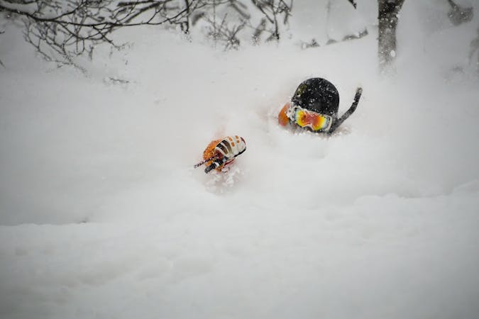
A classic run from the summit of Nito that keeps riders high and close enough to the summit for more laps.
Freeride Skiing Moderate

This is a fantastic NW facing run that brings you from the summit of Nito back to the the upper section of Route 66 that is closed in the winter. It is perfect for taking multiple laps off the summit of Nito on longer days when snow is staying good to the W. It has an expansive, open beginning, and closely spaced, NW facing trees after the bench that hold good snow days after a storm.
To get to this run, it is recommended to follow the Nito Ascent W route, as this will put you on the same aspect you will be skiing, for a better assessment of the snow. Remember to check the local Nadare Forecast (linked below) before heading into the backcountry.
From the summit of Nito, drop in to the open bowl to the W, back towards the way you presumably skinned up. You may cross your skin track, which is fine. Ride this terrain to the bench about 100 metres below the summit, where the trees begin to come together. This is a good spot to pause and keep your group together if you want. If possible, attempt to ski towards the nose, to the riders left, as this will lengthen your run. If you cannot make it there, the skiing is good everywhere below the bench.
The terrain funnels towards the main gully off of Nito and its sub-peak to the N, and may push you in that direction accordingly if you are not on the nose at the bench. Enjoy your ride through the varyingly spaced trees for another 100 metres or so until the terrain begins to level off. At this point make for the road as that will be an easy way to get your bearings and return to your skin track to hike back up for more skiing.
Moderate
Slopes become slightly steeper at around 25-30 degrees.

As well as the slope itself, there are some obstacles (such as rock outcrops) which could aggravate injury.

In the high mountains or remote conditions, all individuals must be completely autonomous in every situation.
23 m away
A classic run from the summit of Nito that keeps riders high and close to the summit for more laps.
Difficult Freeride Skiing
38 m away

A great storm day touring zone with lots of sheltered spots and features that fills in later in the winter.
Difficult Freeride Skiing
39 m away

A great run on a clear day that takes you from the top of Nito all the way down the S/SE face.
Difficult Freeride Skiing
467 m away

An exciting storm day run and great way to return to the trailhead after touring other sections of Nito.
Difficult Freeride Skiing
481 m away

A great storm day touring zone with pleasantly spaced trees and sheltered spots for transitions.
Moderate Freeride Skiing
649 m away

An exciting storm day run with relative easy access and an easy return.
Difficult Freeride Skiing
1.2 km away

The easiest of the three options to ascend Nito.
Moderate Freeride Skiing
1.2 km away

The most direct of the three options to ascend Nito.
Difficult Freeride Skiing
1.2 km away

The most difficult but possibly most rewarding of the three options to ascend Nito.
Moderate Freeride Skiing
1.8 km away

A steep and playful east facing run that infrequently gets skied and can hold snow days after a storm.
Moderate Freeride Skiing
12 routes · Freeride Skiing