1 m away
Nito Ascent W

The easiest of the three options to ascend Nito.
Moderate Freeride Skiing
- Distance
- 2.5 km
- Ascent
- 444 m
- Descent
- 7 m
The most direct of the three options to ascend Nito.
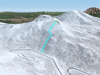
Freeride Skiing Difficult

Though a bit more difficult than Nito Ascent W, this is an easier ascent route than Nito Ascent S. Despite getting steep and sometimes into tight trees towards the top, this is a popular route up Nito as well, and it is likely one will be able to follow an old skin track up this route.
From the trailhead, follow the road as it follows a gentle bend to the walker's left, W. You will pass by a blue road sign that, depending on snow coverage, will be well above head height, or nearly buried. Keep in mind this is a sign over the road, as it is a good indicator of how much snow is covering hazards such as creeks and holes.
After passing the sign, turn off to the right into the woods and begin to switchback up the slope. It is possible the track will break off the road before the sign. This skin track changes locations depending on snow conditions, coverage, and the trail breakers preference. Generally speaking, this skin track winds through the woods and uphill using the ridge line that extends dead S as the right handrail.
Generally speaking this is not the preferred route of many guided groups as it is steeper and more demanding to climb than the W face of Nito. The trees are tighter, and due to its S facing nature, the bamboo is more persistent on this slope. Attempting to climb this route before there is sufficient coverage is not recommended, and can lead to some rather annoying bushwhacking.
After skinning through the trees for approximately 150 metres of vertical, the slope will bench out, though the trees generally remain relatively tight through here. Traverse to the W so you don't have to ski over your skin track on the way down, and enjoy your run. Since you will be skinning up through the terrain and snow you will be skiing on, an assessment of conditions should be relatively straightforward.
Remember to note the water bar just before the road. It takes a lot of snow to fill in, and skiing into this feature at full speed could be as bad as a season ending fall.
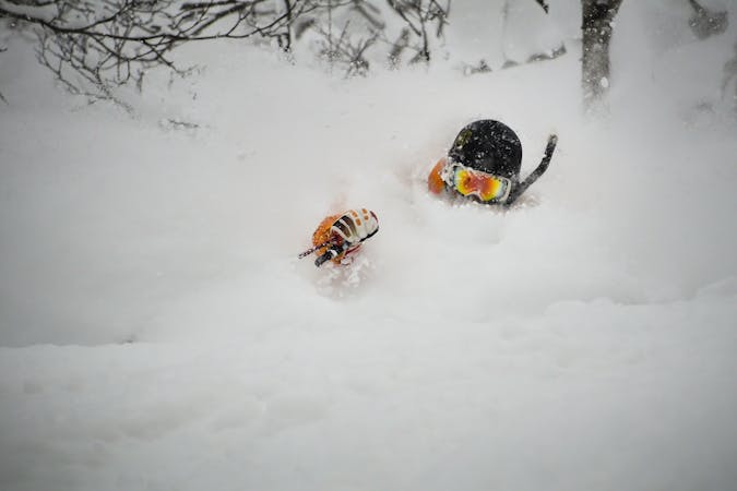
Difficult
Serious gradient of 30-38 degrees where a real risk of slipping exists.

As well as the slope itself, there are some obstacles (such as rock outcrops) which could aggravate injury.

In the high mountains or remote conditions, all individuals must be completely autonomous in every situation.
1 m away
The easiest of the three options to ascend Nito.
Moderate Freeride Skiing
4 m away

The most difficult but possibly most rewarding of the three options to ascend Nito.
Moderate Freeride Skiing
584 m away

An exciting storm day run with relative easy access and an easy return.
Difficult Freeride Skiing
955 m away

An exciting storm day run and great way to return to the trailhead after touring other sections of Nito.
Difficult Freeride Skiing
968 m away

A great storm day touring zone with pleasantly spaced trees and sheltered spots for transitions.
Moderate Freeride Skiing
1.2 km away

A great run on a clear day that takes you from the top of Nito all the way down the S/SE face.
Difficult Freeride Skiing
1.2 km away
A classic run from the summit of Nito that keeps riders high and close enough to the summit for more laps.
Moderate Freeride Skiing
1.2 km away

A great storm day touring zone with lots of sheltered spots and features that fills in later in the winter.
Difficult Freeride Skiing
1.2 km away

The classic route up Chisenupuri. It is not recommended to go higher than the top of the old lift system on storm days.
Difficult Freeride Skiing
1.2 km away

A classic run from the summit of Nito that keeps riders high and close to the summit for more laps.
Difficult Freeride Skiing
12 routes · Freeride Skiing