24 m away
Nito W, Low

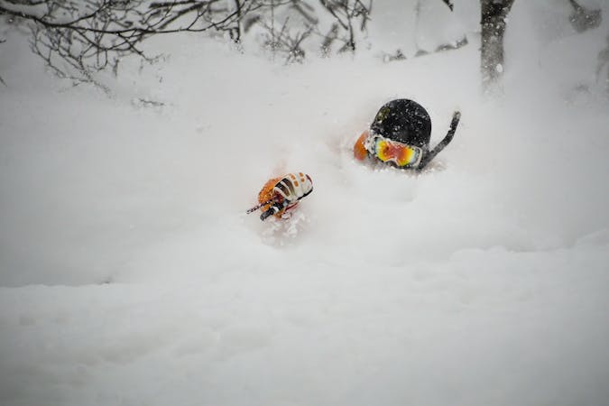
A great storm day touring zone with pleasantly spaced trees and sheltered spots for transitions.
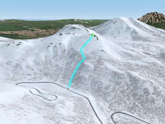
Moderate Freeride Skiing
- Distance
- 403 m
- Ascent
- 0 m
- Descent
- 165 m
An exciting storm day run and great way to return to the trailhead after touring other sections of Nito.
Freeride Skiing Difficult

This is a fun and classic run, particularly on storm days as it gets a lot of sun. It is visible right from the trailhead and is very tempting to ski first thing in the day. It brings you from the main bench on Nito back to Route 66, close to the big blue road sign and the trailhead.
To get to this run, it is recommended to follow the Nito Ascent W route as it is easier than climbing the SW face. From the bench where the trees begin to thin and one would drop in to the W facing terrain, ski along the ridge, to the S back towards the trailhead. Look for a bump or nose about 100 metres out along the ridge. You may have to sidestep a bit to get properly on it. Traditionally, that is why this is a good last run of the day, as you will be able to scope this hump out on previous W facing laps. If you are approaching from Nito Ascent SW, continue westward until you find yourself on top of the nose. Trying to drop in sooner will put you on the riders left side of the main creek that isolates this hump. This is great skiing too, though it isn't what you are aiming for. Remember to check the local Nadare Forecast (linked below) before heading into the backcountry.
Once on the hump, the run takes one dip and flattens for another 30m. After that it begins to roll away into a convexity. This is a tentative start zone, and because this terrain is S facing there is quite frequently a crust lurking here, so tread lightly. Ski down and over the roll towards the road, slight riders left. There are some exciting cliffs and features in this section, as well as a creek to the riders left of the hump. In early season, this creek may have open water and it is important to be cautious, though some of the best features are right next to this creek. Such is life. The run begins to level off after 100 m, and the trees tighten back up. They are fun to cruise through and there are still small stumps and features to jump off.
Ski onto the road slowly, even if following old tracks. There is a large water bar on the uphill side of the road that takes a lot of snow to get covered. Hitting this big dip at full speed would be a bad way to end a great ski day. You will have walked past this on your way out along the road before entering the forest, so it will not be an unfamiliar obstacle. This water bar usually takes until mid-January at least to get covered.
Once on the road, follow it to the left past the big blue road sign and back to the trailhead. http://niseko.nadare.info/
Difficult
Serious gradient of 30-38 degrees where a real risk of slipping exists.

As well as the slope itself, there are some obstacles (such as rock outcrops) which could aggravate injury.

In the high mountains or remote conditions, all individuals must be completely autonomous in every situation.
24 m away
A great storm day touring zone with pleasantly spaced trees and sheltered spots for transitions.
Moderate Freeride Skiing
421 m away

An exciting storm day run with relative easy access and an easy return.
Difficult Freeride Skiing
467 m away
A classic run from the summit of Nito that keeps riders high and close enough to the summit for more laps.
Moderate Freeride Skiing
479 m away

A great run on a clear day that takes you from the top of Nito all the way down the S/SE face.
Difficult Freeride Skiing
490 m away

A classic run from the summit of Nito that keeps riders high and close to the summit for more laps.
Difficult Freeride Skiing
501 m away

A great storm day touring zone with lots of sheltered spots and features that fills in later in the winter.
Difficult Freeride Skiing
954 m away

The easiest of the three options to ascend Nito.
Moderate Freeride Skiing
955 m away

The most direct of the three options to ascend Nito.
Difficult Freeride Skiing
959 m away

The most difficult but possibly most rewarding of the three options to ascend Nito.
Moderate Freeride Skiing
1.4 km away

A steep and playful east facing run that infrequently gets skied and can hold snow days after a storm.
Moderate Freeride Skiing
12 routes · Freeride Skiing