73 m away
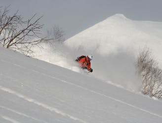
Chisenupuri SE

An amazing south-east facing run that requires a short hike after skiing, or some organization to place a second car farther up the road.
Difficult Freeride Skiing
- Distance
- 972 m
- Ascent
- 0 m
- Descent
- 383 m
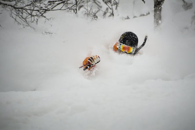
A steep and playful east facing run that infrequently gets skied and can hold snow days after a storm.
Freeride Skiing Moderate

This run is a tremendously fun variation on the popular Chisenupuri ski routes. Due to the distance it deposits skiers from the popular trailheads, this run frequently has few skier tracks on it. And when everything else is covered in bushes early season, this run can be quite fun due to it having very few trees.
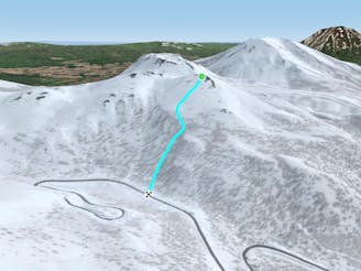
From the top of Chisenupuri Ascent South Route, drop into the east face, towards Nito. Because there are very few trees on this route, it is not recommended to ski this run in poor visibility. The run has several convex features, though it is overall rather concave. Use the rib that runs E/SE as a right handrail when skiing, but keep your distance from it. This ridge frequently gets wind scoured, and has thermal activity constantly leaving holes and shallow spots in the snow.
There are bits of scrub and brush, but overall no trees on this run, making it an ideal spot for skiing early season when most other runs are still too bushy. Exercise caution when reaching the bottom of this 200 metre run, as the transition to the road can be abrupt in some places, and may have exposed metal or fencing.
From the bottom of the run, one is best to return to ski Nito, or simply follow Route 66 down to the Nito Trailhead. It is for this reason that few people ski this route, as it is relatively difficult to return to the Chisenupuri parking lot. One can ascend this descent route though the ridge, which provides the best protection from the convex rolls on the mountain, is frequently shallow and wind-scoured, and makes for difficult skinning.
If organization, weather, and determination are on your side, this run is one of the hidden gems of the Niseko backcountry area.
Moderate
Slopes become slightly steeper at around 25-30 degrees.

Exposure is limited to that of the slope itself. Getting hurt is still likely if the slope is steep and/or the snow is hard.

In the high mountains or remote conditions, all individuals must be completely autonomous in every situation.
73 m away
An amazing south-east facing run that requires a short hike after skiing, or some organization to place a second car farther up the road.
Difficult Freeride Skiing
92 m away
A classic line visible from the road.
Difficult Freeride Skiing
1.4 km away

A great storm day touring zone with pleasantly spaced trees and sheltered spots for transitions.
Moderate Freeride Skiing
1.4 km away

An exciting storm day run and great way to return to the trailhead after touring other sections of Nito.
Difficult Freeride Skiing
1.8 km away
A classic run from the summit of Nito that keeps riders high and close enough to the summit for more laps.
Moderate Freeride Skiing
1.8 km away

A classic run from the summit of Nito that keeps riders high and close to the summit for more laps.
Difficult Freeride Skiing
1.8 km away

An exciting storm day run with relative easy access and an easy return.
Difficult Freeride Skiing
1.8 km away

A great run on a clear day that takes you from the top of Nito all the way down the S/SE face.
Difficult Freeride Skiing
1.8 km away

A great storm day touring zone with lots of sheltered spots and features that fills in later in the winter.
Difficult Freeride Skiing
2.1 km away

The easiest of the three options to ascend Nito.
Moderate Freeride Skiing
12 routes · Freeride Skiing