19 m away
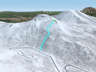
Chisenupuri SE

An amazing south-east facing run that requires a short hike after skiing, or some organization to place a second car farther up the road.
Difficult Freeride Skiing
- Distance
- 972 m
- Ascent
- 0 m
- Descent
- 383 m
A classic line visible from the road.
Freeride Skiing Difficult

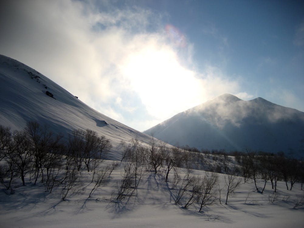
This is one of the easiest ways to access the alpine without putting in too extensive a day in the Niseko area. This run gets one a fair bit of skiing above treeline and a stunning view of the ocean. If you can catch a cat ride to the top of the resort, it is the most affordable, lowest effort alpine skiing available in the Niseko area.
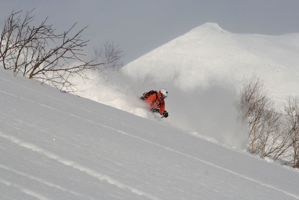
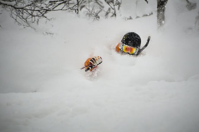
From the top of the Chisenupuri Ascent S Route, drop in to the concave SW face. Being concave, the most hazardous part of this slope is the very beginning. It is in the lee of the prevailing winds and regularly gets loaded. However, because of its aspect it gets a lot of sun and there are generally many crusts that affect the snowpack here. Take time to make an in depth assessment of the snow here, as even a short ride will bring you down through trees, potentially exacerbating injury. In the event of a slide, there are fortunately few to no rocks or cliffs below.
This slope is an exciting and steep face but if you aren't ready to hike more, or have a car parked at the Nito Trailhead, it is recommended to resist temptation to ski this route all the way down to Route 66. After the 150 metre steeper pitch, the slope will level out and it is recommended to find your skin track back towards the ski resort. This will make it very unlikely to get lost on the return, and will make the return to the ski resort much easier in deeper snow.
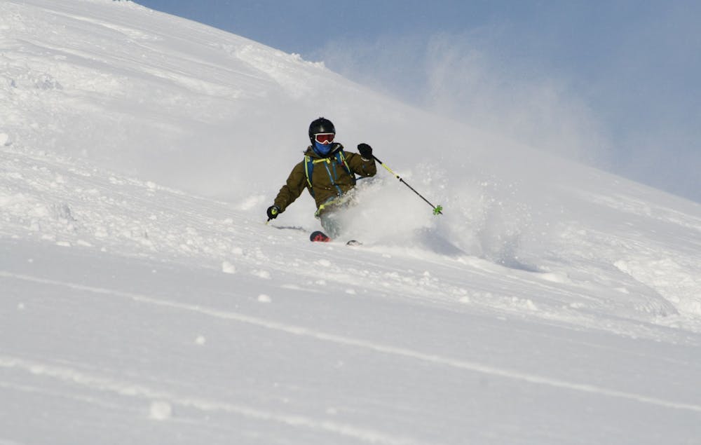
Once back in the resort, the track down with the most exciting skiing is to follow the old lift line, skiing just to the riders left of it. It is important to note that going too far to the left will deposit one into the large hot spring basin before the parking lot. This is ok and there are walkways to get back, however it is always best to be cautious around open water when skiing, and important to note there will be much less water later in the winter.
Difficult
Serious gradient of 30-38 degrees where a real risk of slipping exists.

As well as the slope itself, there are some obstacles (such as rock outcrops) which could aggravate injury.

In the high mountains or remote conditions, all individuals must be completely autonomous in every situation.
19 m away
An amazing south-east facing run that requires a short hike after skiing, or some organization to place a second car farther up the road.
Difficult Freeride Skiing
92 m away

A steep and playful east facing run that infrequently gets skied and can hold snow days after a storm.
Moderate Freeride Skiing
1.5 km away

A great storm day touring zone with pleasantly spaced trees and sheltered spots for transitions.
Moderate Freeride Skiing
1.5 km away

An exciting storm day run and great way to return to the trailhead after touring other sections of Nito.
Difficult Freeride Skiing
1.8 km away
A classic run from the summit of Nito that keeps riders high and close enough to the summit for more laps.
Moderate Freeride Skiing
1.8 km away

An exciting storm day run with relative easy access and an easy return.
Difficult Freeride Skiing
1.8 km away

A classic run from the summit of Nito that keeps riders high and close to the summit for more laps.
Difficult Freeride Skiing
1.9 km away

A great run on a clear day that takes you from the top of Nito all the way down the S/SE face.
Difficult Freeride Skiing
1.9 km away

A great storm day touring zone with lots of sheltered spots and features that fills in later in the winter.
Difficult Freeride Skiing
2.1 km away

The easiest of the three options to ascend Nito.
Moderate Freeride Skiing
12 routes · Freeride Skiing