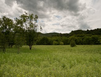
1.3 km away
Mill Trail

Walk to a historic cabin in the woods beside a river.
Easy Hiking
- Distance
- 663 m
- Ascent
- 42 m
- Descent
- 42 m
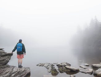
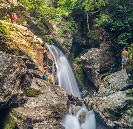
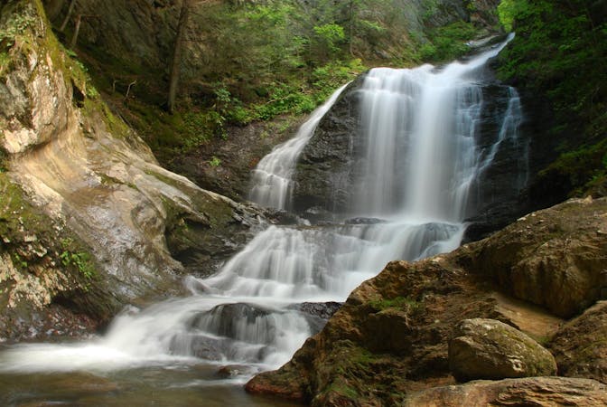
A 40-foot waterfall and summer swimming holes in a mountain stream.
Hiking Easy

Bingham Falls is an easy and worthwhile hike in between the town of Stowe and Stowe Mountain Resort. It’s especially good on a warm summer day when you’ll enjoy the shade of the forest and the cold water of the creek. Even on days that are too chilly for swimming, lots of people come to admire the waterfall and spend time in the forest. As with any hike in the area, it’s also excellent for foliage in the fall.
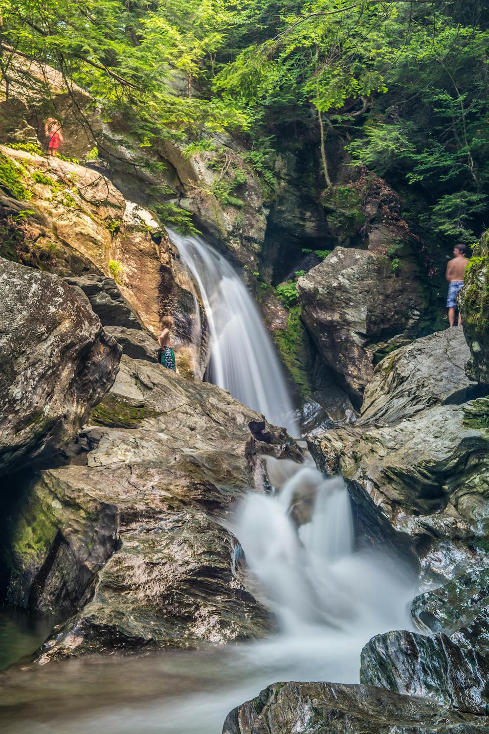
The main waterfall at Bingham Falls is about 40 feet high, and it plunges into a large, clear pool. The water then cascades through a miniature gorge, over many smaller waterfalls and pools. The trail goes downhill from the road to the creek; it’s mostly easy-going but has stone stairs and roots in some places. Beware of slippery spots all along the trail, but especially the rocks near the water’s edge.
Sources: https://www.stowelandtrust.org/conserved/properties/binghamfalls/
Easy
Walking along a well-kept trail that’s mostly flat. No obstacles are present.

The trail contains some obstacles such as outcroppings and rock which could cause injury.

Close to help in case of emergency.
1.3 km away
Walk to a historic cabin in the woods beside a river.
Easy Hiking
2.2 km away

Forest hike among the ski runs that finishes near a mountainside café, and provides access to higher trails on Mount Mansfield.
Moderate Hiking
2.7 km away
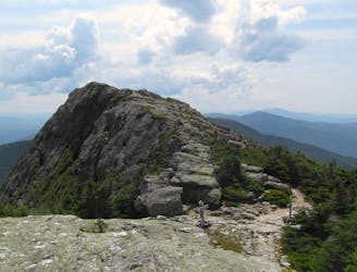
Hike Mount Mansfield bottom to top, starting from just outside Stowe Mountain Ski Resort.
Severe Hiking
3.8 km away
The easiest route to the summit of Mount Mansfield.
Moderate Hiking
4.1 km away
Short but strenuous route from the top of the gondola to the summit of Mount Mansfield.
Extreme Hiking
4.1 km away
Short, family-friendly nature trail with a view of Vermont's tallest mountain and a chance at spotting wildlife.
Easy Hiking
4.2 km away

A less exposed and less steep alternative to the Long Trail over the summit of Mount Mansfield.
Severe Hiking
4.7 km away
Popular hike to a large pond near the top of a mountain.
Moderate Hiking
5.9 km away
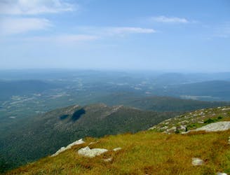
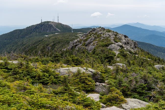
Widely considered the best trail to the 4,393-foot summit of Mount Mansfield.
Difficult Hiking
5.9 km away
Reach the summit of Mount Mansfield via three of its most thrilling trails.
Extreme Hiking
8 routes · Hiking
10 routes · Hiking
8 routes · Hiking

10 routes · Hiking