3 m away
Maple Ridge - Sunset Ridge Loop
Reach the summit of Mount Mansfield via three of its most thrilling trails.
Extreme Hiking
- Distance
- 12 km
- Ascent
- 870 m
- Descent
- 870 m
Widely considered the best trail to the 4,393-foot summit of Mount Mansfield.
Hiking Difficult

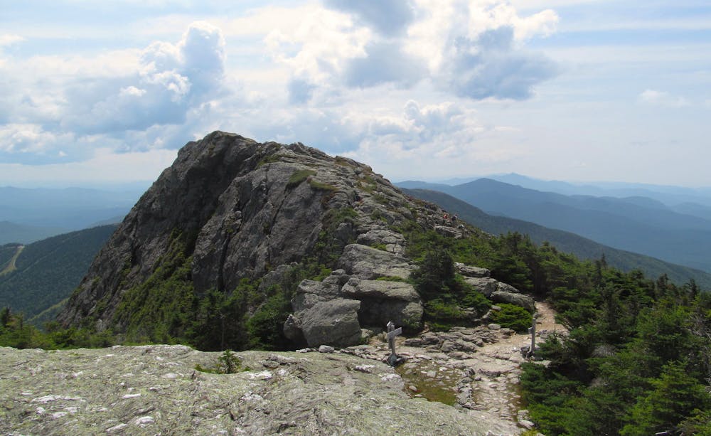
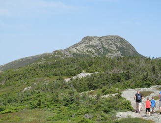
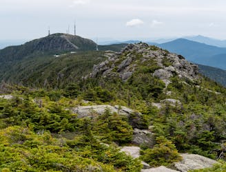
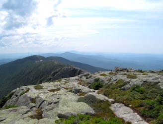
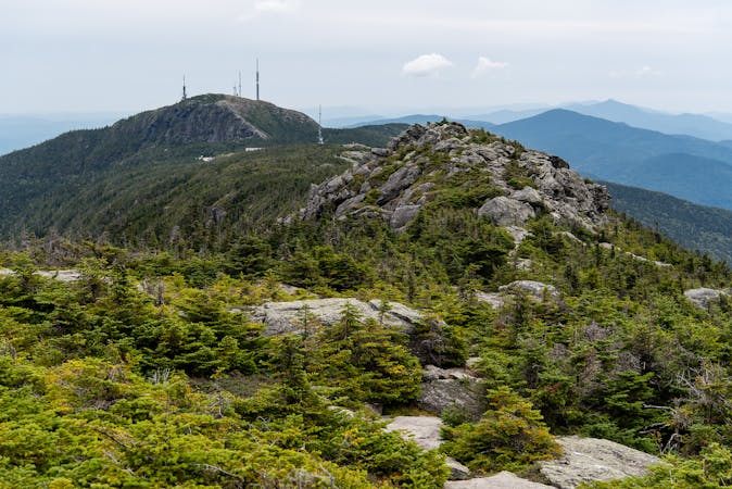
Mount Mansfield is the state highpoint of Vermont. This superlative, along with its proximity to Burlington and Stowe, makes it one of the top hiking destinations in the Northeast. There are many routes to the various peaks of its 4,000+ ridgeline, but Sunset Ridge is considered the premier trail for its relatively direct and amazingly scenic ascent to the true summit, known as The Chin. All the peaks are named for features of a human face, which the mountain is said to resemble in profile.
As with hiking anywhere in Vermont, be prepared for muddy tread and slippery rocks on Sunset Ridge Trail. The challenge that’s unique to Mount Mansfield is the possibility of radically different weather at elevation than where the hike began. Conditions above treeline can be truly alpine and subject to extremes. Be prepared for wind, wet, and cold, even if the weather seems nice at the start.
The trailhead is in Underhill State Park, which charges a small fee for entry. The environment is typical Vermont forest–dense and moist. Nearly every foot of the trail is comprised of rocks or roots, but it’s well-traveled and not too difficult. Slight challenges come at muddy stream crossings, high steps on rock ledges, and sometimes using the hands for short scrambles. Roughly one half of the trail is like this, stepping steadily upward under dense canopy. Be sure not to miss the 0.2-mile side trail to see Cantilever Rock, a large block jutting oddly outward from the mountainside.
Shorty after Cantilever Rock, the forest type changes substantially. On the upper half of the hike, deciduous trees become replaced by conifers, and height of the foliage shrinks as you climb higher. Forest soils soon give way to bare rock, and before you know it, you are in the alpine realm. It is very important that you stay on the trail here because the tundra vegetation is easily damaged by trampling. It can be hard to follow, but look closely for cairns, rows of stones, and painted blazes that mark the way.
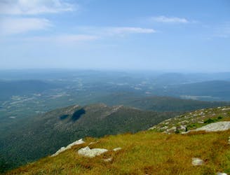
Keep pushing upward, and eventually, you will reach the intersection with the Long Trail, which is Vermont’s famous trek along the Green Mountains. The Long Trail traces the spine of Mount Mansfield, and joining it means you are almost at the top. Just a bit farther is the 4,393-foot summit. If visibility is good (dense fog is common and can form unexpectedly), you can see many miles in all directions, up and down the mountain range, and out to Lake Champlain. On a very clear day (also free of haze), you can see all the way to Mount Washington in New Hampshire.
Sources: http://4000footers.com/mansfield.shtml# https://www.summitpost.org/sunset-ridge-trail/394696
Difficult
Hiking trails where obstacles such as rocks or roots are prevalent. Some obstacles can require care to step over or around. At times, the trail can be worn and eroded. The grade of the trail is generally quite steep, and can often lead to strenuous hiking.

The trail contains some obstacles such as outcroppings and rock which could cause injury.
Away from help but easily accessed.
3 m away
Reach the summit of Mount Mansfield via three of its most thrilling trails.
Extreme Hiking
2.2 km away
The easiest route to the summit of Mount Mansfield.
Moderate Hiking
2.4 km away
Short but strenuous route from the top of the gondola to the summit of Mount Mansfield.
Extreme Hiking
2.6 km away
Climb to one of Mount Mansfield’s lesser peaks, with an overnight shelter and options for longer loop routes.
Severe Hiking
3 km away

A less exposed and less steep alternative to the Long Trail over the summit of Mount Mansfield.
Severe Hiking
4.2 km away
Hike Mount Mansfield bottom to top, starting from just outside Stowe Mountain Ski Resort.
Severe Hiking
4.2 km away

Forest hike among the ski runs that finishes near a mountainside café, and provides access to higher trails on Mount Mansfield.
Moderate Hiking
4.9 km away
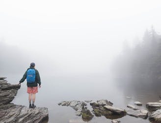
Popular hike to a large pond near the top of a mountain.
Moderate Hiking
5.9 km away
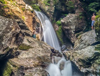
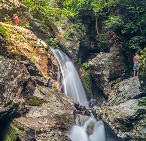
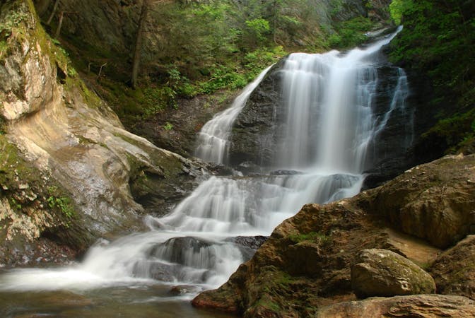
A 40-foot waterfall and summer swimming holes in a mountain stream.
Easy Hiking
7 km away

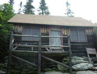
Walk to a historic cabin in the woods beside a river.
Easy Hiking
8 routes · Hiking
10 routes · Hiking
8 routes · Hiking

10 routes · Hiking