1 km away
Cliff Trail
Short but strenuous route from the top of the gondola to the summit of Mount Mansfield.
Extreme Hiking
- Distance
- 2.1 km
- Ascent
- 222 m
- Descent
- 223 m
The easiest route to the summit of Mount Mansfield.
Hiking Moderate

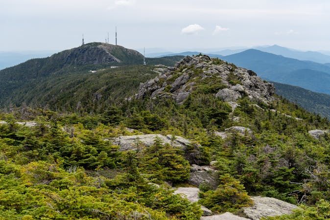
Stowe, Vermont sits at the foot of the tallest mountain in the state–Mount Mansfield at 4,393 feet. On top of the mountain, the extreme climate creates a tundra-like landscape of stunted conifers and windswept rock. It’s a harsh environment, but well worth visiting for the unbeatable views over Vermont’s endless green hills, and for the satisfaction of standing on the state highpoint.

That’s why Mount Mansfield is one of the most popular hiking destinations in Vermont. Many trails ascend its slopes and converge on top. The hike described here is the easiest way to the summit, though it’s certainly no “walk in the park.” It is the best route for families with small children or anyone unaccustomed to strenuous hiking. It begins from the Mount Mansfield Visitor Center, which is at the end of the Auto Toll Road in Stowe Mountain Resort.
The road is typically open from May to October, weather permitting. The drive itself is beautiful, winding upward through a verdant forest on a ridgeline overlooking the ski resort. The hike follows a section of the Long Trail, which is a footpath traversing the Green Mountains end to end. At first, you’ll dive into a dense forest of squat evergreens, but soon emerge onto bare rock along the spine of the mountain, and the slope becomes steeper. Watch your footing, because the rock is often wet and slippery. Also, take care to stay on the path and not trample the soil or plants that cling to life at this elevation.
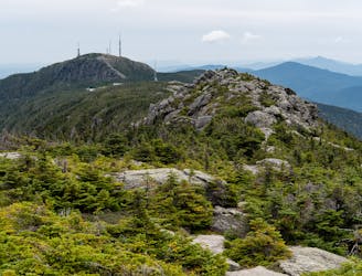
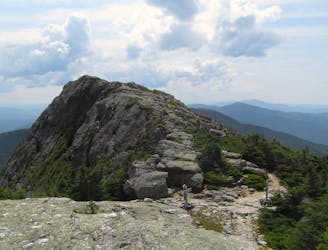
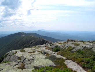
Following white blazes painted on the rock, the trail moves steadily upward, weaving among boulders and patches of greenery, with huge views in every direction. This is part of Vermont's famous Long Trail–a footpath that traverses the Green Mountains and spans the state from Massachusetts to Canada.
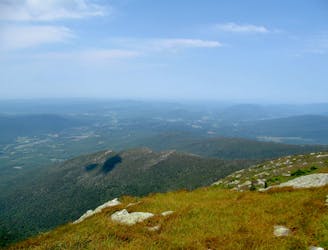
Eventually, you’ll reach the true summit of Mount Mansfield, a dome of bare rock rising higher than anything else around. On a clear day, you can see Burlington, Lake Champlain, and the Adirondacks beyond. On a very clear day, you can see eastward all the way to the White Mountains of New Hampshire.
Sources: https://www.stowe.com/explore-the-resort/activities-and-events/auto-toll-road.aspx https://www.summitpost.org/mount-mansfield/150938
Moderate
Hiking along trails with some uneven terrain and small hills. Small rocks and roots may be present.

The trail contains some obstacles such as outcroppings and rock which could cause injury.
Away from help but easily accessed.
1 km away
Short but strenuous route from the top of the gondola to the summit of Mount Mansfield.
Extreme Hiking
1.7 km away

A less exposed and less steep alternative to the Long Trail over the summit of Mount Mansfield.
Severe Hiking
2.1 km away

Forest hike among the ski runs that finishes near a mountainside café, and provides access to higher trails on Mount Mansfield.
Moderate Hiking
2.2 km away
Widely considered the best trail to the 4,393-foot summit of Mount Mansfield.
Difficult Hiking
2.2 km away
Reach the summit of Mount Mansfield via three of its most thrilling trails.
Extreme Hiking
2.2 km away
Hike Mount Mansfield bottom to top, starting from just outside Stowe Mountain Ski Resort.
Severe Hiking
3.6 km away
Climb to one of Mount Mansfield’s lesser peaks, with an overnight shelter and options for longer loop routes.
Severe Hiking
3.6 km away
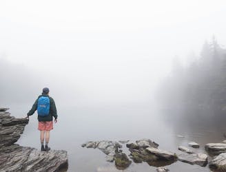
Popular hike to a large pond near the top of a mountain.
Moderate Hiking
3.8 km away
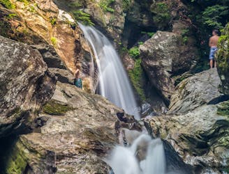
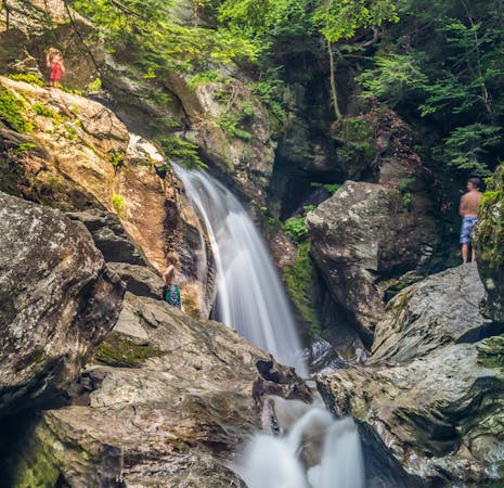
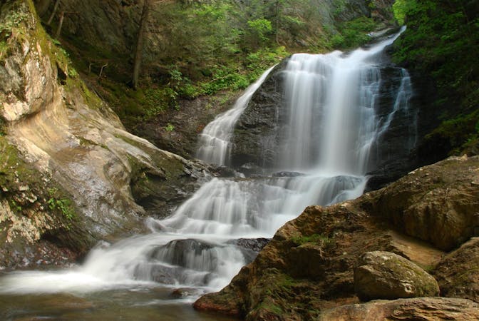
A 40-foot waterfall and summer swimming holes in a mountain stream.
Easy Hiking
4.9 km away

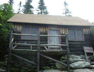
Walk to a historic cabin in the woods beside a river.
Easy Hiking
8 routes · Hiking
10 routes · Hiking
8 routes · Hiking

10 routes · Hiking