2.6 km away
Maple Ridge - Sunset Ridge Loop
Reach the summit of Mount Mansfield via three of its most thrilling trails.
Extreme Hiking
- Distance
- 12 km
- Ascent
- 870 m
- Descent
- 870 m
Climb to one of Mount Mansfield’s lesser peaks, with an overnight shelter and options for longer loop routes.
Hiking Severe

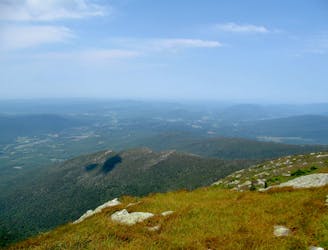
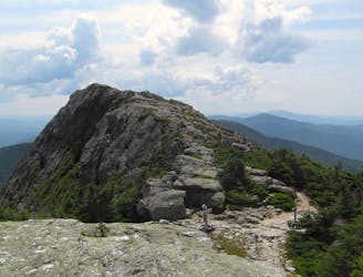
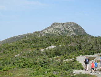
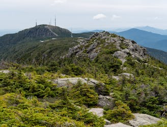
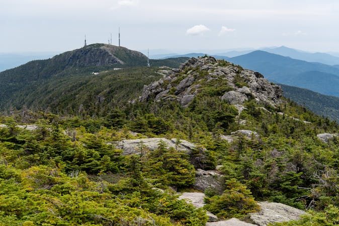
The Forehead is not the highest summit of Mount Mansfield, but it might be the most rugged. All the mountain’s peaks are named for facial features that they resemble in profile from the east, with The Chin being the true summit at 4,393 feet. The Forehead lies at the southern end of the summit ridge, rising to 3,940 feet. The Long Trail crosses over it, and Butler Lodge Trail is one way to reach that section and stand atop The Forehead.
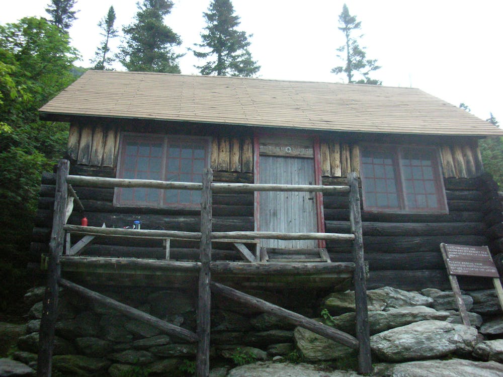
Butler Lodge Trail does have a lodge that you can stay in. Butler Lodge is one of the overnight accommodations built for the Long Trail. It’s a cabin with primitive sleeping quarters for up to 14 people. Anyone can stay there, if there’s room, for a $5 fee from April to October. In the offseason, it is free. The lodge is convenient if you want to break your ascent into multiple days or take on a longer route that includes The Forehead.
The trail begins from the trailhead on Stevensville Road and heads gradually up toward the lodge. This portion is fairly typical Green Mountain hiking, with rocks and roots and mud, but nothing too technical. Above the lodge, things get more interesting. To surmount the Forehead, you’ll join with the Long Trail and break into the subalpine zone, where there is little shelter from the elements. Ladders and exposed scrambles make parts of the trail, and much of it is on bare rock that’s often slippery.
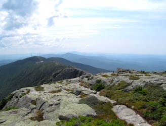
From the top of The Forehead, you can return the way you came, or make a loop with Wampahoofus Trail to get back to Butler Lodge. There’s also the option to extend your hike on the Long Trail and tag other summits on Mount Mansfield.
Sources: https://www.greenmountainclub.org/the-long-trail/overnight-accommodations/ https://www.anotherlongwalk.com/2013/10/day-21-mount-mansfield.html https://vtsports.com/jerryis-favorite-hikes-mount-mansfield/
Severe
Hiking challenging trails where simple scrambling, with the occasional use of the hands, is a distinct possibility. The trails are often filled with all manner of obstacles both small and large, and the hills are very steep. Obstacles and challenges are often unexpected and can be unpredictable.

Some trail sections have exposed ledges or steep ascents/descents where falling could cause serious injury.
Little chance of being seen or helped in case of an accident.
2.6 km away
Reach the summit of Mount Mansfield via three of its most thrilling trails.
Extreme Hiking
2.6 km away
Widely considered the best trail to the 4,393-foot summit of Mount Mansfield.
Difficult Hiking
3.6 km away
The easiest route to the summit of Mount Mansfield.
Moderate Hiking
4.4 km away
Short but strenuous route from the top of the gondola to the summit of Mount Mansfield.
Extreme Hiking
5.1 km away

A less exposed and less steep alternative to the Long Trail over the summit of Mount Mansfield.
Severe Hiking
5.4 km away

Forest hike among the ski runs that finishes near a mountainside café, and provides access to higher trails on Mount Mansfield.
Moderate Hiking
5.7 km away
Hike Mount Mansfield bottom to top, starting from just outside Stowe Mountain Ski Resort.
Severe Hiking
6.3 km away
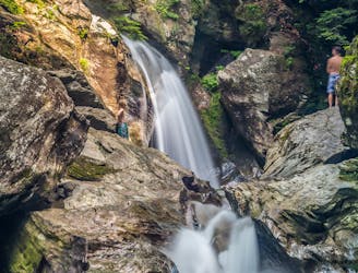
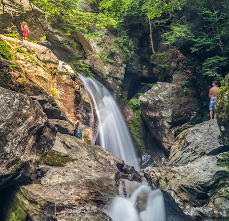
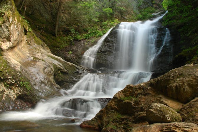
A 40-foot waterfall and summer swimming holes in a mountain stream.
Easy Hiking
7 km away

Walk to a historic cabin in the woods beside a river.
Easy Hiking
7.1 km away
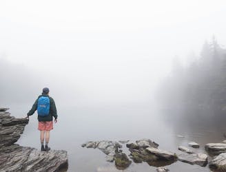
Popular hike to a large pond near the top of a mountain.
Moderate Hiking
8 routes · Hiking
10 routes · Hiking
8 routes · Hiking

10 routes · Hiking