1.9 km away
Profanity Trail (Bad Weather Bypass)

A less exposed and less steep alternative to the Long Trail over the summit of Mount Mansfield.
Severe Hiking
- Distance
- 539 m
- Ascent
- 173 m
- Descent
- 0 m
Popular hike to a large pond near the top of a mountain.
Hiking Moderate

Sterling Pond is one of the best moderate hikes at Smugglers Notch, and as such, it sees a lot of traffic. It’s a must-do if you are passing through the area in the summer, or if you spend some time at Stowe and want to check off the classic hikes. It’s best on a warm day when you can enjoy the mountain air and dip your feet in the water, or in the fall when the mountains turn ablaze with color.
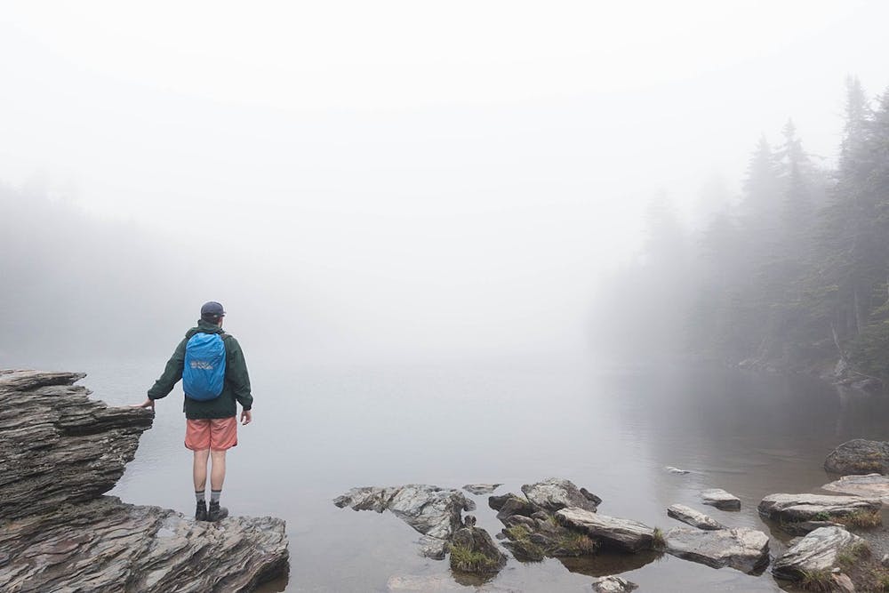
The hike to the pond is sustained uphill the whole way. The first third is particularly steep, with tall, stone steps making much of the trail. It’s all very well maintained, however, and the angle lessens a bit above the stairs. The scenery is dense forest, with Vermont’s many species of trees and lush understory plants on display, along with the granite rock formations and trickling streams that are so abundant in these mountains.
The pond, interestingly enough, lies at the top of the hill, in a natural depression formed by glacial action long ago. It’s a dramatic spectacle–sparkling water lined by deep green conifers–and its high elevation invites moody weather, like dense fog or rain, on nearly any day. If you like to fish, you can catch impressive trout in the cold, clear water.
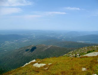
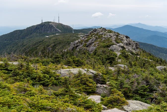
For a bonus adventure, consider hiking to the top of nearby Spruce Peak. En route to the pond, where the Sterling Pond Trail joins the Long Trail, both paths share the route of a ski track. You can hike up the ski track to reach the summit. From there, you’ll get an elevated view over Smugglers Notch and across to Mount Mansfield.
Sources: http://vtstateparks.blogspot.com/2013/07/sterling-pond-hike-stowe-vt.html https://www.vtcng.com/thingstodo/outdoors/sterling-pond-hike/articlea1335e4c-af5d-5d42-a98c-9008ea8b653a.html
Moderate
Hiking along trails with some uneven terrain and small hills. Small rocks and roots may be present.

The trail contains some obstacles such as outcroppings and rock which could cause injury.
Away from help but easily accessed.
1.9 km away
A less exposed and less steep alternative to the Long Trail over the summit of Mount Mansfield.
Severe Hiking
2.2 km away
Hike Mount Mansfield bottom to top, starting from just outside Stowe Mountain Ski Resort.
Severe Hiking
2.7 km away
Short but strenuous route from the top of the gondola to the summit of Mount Mansfield.
Extreme Hiking
2.8 km away

Forest hike among the ski runs that finishes near a mountainside café, and provides access to higher trails on Mount Mansfield.
Moderate Hiking
3.6 km away
The easiest route to the summit of Mount Mansfield.
Moderate Hiking
4.7 km away
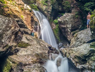
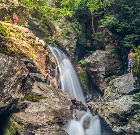
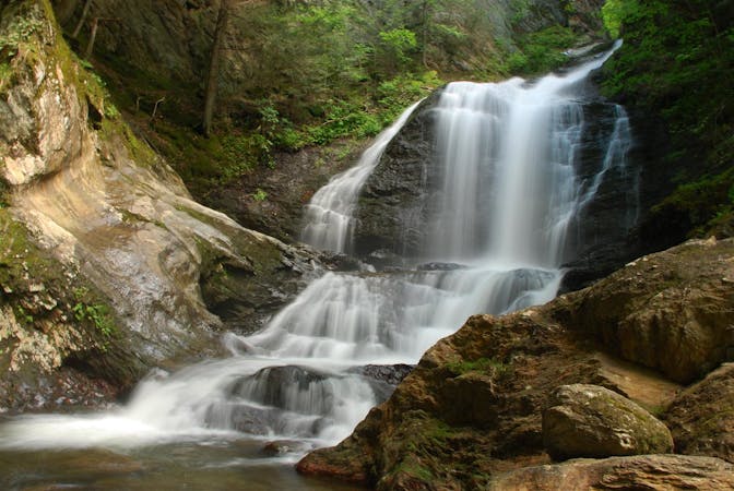
A 40-foot waterfall and summer swimming holes in a mountain stream.
Easy Hiking
4.9 km away
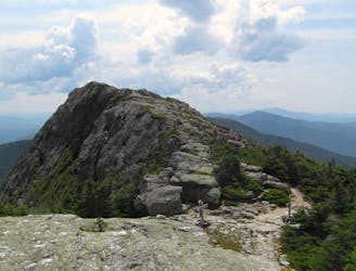
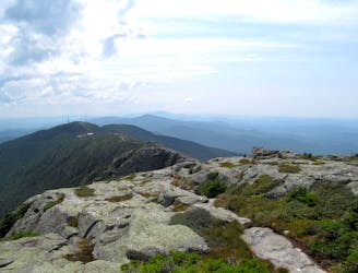
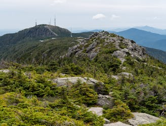
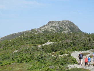
Widely considered the best trail to the 4,393-foot summit of Mount Mansfield.
Difficult Hiking
4.9 km away
Reach the summit of Mount Mansfield via three of its most thrilling trails.
Extreme Hiking
5.9 km away

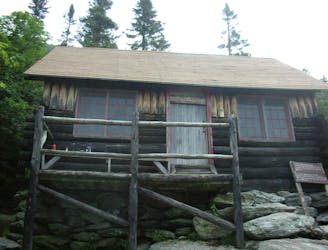
Walk to a historic cabin in the woods beside a river.
Easy Hiking
7.1 km away
Climb to one of Mount Mansfield’s lesser peaks, with an overnight shelter and options for longer loop routes.
Severe Hiking
8 routes · Hiking
10 routes · Hiking
8 routes · Hiking

10 routes · Hiking