609 m away
Haselton Trail

Forest hike among the ski runs that finishes near a mountainside café, and provides access to higher trails on Mount Mansfield.
Moderate Hiking
- Distance
- 4.6 km
- Ascent
- 601 m
- Descent
- 601 m
Hike Mount Mansfield bottom to top, starting from just outside Stowe Mountain Ski Resort.
Hiking Severe

The Long Trail is Vermont’s famous trek across the Green Mountains, notable as the first long-distance hiking trail ever established in the United States. Of the many summits the Long Trail crosses, Mount Mansfield is the tallest and is Vermont’s state highpoint. Mount Mansfield has many trails and routes to the summit, but if you are visiting Stowe in the warmer months, hiking the Long Trail from the base of the mountain is one of the most rewarding routes you can take.
The hike begins from Mountain Road, where the Long Trail crosses just north of Stowe Mountain Resort. Unfortunately, there is no real parking lot for this trailhead. You’ll have to park in a narrow pullout beside the road, or park at the resort and walk along the road to reach the trail. Look for white blazes on trees that mark the Long Trail, then follow them into the forest to begin. It starts out mellow but soon becomes steeper. Muddy and slippery spots are common, so wear good shoes and use caution.
The trail gets progressively rockier and steeper as it goes up. There are even sections where you must use your hands to scramble bouldery gullies and rock ledges. Just go slow and carefully choose your hand and foot placements.
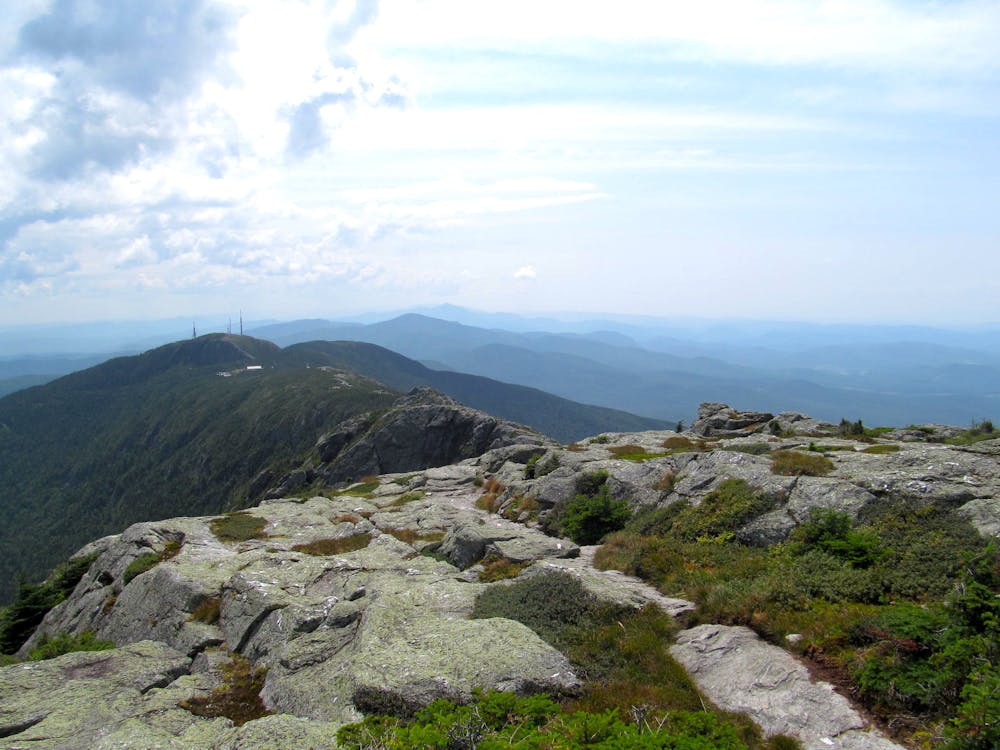
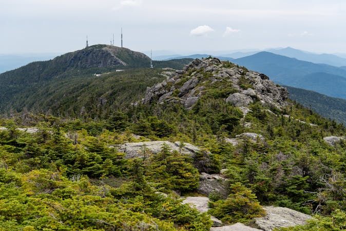
High on the trail, the trees transition from tall, broad-leafed hardwoods to short and stout evergreens. These are the only trees that can grow at such high elevation. Eventually, the trees disappear altogether, replaced by stunted, wind-warped firs known as Krummholz. Besides those, it’s mostly grass, moss, and an abundance of lichen that cling to life here in the alpine zone. Be very careful to stay on the trail and not trample any of this vegetation.
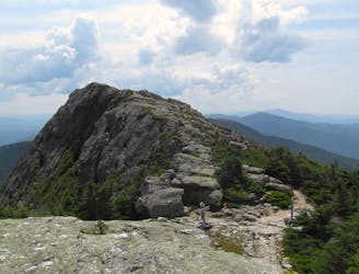
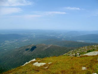
Be prepared for cold and quickly changing weather at elevation. Don’t be ashamed to turn around if conditions turn bad. If the weather is clear, however, the views are amazing and worth every bit of the effort to reach them. You’ll gaze over the mountain’s undulating rocky spine, down at the ski resort below, and over endless green hills in all directions.
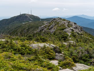
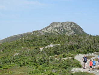
Above treeline, navigation can be difficult because the trail disappears into an expanse of gray stone, but if you keep looking for the white blazes you will stay on track. The final scramble to the summit may be the most difficult part of the trail, with some very steep scrambling. Once on top, you'll be standing on a broad dome of rock and grass jutting into the sky. On a clear day, you can see west to Lake Champlain and the Adirondacks of New York, north to the green expanse of Canada, and east to the White Mountains of New Hampshire.
When you are ready, you can simply return the way you came. There are other options, however, for linking sub-peaks of Mount Mansfield like the nearby Adam’s Apple, or making a loop with another trail and returning to the Long Trail.
The Profanity Trail) is one option for a loop, and it's also the "bad weather bypass" for the Long Trail. It takes an alternate route below the ridgeline, dodging the toughest parts of the Long Trail, but it still reaches the summit. If you want to skip the scrambling on Long Trail, either on the way up or the way down, you can take Profanity Trail instead.
Sources: http://goeast.ems.com/alpha-guide-mount-mansfield/ https://www.summitpost.org/long-trail/166130 https://www.greenmountainclub.org/the-long-trail/
Severe
Hiking challenging trails where simple scrambling, with the occasional use of the hands, is a distinct possibility. The trails are often filled with all manner of obstacles both small and large, and the hills are very steep. Obstacles and challenges are often unexpected and can be unpredictable.

Some trail sections have exposed ledges or steep ascents/descents where falling could cause serious injury.

Away from help but easily accessed.
609 m away
Forest hike among the ski runs that finishes near a mountainside café, and provides access to higher trails on Mount Mansfield.
Moderate Hiking
1.6 km away

A less exposed and less steep alternative to the Long Trail over the summit of Mount Mansfield.
Severe Hiking
1.8 km away
Short but strenuous route from the top of the gondola to the summit of Mount Mansfield.
Extreme Hiking
2.2 km away
Popular hike to a large pond near the top of a mountain.
Moderate Hiking
2.2 km away
The easiest route to the summit of Mount Mansfield.
Moderate Hiking
2.7 km away
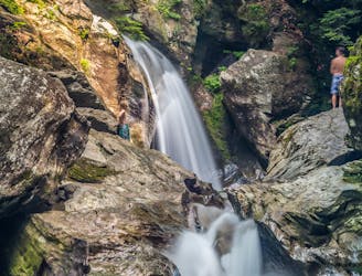
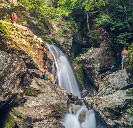
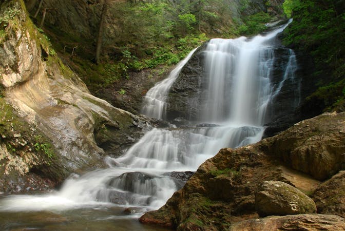
A 40-foot waterfall and summer swimming holes in a mountain stream.
Easy Hiking
4 km away

Walk to a historic cabin in the woods beside a river.
Easy Hiking
4.2 km away
Widely considered the best trail to the 4,393-foot summit of Mount Mansfield.
Difficult Hiking
4.2 km away
Reach the summit of Mount Mansfield via three of its most thrilling trails.
Extreme Hiking
5.7 km away
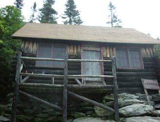
Climb to one of Mount Mansfield’s lesser peaks, with an overnight shelter and options for longer loop routes.
Severe Hiking
8 routes · Hiking
10 routes · Hiking
8 routes · Hiking

10 routes · Hiking