3 m away
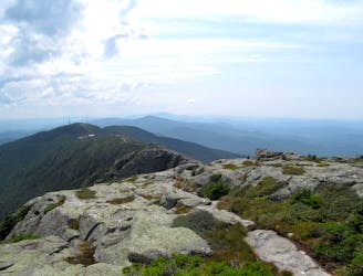
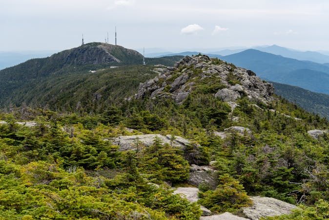
Mount Mansfield: Sunset Ridge Trail
Widely considered the best trail to the 4,393-foot summit of Mount Mansfield.
Difficult Hiking
- Distance
- 8.2 km
- Ascent
- 770 m
- Descent
- 770 m
Reach the summit of Mount Mansfield via three of its most thrilling trails.
Hiking Extreme

This loop route to the Summit of Mount Mansfield combines Sunset Ridge Trail, Long Trail, Maple Ridge Trail, and CCC Road. Together they make an adventurous and highly scenic tour of Vermont’s highest mountain.
Maple Ridge may be the most extreme of the main trails on Mansfield. Though most of it is typical Green Mountain hiking (rocky, rooty, and muddy), some parts require hand-and-foot scrambling as well as careful steps on precipitous rock. In one spot, there’s even a chasm that must be crossed with a short but intimidating jump.
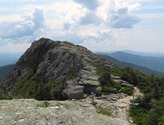
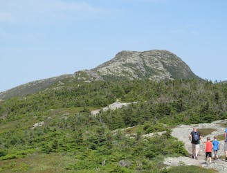
Sunset Ridge Trail is mellow compared to Maple Ridge, but is still quite steep. It’s a more popular trail, and widely considered the most scenic route to the summit of Mansfield. Much of it is above timberline, tracing a rounded ridge of stone with huge views on all sides.
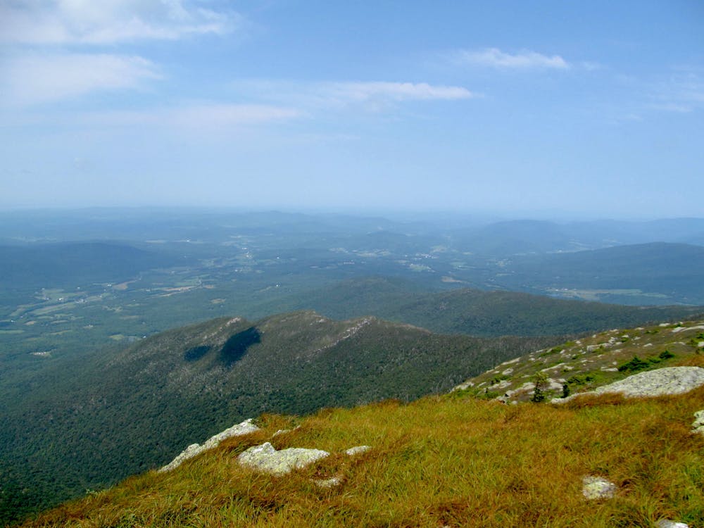
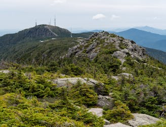
Between Sunset Ridge and Maple Ridge on top of Mansfield is the Long Trail, which connects all the mountain’s peaks. On this loop, you will stand atop The Forehead (3,940 feet), The Nose (4,062'), and The Chin––which is the true summit at 4,393 feet. To link all three requires more than two miles of hiking in the alpine zone, highly exposed to the elements. If a storm builds, you can follow the bad weather bypass trails, which dip into the relative shelter of trees at lower elevation. They are signed at junctions along the ridgeline.
The trail linking the bottoms of Sunset Ridge and Maple ridge is the CCC Road, a wide path that rolls through mixed hardwood forest near the base of the mountain. It connects Underhill State Park and the trailhead on Stevensville Road, either of which makes a good starting point for this loop. The state park charges a small fee for entry but has a paved road and ample facilities. Stevensville Road turns to dirt at the end, and facilities are more primitive. Note that the route mapped here starts from Underhill State Park. If you start from Stevensville Road instead, you’ll follow Frost Trail to Maple Ridge Trail.
Sources: https://www.summitpost.org/mount-mansfield/150938 http://4000footers.com/mansfield.shtml#
Extreme
Scrambling up mountains and along technical trails with moderate fall exposure. Handholds are necessary to navigate the trail in its entirety, although they are not necessary at all times. Some obstacles can be very large and difficult to navigate, and the grades can often be near-vertical. The challenge of the trail and the steepness of the grade results in very strenuous hiking. Hikes of this difficulty blur the lines between "hiking" and "climbing".

Some trail sections have exposed ledges or steep ascents/descents where falling could cause serious injury.

Away from help but easily accessed.
3 m away
Widely considered the best trail to the 4,393-foot summit of Mount Mansfield.
Difficult Hiking
2.2 km away
The easiest route to the summit of Mount Mansfield.
Moderate Hiking
2.5 km away
Short but strenuous route from the top of the gondola to the summit of Mount Mansfield.
Extreme Hiking
2.6 km away
Climb to one of Mount Mansfield’s lesser peaks, with an overnight shelter and options for longer loop routes.
Severe Hiking
3 km away

A less exposed and less steep alternative to the Long Trail over the summit of Mount Mansfield.
Severe Hiking
4.2 km away
Hike Mount Mansfield bottom to top, starting from just outside Stowe Mountain Ski Resort.
Severe Hiking
4.2 km away

Forest hike among the ski runs that finishes near a mountainside café, and provides access to higher trails on Mount Mansfield.
Moderate Hiking
4.9 km away
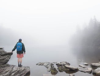
Popular hike to a large pond near the top of a mountain.
Moderate Hiking
5.9 km away
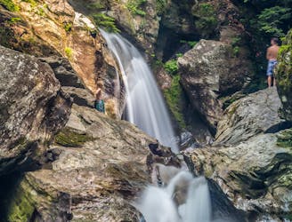
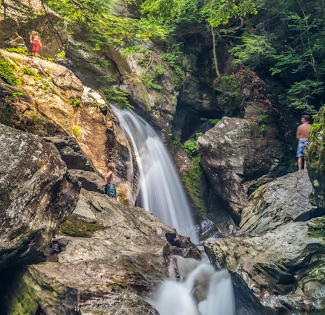
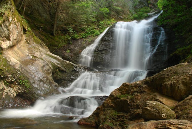
A 40-foot waterfall and summer swimming holes in a mountain stream.
Easy Hiking
7 km away

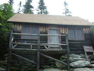
Walk to a historic cabin in the woods beside a river.
Easy Hiking
8 routes · Hiking
10 routes · Hiking
8 routes · Hiking

10 routes · Hiking