6 m away
Long Trail South to Mansfield Summit
Hike Mount Mansfield bottom to top, starting from just outside Stowe Mountain Ski Resort.
Severe Hiking
- Distance
- 6.7 km
- Ascent
- 835 m
- Descent
- 835 m
Mount Mansfield Hike - Vermont VT
Hiking Severe

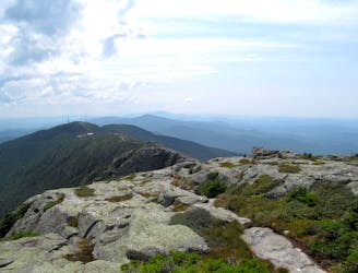
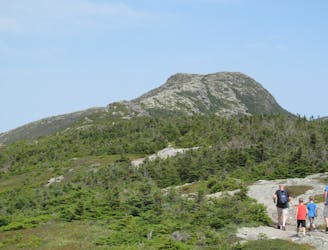
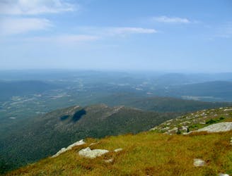
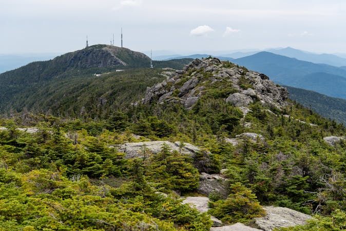
The Mount Mansfield is not only Vermont's highest mountain, but also one of its most interesting and rewarding for it’s amazing views.
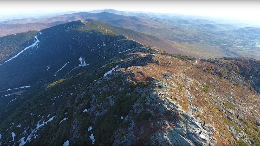
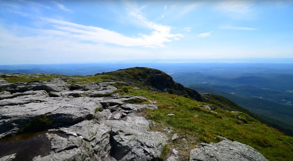

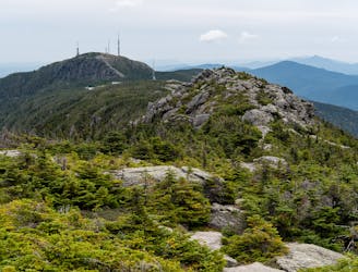
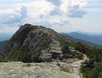
Viewed from the east, locations along Mt. Mansfield's long ridgeline are described as the Adam's Apple, Chin (the highest point) , Nose, and Forehead.
The path has great opportunities for photos along the way and is easy to follow. It is a combination of different trails along it’s way, as the “Long Trail” which connects different summits in Vermont.
PARKING: The hike begins at Underhill State Park off of Mountain Road. There is a parking area for a fee of $4/person. Because the park has tent camping, there are bathrooms and potable water available at the trailhead.
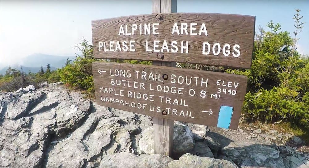
START AND HOW TO: Start: The hike starts along CCC Road. You will continue on this road until you reach the Maple Ridge Trail, which is also the most technical route on the hike. There is a rock wall where one has to climb, and might be difficult for inexperienced people. You might find it frightening, but holding on you will be able to do it safely. After finishing this hardest part, you will join the Long trail North. The long trail is the famous trail of Vermont, which connects many mountain peaks. On that trail you will pass the forehead, the nose and go northwards along the ridgeline to the chin. From there, you can continue and extend your hike to “adam's apple” or turn around and walk home descending along the sunset ridge trail. Be aware that turning around might be a good option if you are short on time, or the weather is worsening.
if you are afraid of heights, walking the ridgeline to the Chin can give you some emotions: There is a 1000 ft drop to the right that provides for amazing views but will stunt those who may not be comfortable with heights. It is worth it though.
An adventure that everyone that does it, loves.
ATTENTION: It can be slippery, even a few days after the rain; There is some basic rock climbing involved
WEATHER:
Because of these two challenging sections, it is not recommended to attempt this hike in bad weather conditions where the rocks would be wet or icy.
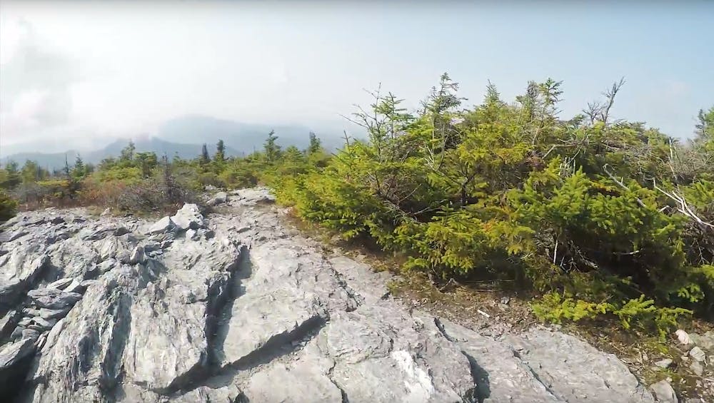
VEGETATION:
This is one of only two places in Vermont where the rare arctic-alpine tundra survives. There is a much smaller area on Camel's Hump, but Mt. Mansfield supports 200 acres of rare tundra plants. Whichever route you take, stay on the trail to avoid harming the very delicate plants. Tundra once covered a far greater area, but as the glacier receded, the climate grew too warm for these cold-loving plants. Although it is tempting to get as close as possible to these rare plants, remember that although they are resistant to severe weather, they are very sensitive to foot traffic.
Severe
Hiking challenging trails where simple scrambling, with the occasional use of the hands, is a distinct possibility. The trails are often filled with all manner of obstacles both small and large, and the hills are very steep. Obstacles and challenges are often unexpected and can be unpredictable.

Some trail sections have exposed ledges or steep ascents/descents where falling could cause serious injury.

Away from help but easily accessed.
6 m away
Hike Mount Mansfield bottom to top, starting from just outside Stowe Mountain Ski Resort.
Severe Hiking
604 m away

Forest hike among the ski runs that finishes near a mountainside café, and provides access to higher trails on Mount Mansfield.
Moderate Hiking
1.7 km away

A less exposed and less steep alternative to the Long Trail over the summit of Mount Mansfield.
Severe Hiking
1.8 km away
Short but strenuous route from the top of the gondola to the summit of Mount Mansfield.
Extreme Hiking
2.2 km away
Popular hike to a large pond near the top of a mountain.
Moderate Hiking
2.2 km away
The easiest route to the summit of Mount Mansfield.
Moderate Hiking
2.7 km away
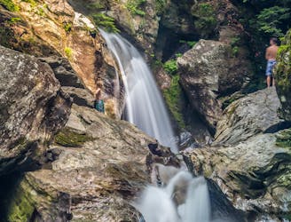
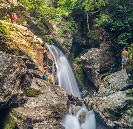
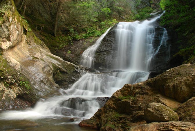
A 40-foot waterfall and summer swimming holes in a mountain stream.
Easy Hiking
4 km away

Walk to a historic cabin in the woods beside a river.
Easy Hiking
4.2 km away
Widely considered the best trail to the 4,393-foot summit of Mount Mansfield.
Difficult Hiking
4.2 km away
Reach the summit of Mount Mansfield via three of its most thrilling trails.
Extreme Hiking
8 routes · Hiking
10 routes · Hiking
8 routes · Hiking

10 routes · Hiking