27 m away
Eastern Loop of Mount Rainier National Park
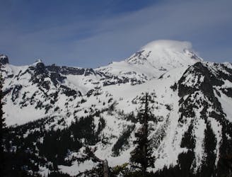
Linking together Governors Ridge, Cowlitz Chimney, Sarvant Glacier and Tamanos Mountain
Severe Ski Touring
- Distance
- 27 km
- Ascent
- 2.9 km
- Descent
- 2.9 km
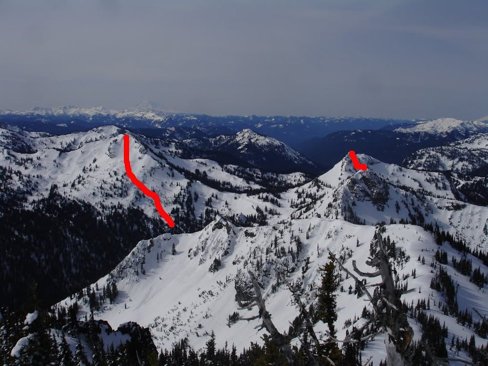
Tagging most of the good lines of the backcountry south of Crystal Mountain
Ski Touring Difficult

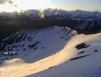
The Cayuse Pass to Crystal Mountain Traverse is a great spring mission to see basically all of the backcountry south of the resort in a single tour. This trip is all about timing as you need to go once Cayuse Pass is open. This is usually a week or two before Chinook Pass opens and though you start lower there is a better chance that the snowpack is still thick. While you can take one car and hope for the best, hitchhiking wise it is a good idea to leave a car at Crystal Mountain then there is no fear of retrieving your original car at Chinook Pass. OK that’s enough logistics for one route so lets get to the good stuff.

Parking the car at Cayuse Pass make sure to bring enough food and water as this is a long tour. Follow the Chinook Pass road up to the first switchback but be careful as directly above you is a huge face that can slide, Usually by the time you get there they have already started plowing this part out so maybe just walk on the concrete. Once at the first switchback start heading East through the main gully which is low angled forest. Before long you will reach the West ridge of Naches Peak and climb up until arriving at the false summit. Drop in but make sure you are always heading in the skiers left direction and don’t go all the way to the flats as you won’t be high enough to make it to the road. Once riding around the shoulder to the North slope do a hard traverse left and if all goes well you will be up at Chinook Pass and if not start bootpacking back up.
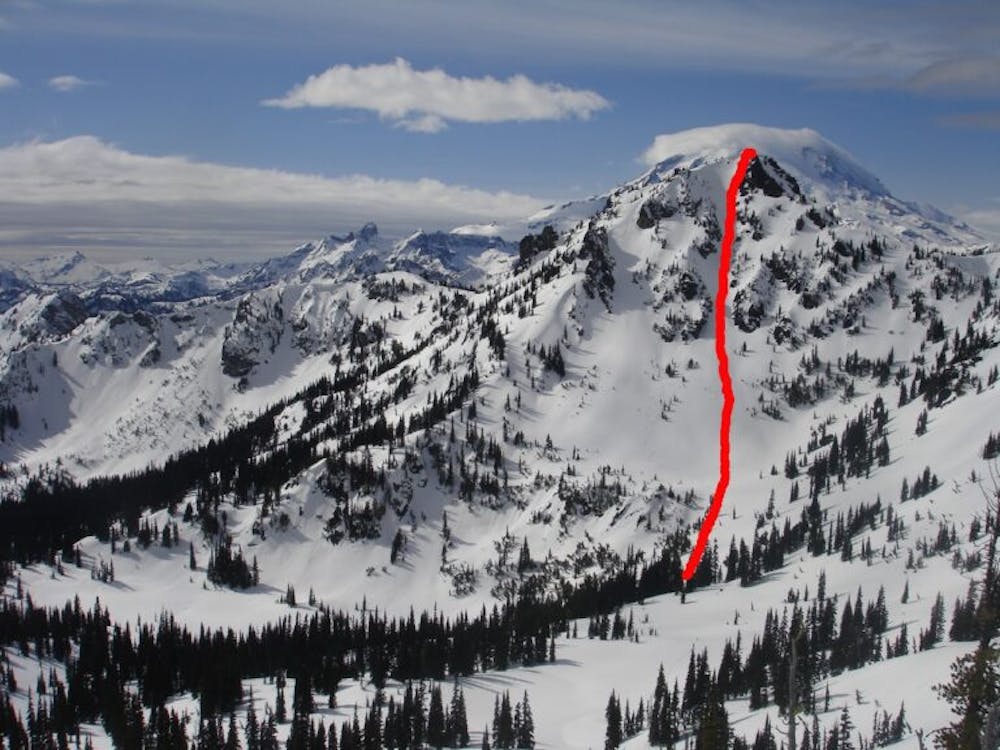
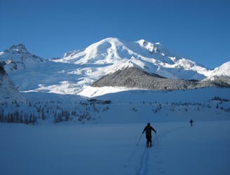
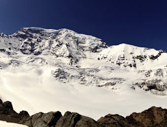
Standing at Chinook Pass switch over to skinning and start heading north. After a few minutes you will reach the East side Parking lot then start climbing to reach the col between Yakima and Deadwood Peaks. Start a traverse Southwest loosing a bit of elevation before reaching the base of Yakima Peak. Since the slope is steep you will probably have to bootpack up but once on the summit retrace your steps down into the valley. At this moment you’ve ticked 2 runs off and only 4 more to go.
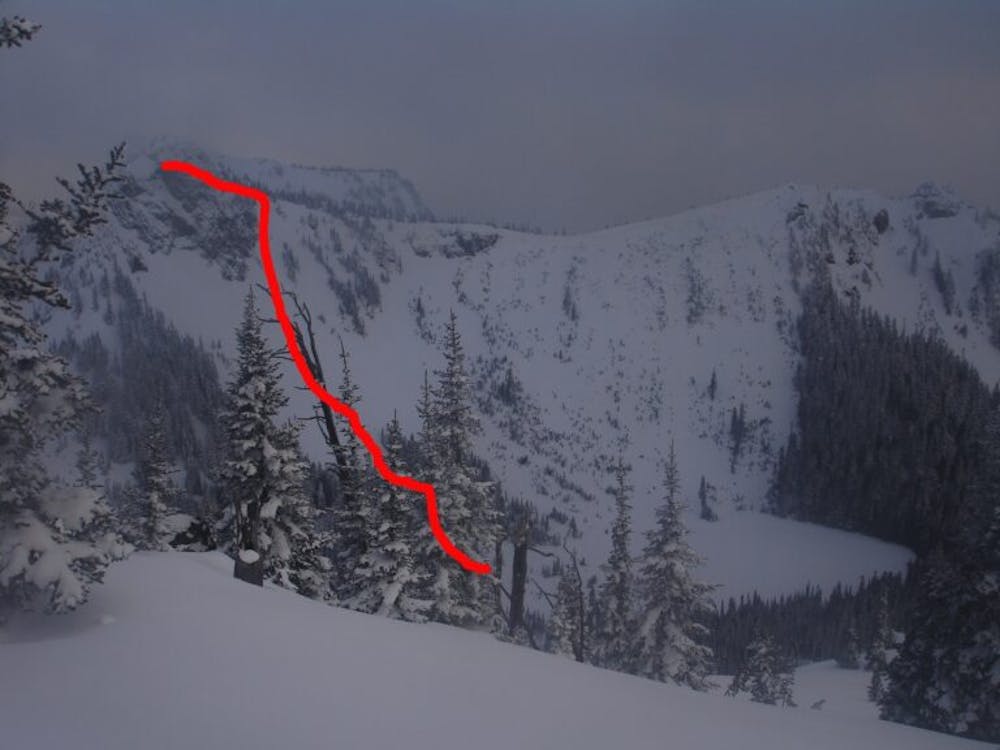
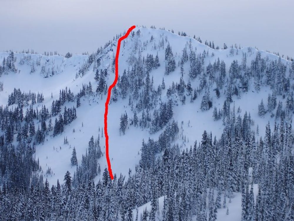
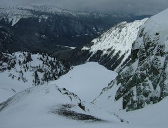
Once in the basin you will notice a low section in the ridge north that will be your next objective. With a few well placed switchbacks gain the ridge and below you to the north is some semi dense trees, descend down this slope until arriving at Deadwood lake. Now it is time to head north once again but make sure you make it into a small bowl which you can climb all the way up to Chinook Peak. Now it is time to ride down the East slope and in my opinion the best line of the route, the Sheep Lake Couloir.
Riding all the way to Sheep Lake it is time to ascend once again heading northeast until you arrive at a small ridge then climb this all the way to the top. Now you are standing on top of a sweet looking bowl to the north which you drop in and follow its main drainage all the way down to Placer Lake.
Standing on the shores of Placer Lake it is time to climb up to Dogleg Peak but don’t get too excited as this is possibly the most complex part of the route. Wrap around to the North shore before heading into dense forests. Make sure to not gain too much elevation as you head north wrapping around a small ridge before heading to the southern base of Dogleg Peak. From here on out it is a direct skin up towards the western ridge of Dogleg Peak as this is a much easier route then directly heading for the summit. Once on the ridge do the final climb to the summit.
Standing up top you can now see your Crystal Mountain to the north and the parking lot in the distance. From here on it is one final descent to make it to some dry socks and the comfort of a heated car. You can either drop northeast to the Dogleg bowl or go all in heading directly north over the roll over and into Dogleg Couloir before arriving at Lower Henskin Lake. If you are a skier just glide across the shores but if a snowboarding you’re stuck bootpack but make sure not to go onto the lake, it is late in the season and you can’t trust the ice. With a few minute walk through the woods you are now on top of Quicksilver and making the final turns to the parking lot.
Sound Simple…nope sound straight foreword…..nope but does it sound fun yeah in a slightly masochistic way.
Click here for a trip within the area and much more photos https://www.whereiskylemiller.com/crystal-mountain/cayuse-pass-crystal-mountain/
Difficult
Serious gradient of 30-38 degrees where a real risk of slipping exists.

As well as the slope itself, there are some obstacles (such as rock outcrops) which could aggravate injury.

Little chance of being seen or helped in case of an accident.
27 m away
Linking together Governors Ridge, Cowlitz Chimney, Sarvant Glacier and Tamanos Mountain
Severe Ski Touring
5.1 km away
Making the most out of the numerous different aspects on Tamanos Mountain
Difficult Ski Touring
5.9 km away
Making the most out of a long weekend exploring the Ohanapecosh area
Difficult Ski Touring
5.9 km away
Riding the Banshee Couloir, Cowlitz Chimney and Tamanos Mountain in a single day
Difficult Ski Touring
5.9 km away
Exploring the east side of Mount Rainier in winter
Difficult Ski Touring
8.6 km away
Mid Winter trip up the lower slopes of the Emmons Glacier
Moderate Ski Touring
8.7 km away
Making the most out of a spring weekend
Difficult Ski Touring
8.8 km away
Linking together two great lines during a single ski tour
Difficult Ski Touring
8.8 km away
Heading from the Third Burroughs all the way to 410 through the Sourdough Range
Severe Ski Touring
8.8 km away
A classic ascent and pleasant ski descent!
Severe Ski Touring

9 routes · Ski Touring
6 routes · Ski Touring