27 m away
Chinook Pass to Crystal Mountain
Tagging most of the good lines of the backcountry south of Crystal Mountain
Difficult Ski Touring
- Distance
- 15 km
- Ascent
- 2 km
- Descent
- 2.1 km
Linking together Governors Ridge, Cowlitz Chimney, Sarvant Glacier and Tamanos Mountain
Ski Touring Severe

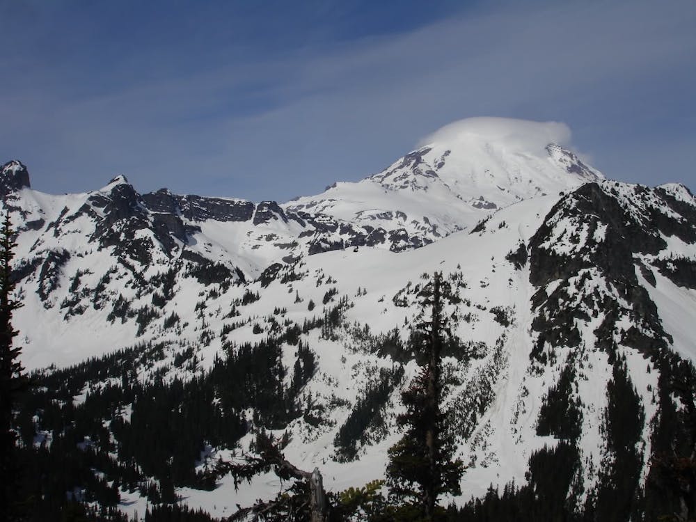
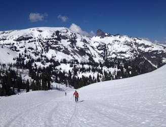
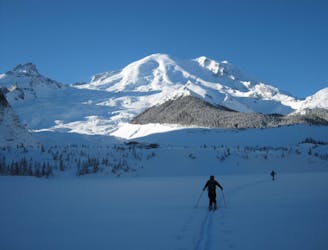
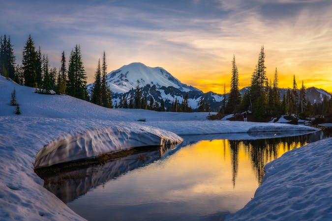
This tour was a scenic loop of the Eastern side of Mount Rainier taking advantage of riding some amazing lines. Just planing this tour you need to make sure that it is a sunny day as most of the tour is in alpine terrain. Timing is everything as you want to get in right at the moment that Cayuse Pass opens so there is a healthy snowpack both in the alpine as well as the valleys. This ski tour is quite remote so make sure to be self sufficient and be early as you need to climb the Cowlitz Chimney before the heat of the day.
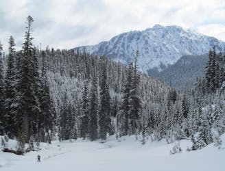
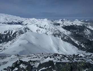
Leaving Cayuse Pass start climbing west through a small semi open drainage that gets you up to a low col before descending west into the valley below. From here start heading northwest up the main drainage which will start forested but before long turns into alpine arriving at the high col of Governor’s Ridge. Standing on top of the ridge start riding fall line down the west slope but when about halfway start making a hard skiers left arriving on the shores of Owyhigh Lake. Now it is time to start heading south first going over a small hill then after traversing the basin you will make it up to the ridge separating this zone from the Cowlitz Chimney.
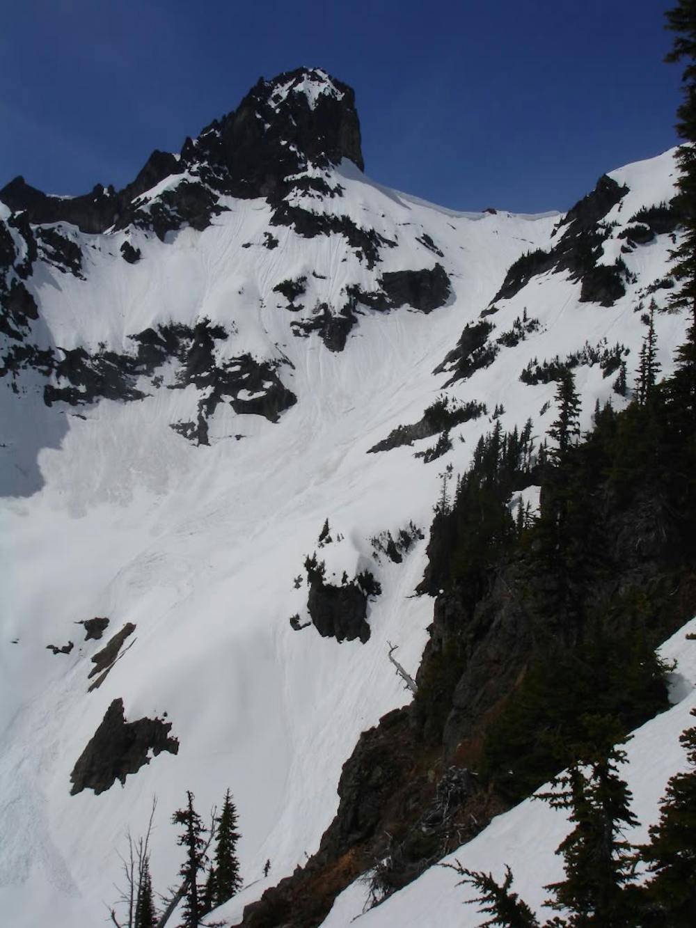
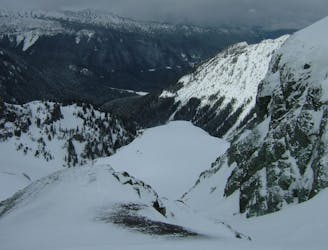
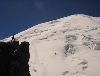
Descending South into the small basin you will know be directly below the Cowlitz Chimneys Eastern slope. It is time to put on Crampons and start climbing while making sure to climb on the side and not directly in the gut. Once on top put on your ski gear and make your way back down making sure to stay away from your up track. If all went well and you didn’t cause a stuff into the tracks you can just retrace your steps back to the top of the Cowlitz Chimneys.
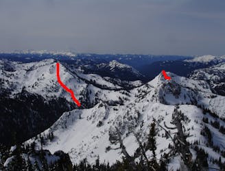
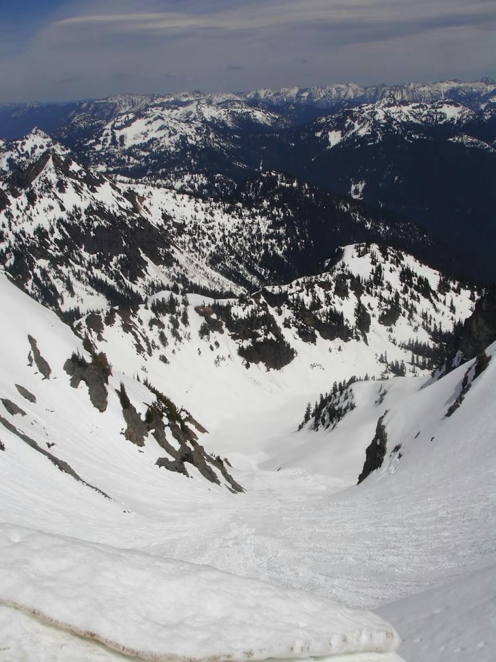
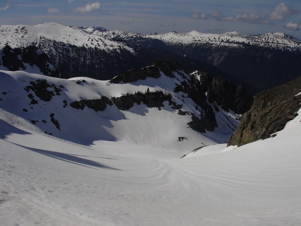
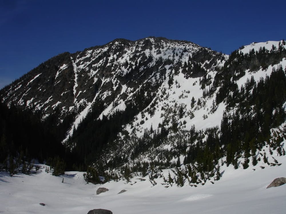
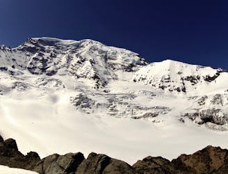
Standing on top start heading west with a small descent before heading north to the low col which provides access to the Sarvant Glacier. Standing on top enjoy a low angle run down the main glacier which starts north than wraps Northwest. Your next objective is a low col between Tamanos Mountain and the Third Chimney. This is a challenging climb which you should only do if the snow under your feet is stable. With crampons on climb directly up until you arrive on the ridge then start heading north. A few feet below the true summit of Tamanos you will spot a nice looking couloir that drops northeast into the valley.
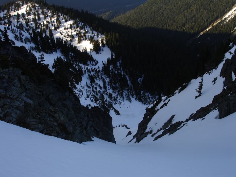
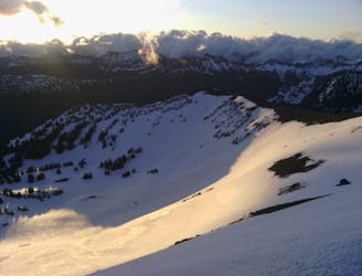
When I dropped into the Northeast couloir of Tamanos I decided to ride all the way down to the valley going skiers left of the sub drainage but I would recommend just following the trail back down. Before long you will arrive at the White River road and if smart have a car waiting for you at the Mathers Y. I wasn’t so smart so I had to walk along the road all the way back up to Cayuse pass. Numerous cars passed by but I joked that no one would be crazy enough to pick up a snowboarder.
To see my trip in the area and more photos check out this link https://www.whereiskylemiller.com/mt-rainier/cowlitz-chimneys/
Severe
Steep skiing at 38-45 degrees. This requires very good technique and the risk of falling has serious consequences.

As well as the slope itself, there are some obstacles (such as rock outcrops) which could aggravate injury.

Little chance of being seen or helped in case of an accident.
27 m away
Tagging most of the good lines of the backcountry south of Crystal Mountain
Difficult Ski Touring
5 km away
Making the most out of the numerous different aspects on Tamanos Mountain
Difficult Ski Touring
5.8 km away
Making the most out of a long weekend exploring the Ohanapecosh area
Difficult Ski Touring
5.8 km away
Riding the Banshee Couloir, Cowlitz Chimney and Tamanos Mountain in a single day
Difficult Ski Touring
5.9 km away
Exploring the east side of Mount Rainier in winter
Difficult Ski Touring
8.6 km away
Mid Winter trip up the lower slopes of the Emmons Glacier
Moderate Ski Touring
8.7 km away
Making the most out of a spring weekend
Difficult Ski Touring
8.7 km away
Linking together two great lines during a single ski tour
Difficult Ski Touring
8.8 km away
Heading from the Third Burroughs all the way to 410 through the Sourdough Range
Severe Ski Touring
8.8 km away
A classic ascent and pleasant ski descent!
Severe Ski Touring

9 routes · Ski Touring
6 routes · Ski Touring