6 m away
Goat Island Mountain
The amazing and terrifying North Swaths of Goat Island Mountain
Severe Ski Touring
- Distance
- 12 km
- Ascent
- 1.1 km
- Descent
- 1.1 km
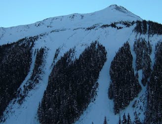
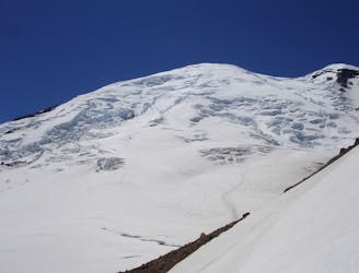
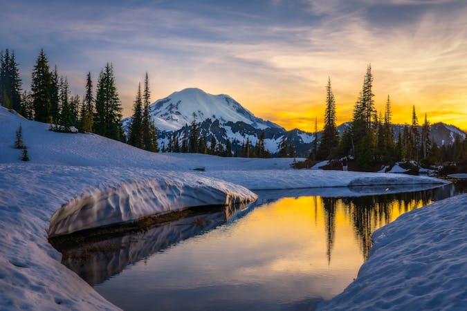
Ski touring on the east side of Mount Rainier in December
Ski Touring Difficult

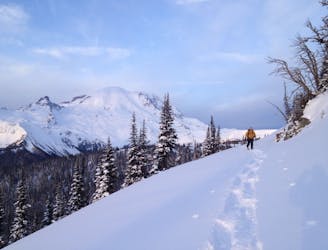
Winter within the Eastern Side of Mount Rainier National Park is a world of isolation. Just to get in you need to snowmobile from Crystal Mountain Blvd all the way to the White River but don’t expect a groomed trail. We used to joke that this was the hardest part of the day but as a reward you are now in a backcountry powder lovers Paradise. The Northeast slopes of Mount Ruth is one of those gems that really is at its best when filled with bottomless powder turns from top to bottom. That being said treat this line with respect as it gets loaded with snow and it is quite normal for the lower section to be holding a good sized slab. Tread with caution.
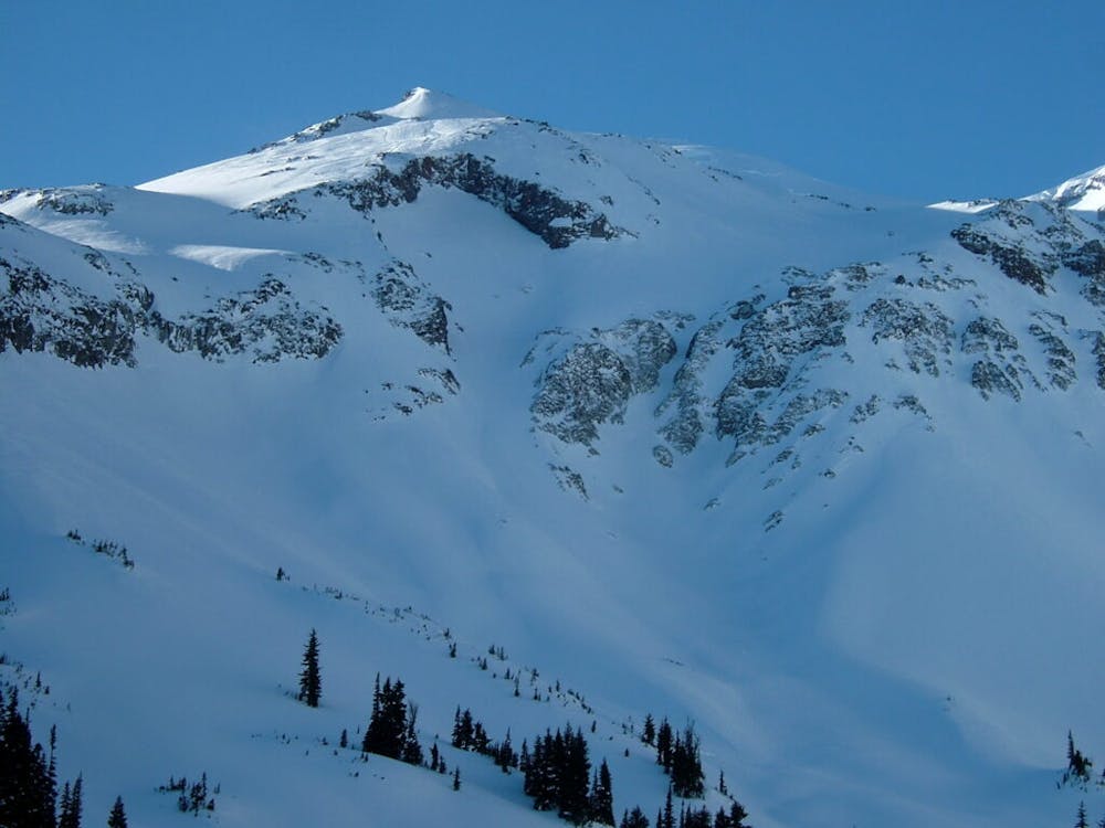
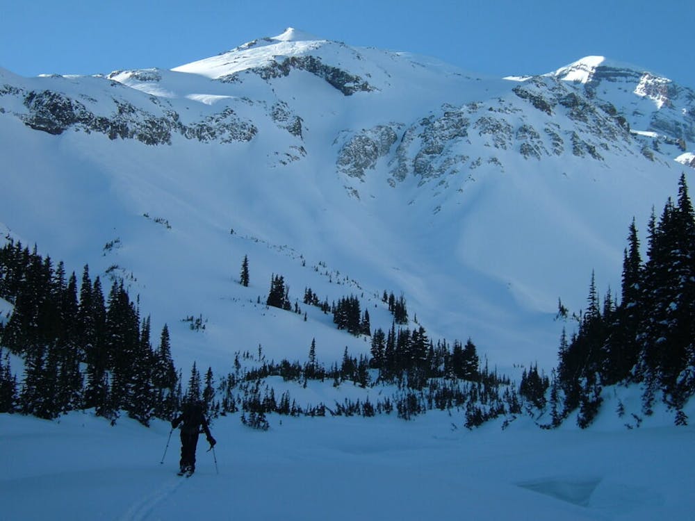
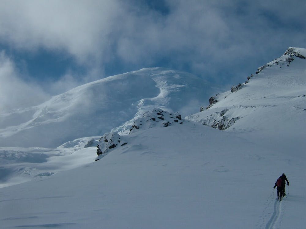
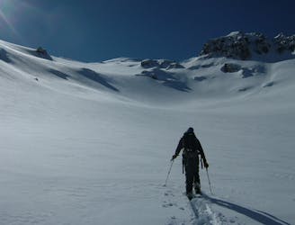
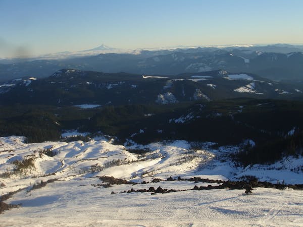
After around an hour of riding a sled up to the White River Campground it is time to start breaking trail. Fortunately the Glacier Basin trail is wide enough that it is easy to follow making your way towards the alpine. Once just below Glacier Basin you can start heading up the creek area as it should be buried in snow. This is a faster route up but also helps for when it is time to head down.
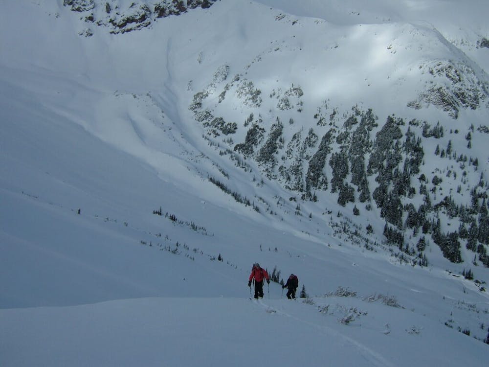
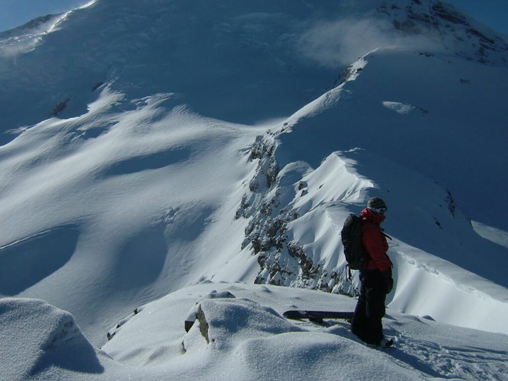
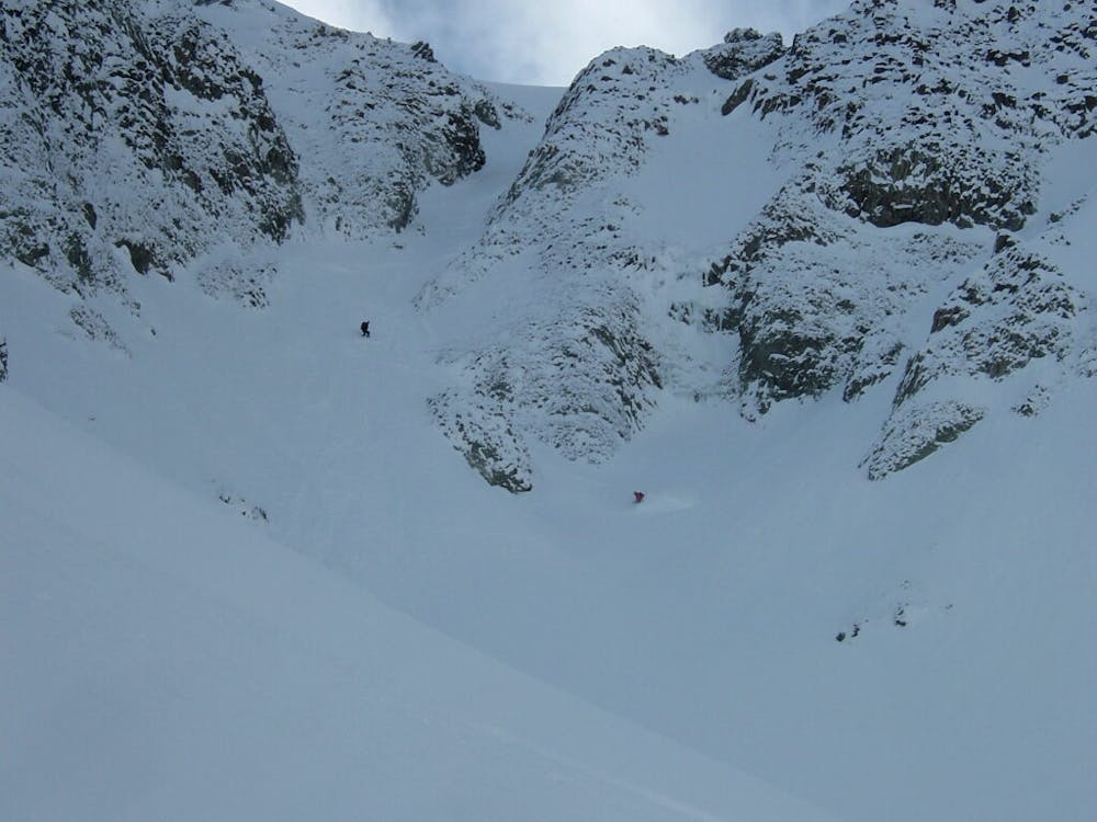
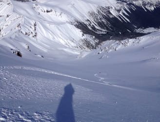
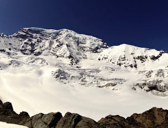
Once in the alpine of Glacier Basin start heading South up to the ridge directly East of Mount Ruth. On the low point of the ridge it is an easy climb all the way to the top. Standing on the summit is a weird experience as you can’t see any signs of other human activity. When descending start heading directly north into the powder filled gully before it starts heading Northwest. Before long this slope will roll over with a small chute on the skiers left and a big one on the skiers right. Now it is up to you wether you want a tight line or the open one but either way you go expect that it could slab on the convex roller.
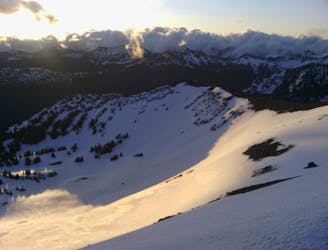
Dropping over the convex roller it starts steep and it a tight choke but after that is a mellow apron all the way to the valley below. Make sure to keep your speed as you will want to ride all the way to where you originally crossed over the creek. Like so many tours this exit is much nicer for skiers as you can ski down almost the entire route but as a snowboarder you will need to take your board off a handful of times. The great thing though is that you will always have your skin track to follow as without it this trail can be a somewhat confusing descent.
To see my trip in the area and more photos check out this link https://www.whereiskylemiller.com/mt-rainier/mount-ruth/
Difficult
Serious gradient of 30-38 degrees where a real risk of slipping exists.

As well as the slope itself, there are some obstacles (such as rock outcrops) which could aggravate injury.

Little chance of being seen or helped in case of an accident.
6 m away
The amazing and terrifying North Swaths of Goat Island Mountain
Severe Ski Touring
11 m away
Linking together the two nicest lines in Glacier Basin
Difficult Ski Touring
15 m away
Descending down the Emmons Glacier on Mount Rainier
Difficult Ski Touring
89 m away
Heading up Glacier Basin to Snowboard the Interglacier in powder conditions
Difficult Ski Touring
170 m away
Climbing up the Emmons and descending down the Interglacier in powder
Difficult Ski Touring
173 m away
Another great south facing line within Glacier Basin
Difficult Ski Touring
180 m away
Making the most out of the alpine terrain within the Sourdough Mountains
Severe Ski Touring
191 m away
A classic ascent and pleasant ski descent!
Severe Ski Touring
205 m away
Heading from the Third Burroughs all the way to 410 through the Sourdough Range
Severe Ski Touring
239 m away
Linking together two great lines during a single ski tour
Difficult Ski Touring

9 routes · Ski Touring
6 routes · Ski Touring
5 routes · Ski Touring