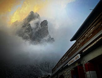
Alta Via 2 - Brixen / Bressanone to Rifugio Genova
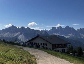
The first day of the legendary AV2!
Severe Hiking
- Distance
- 15 km
- Ascent
- 778 m
- Descent
- 515 m
Hike 125kms from Brixen/Bressanone to Passo Cereda via wild trails, epic via ferratas and some of the best huts in Europe!
Hiking Severe, Extreme
Also in Belluno, Italy • Bozen, Italy
Like any solid multi-day adventure, you will be faced with the good, the bad, and the ugly. The good - spectacular views and incredible routes. The bad – noisy dormitories, arduous terrain and ravenous weather. The ugly - no water.
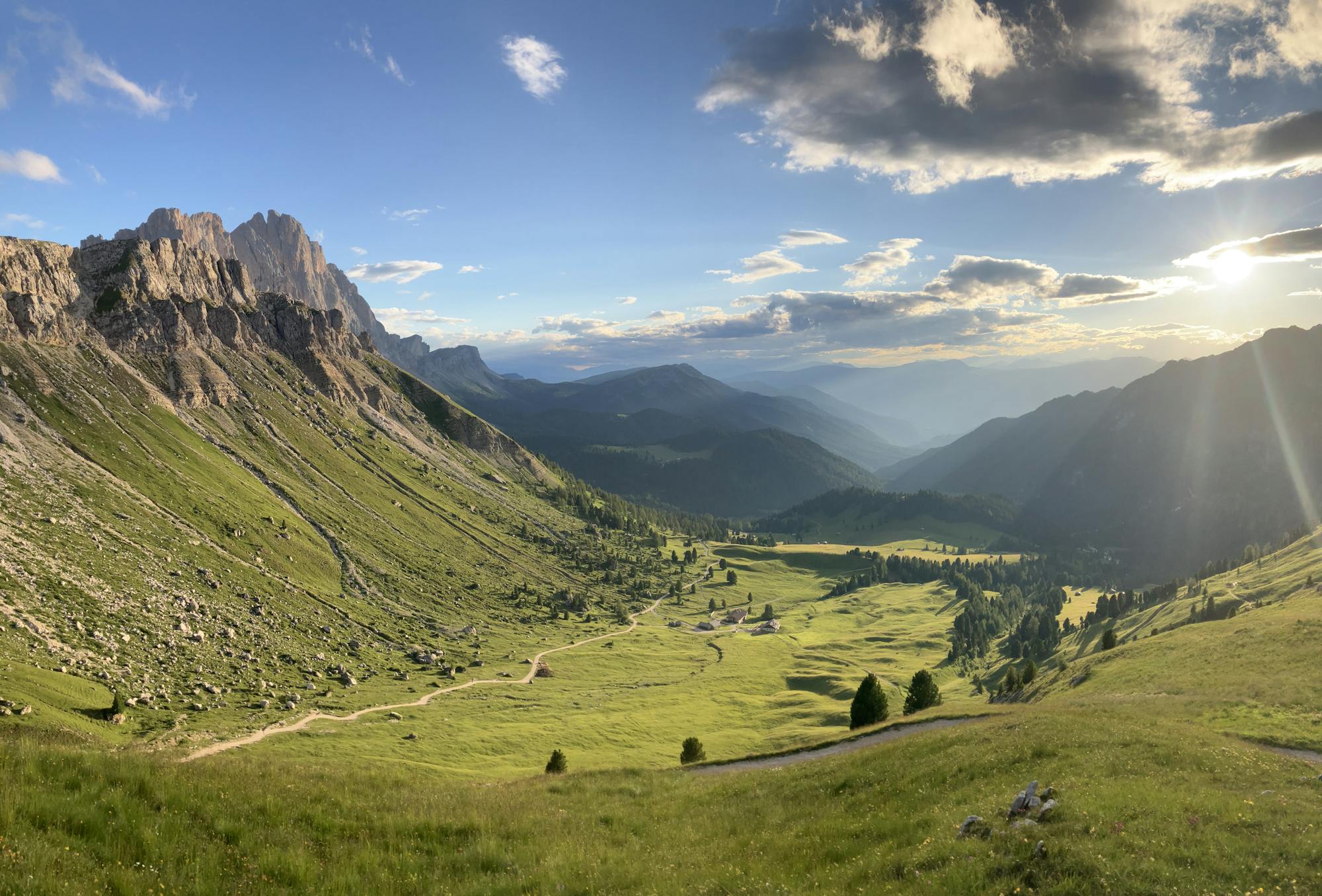
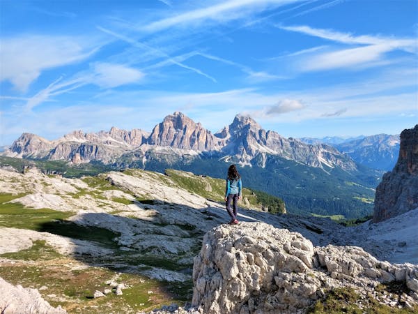
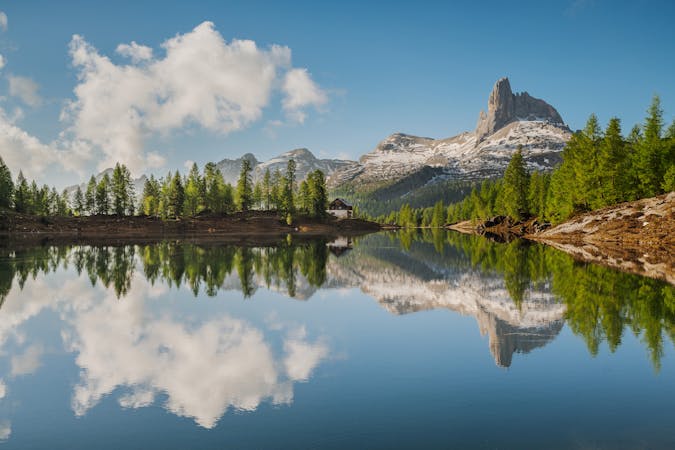
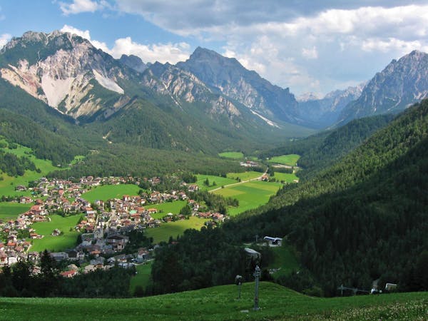
Dubbed “Alta Via delle Leggende” – high route of the legends – the Alta Via 2 (AV2) snakes its way through Italy’s famous Dolomite mountains, crossing Puez-Odle National Park, the Sella Massif and around the Marmolada Group - housing the region’s highest mountain and largest glacier. The trail takes you through lunar landscapes with iconic Dolomitic spires rising high above the ground, to alpine meadows and wooded valleys containing vast areas of colourful wildflower meadows. The spectacular geology of this area showcases a variety of rock providing dream-like viewpoints with utterly breath-taking landscapes. For the hardcore hikers seeking a truly Dolomitic adventure, the AV2 is an absolute must.
This FATMAP guidebook starts in the mountain town of Brixen / Bressanone in the South Tyrol and travels 125.5km ending in Passo Cereda situated in the province of Trentino. Although the official route of the AV2 is 160km long and finishes in the town of Feltre, the trail after Passo Cereda is said to be less dramatic and more tedious than the trail prior to Passo Cereda. For those seeking to hike the extra 2 – 4 days to the town of Feltre itself to officially complete the AV2, please source that information from elsewhere.
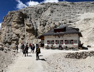
This guidebook lists 11 days of hiking, staying in rifugios (mountain huts) at night and includes some well-known via ferrata / klettersteig / iron-ladder routes that scale peaks and traverse sheer walls. Please note that 11 days is only a guide. For those wanting to complete the route in a shorter / longer duration or only complete certain days of the route, plan accordingly. Although some days in this guidebook may seem short in duration, this is to accommodate for sufficient rest after a long day beforehand or to give you the option to complete a local via ferrata route.
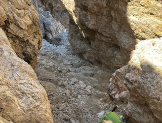
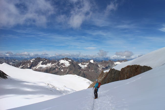
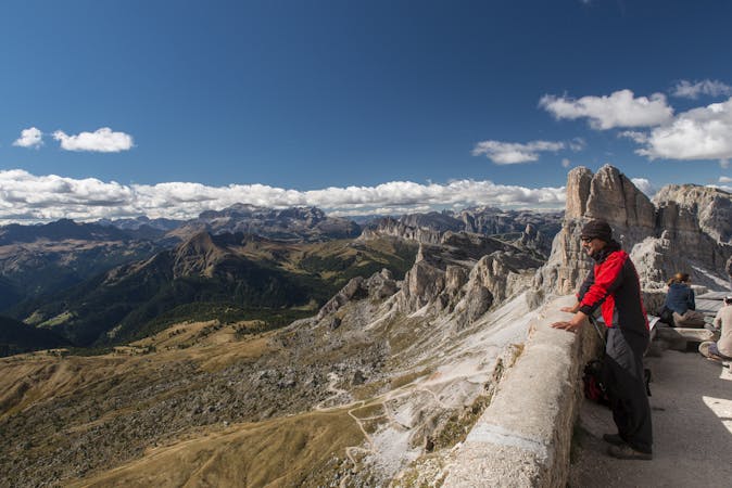
A word of warning regarding via ferrata. This FATMAP guidebook and the GPX files associated with it enter some technical and challenging via ferrata routes. These routes range from beginner difficulty leading up to an extreme graded via ferrata. All guides in this guidebook provide links to further information on each named via ferrata and optional routes / paths to skip difficult via ferrata terrain. The official AV2 route itself does contain sections of cable-aided trails with high exposure to fatal terrain. For those with a climbing background this should pose no issue. For those without, consider using via ferrata equipment in these sections. The AV2 requires hikers to make autonomous decisions, meaning it is up to you whether you use equipment or tackle a via ferrata. Use your judgement wisely and never feel ashamed to turn around. The AV2 is no easy stroll in the park!
Climate change and global warming is a very real threat and these effects can be seen evidentially in the mountains. Limited snowfall during the winter months means that rivers and lakes are poorly filled by snowmelt in spring and summer, leading to emergency water shortages at rifugios and mountain villages. For hikers and climbers, this escalates to no shower or toilet facilities at rifugios, undrinkable tap water and even the closure of some rifugios.
Bottled water is available to purchase but at a price. Water sources on the AV2 that would usually be reliable for direct water collection may cease to exist in the upcoming years, especially as the Dolomite region is liable to long droughts. A recommendation is to purchase a good, portable water purifier / filter that gives you access to drinkable tap water. Entering the lunar and barren landscapes of the Dolomites with minimal water is bad situation on a hot day.
The AV2 is not for the faint-hearted. Formidable ascents and gruelling descents, laborious traverses and strenuous crossings make it a tough day out in the mountains for any avid mountaineer. Those willing to undertake this adventure of a lifetime, the rewards and satisfaction provided by this trail make the AV2 a true Italian masterpiece of nature.
The first day of the legendary AV2!
Severe Hiking
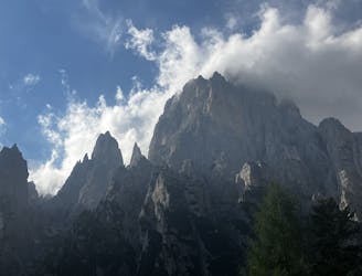
A real contender in the views department!
Severe Hiking

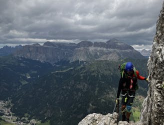
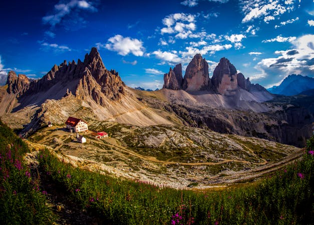
One of the best viewpoints in the Dolomites with a fantastic via ferrata to go with it!
Extreme Hiking
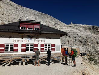
A shorter day for those heading to Rifugio Boe and Piz Boe summit. A mega day for those wanting some vertical action!
Extreme Hiking
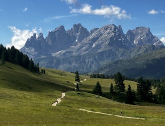
A good day of hiking with an incredible viewpoint!
Severe Hiking
A big day for those chasing another vertical via ferrata!
Extreme Hiking
Another long day out on the AV2 trail!
Severe Hiking
A shorter day on the AV2 but options to explore!
Severe Hiking
A moderately hard day with some tiresome ascents and steep descents!
Extreme Hiking
Prepare the mind, body and soul for 1300m of descent!
Extreme Hiking

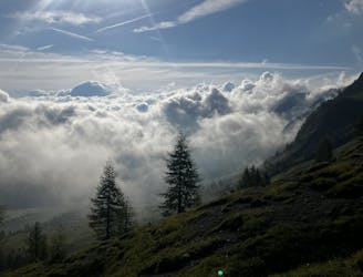
A never-ending section of the AV2!
Severe Hiking
9 routes · Alpine Climbing · Hiking
3 routes · Hiking
9 routes · Alpine Climbing · Hiking
5 routes · Mountain Biking · Hiking
2 routes · Hiking

10 routes · Hiking
7 routes · Hiking
6 routes · Hiking
6 routes · Mountain Biking · Hiking
7 routes · Hiking