6 m away
Ahornspitze Peter Habeler Weg
The classic route up one of the Zillertal's most famous peaks.
Severe Hiking
- Distance
- 5.1 km
- Ascent
- 722 m
- Descent
- 722 m
A fabulous trip along a beautiful ridge.
Hiking Extreme

For those looking to make the Ahornspitze an even greater challenge, this is the route for you. The hike is high, wild and peaceful, and it features some tricker, more exposed scrambling than that found on the Ahornspitze's "normal route" - The Peter Habeler Weg.

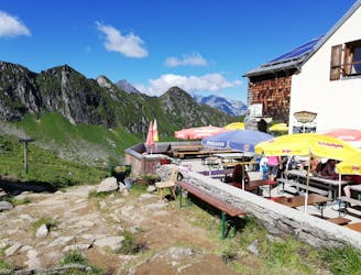
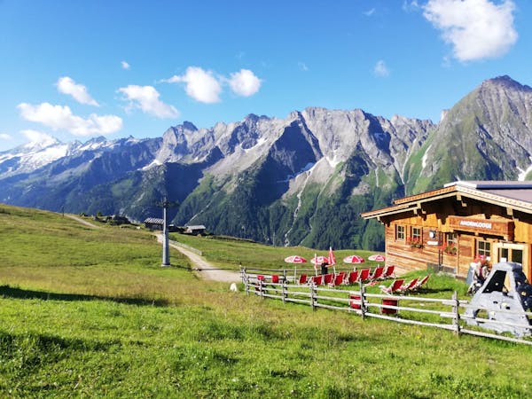
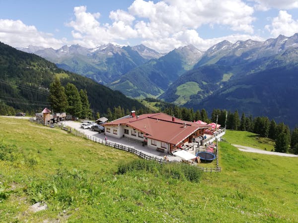
The route shown here starts from the Edelhütte but those with sufficient fitness and determination can climb the peak in a "oner" return trip from the Ahornbahn cable car. Starting from the hut makes the summit day more manageable and gives you a good excuse to stay in a lovely mountain retreat, but it isn't strictly necessary.
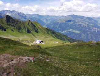
Head due south out of the hut on a clear path signposted for the Kasseler Hütte and with a warning that it is only for skilled mountaineers. An ominous start!
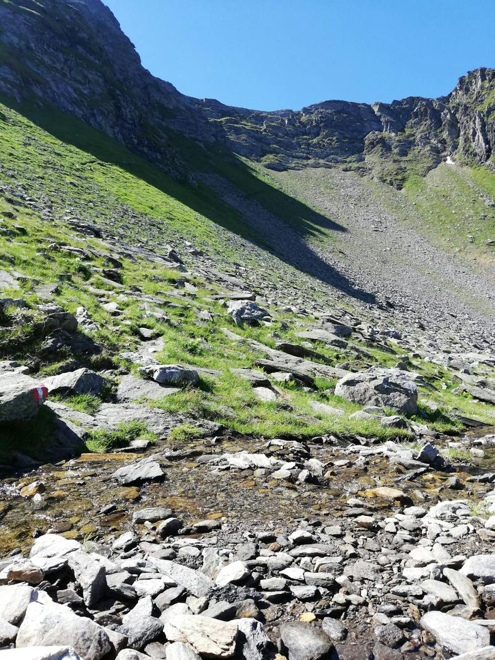
The path climbs easily up towards an improbable looking scramble through a seemingly impenetrable rock wall. Even at the foot of the rock wall it's hard to understand how you're going to reach the col which sits about 100 metres above you, but a route has been found which cunningly finds a way up. The route is protected by cables but a good head for heights is still required if you're to get up it safely and without issue.
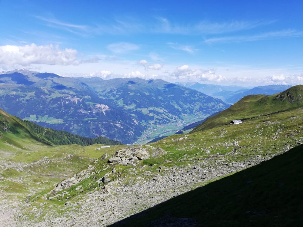
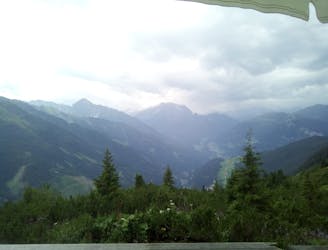
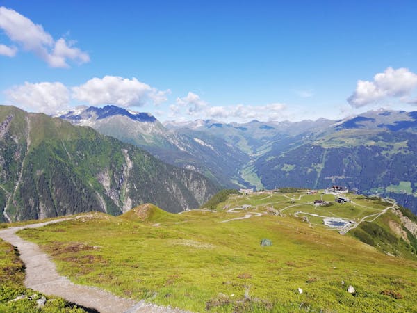
Upon reaching the col the vista suddenly reveals itself, and what a vista it is! Spending some time using FATMAP to identify the various mountains around you is time well spent, provided - of course - that you've still got enough hours to complete this route!
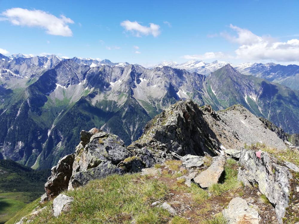
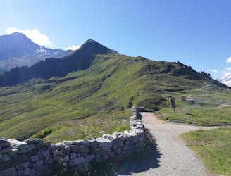
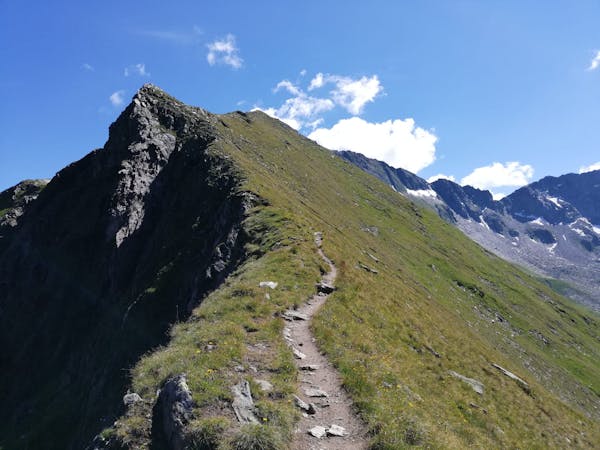
Turn left from the col and follow the (at times) vague path along the Popbergschneide ridge, always marked with red paint. The ridge is exposed in places but never technical - this is a route which an experienced and fit hiker can tackle. There are fabulous views throughout the scramble along the Popbergschneide and the ambience is wonderful. In stark contrast to the Peter Habeler Weg, this route is deserted and if you share it with more than a couple of other parties, you can count yourself unlucky.
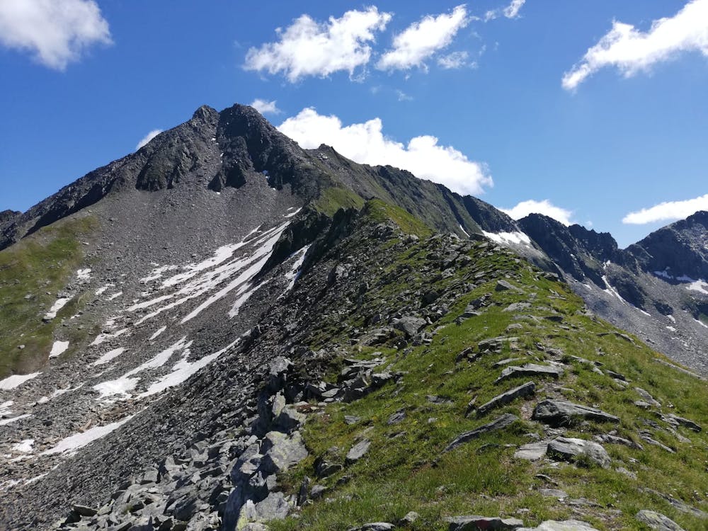
Eventually the ridge leads to the col where this line joins the Peter Habeler Weg. Carry on over the col and begin the long, easy scramble up the Ahornspitze's blunt south-west ridge. Climbing the ridge requires constant micro navigation and there are countless mini variations possible, but the "official" route is marked with red and white paint marks. Sections of the scramble are exposed but there's nothing technically challenging and for experienced hikers the scramble is more pleasure than purgatory!
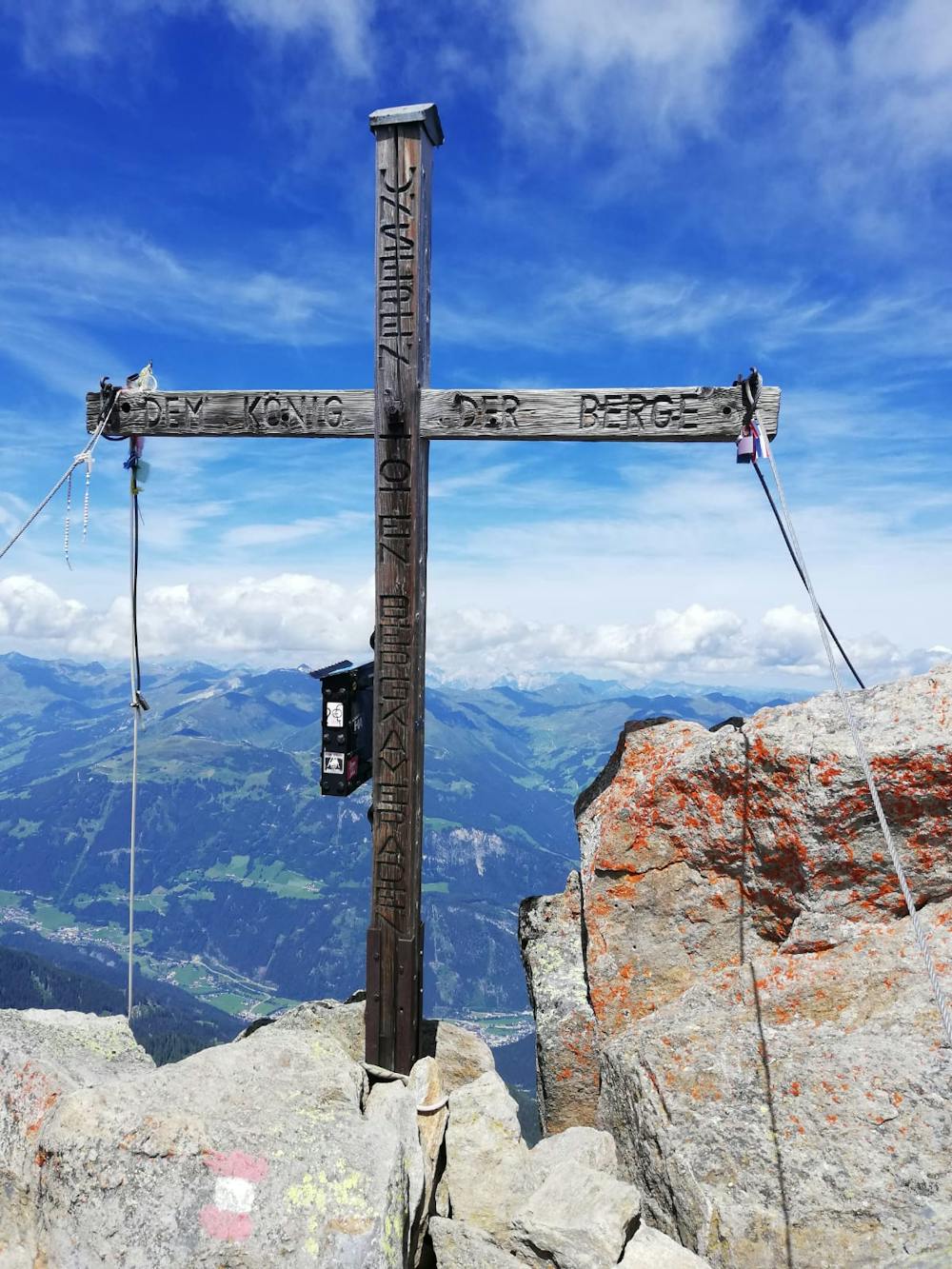
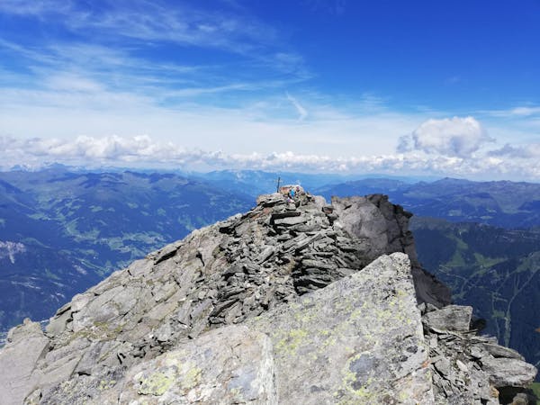
The ridge leads you logically onto a fore-summit, from where you drop to the left of the ridge and follow a series of cable-protected, exposed ledges to the summit itself. The view will likely make your recent exertions feel like a distant memory!
Descend back down the same route, taking care not to knock any loose rocks onto those coming up, and descend the Peter Habeler Weg down to the Edelhütte.
Extreme
Scrambling up mountains and along technical trails with moderate fall exposure. Handholds are necessary to navigate the trail in its entirety, although they are not necessary at all times. Some obstacles can be very large and difficult to navigate, and the grades can often be near-vertical. The challenge of the trail and the steepness of the grade results in very strenuous hiking. Hikes of this difficulty blur the lines between "hiking" and "climbing".

Some trail sections have exposed ledges or steep ascents/descents where falling could cause serious injury.
Little chance of being seen or helped in case of an accident.
6 m away
The classic route up one of the Zillertal's most famous peaks.
Severe Hiking
2.1 km away
A beautiful, buggy-friendly hike suitable for kids of all ages.
Easy Hiking
2.2 km away
A wonderful, high mountain loop to a popular hut.
Difficult Hiking
2.2 km away
An easy and popular summit which offers breathtaking views
Moderate Hiking
4 km away
A tough climb up to a traditional Austrian mountain hut.
Difficult Hiking
5.6 km away

An amazing hike/scramble in the heart of the Zillertal.
Severe Hiking
8 km away
A gorgeous, easy stroll along a famous ridge line.
Moderate Hiking
8.5 km away
A fun little peak with exceptional views.
Moderate Hiking
5 routes · Hiking
3 routes · Hiking
3 routes · Hiking
6 routes · Hiking
8 routes · Mountain Biking · Hiking · Road Biking

25 routes · Hiking
8 routes · Mountain Biking · Hiking · Road Biking