2 km away
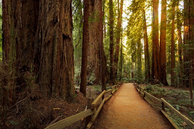
Muir Woods Canopy View Loop
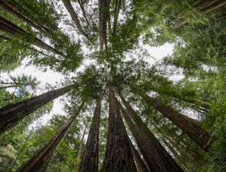
A beautiful loop connecting some of the best trails among the towering redwood trees in Muir Woods National Monument.
Moderate Hiking
- Distance
- 5.3 km
- Ascent
- 196 m
- Descent
- 196 m
The locally famous trail and race course from Mill Valley to Stinson Beach, through redwood forest and offering hilltop coastal views.
Hiking Difficult

Dipsea is well-known by trail runners in Marin County, and by many in the greater Bay Area, as the course of an annual race as well as an every-day favorite for fitness. This 7-mile footpath links some of the best scenery between Mill Valley and Stinson Beach, passing through Muir Woods and Mount Tamalpais State Park. It begins in an urban forest, dives into deep redwood groves, climbs to rolling grassland and panoramic ridgelines, and finishes at the beach.
The start is on Cascade Way next to Old Mill Park. This first section is mostly stairs, which climb between neighborhood streets and houses on the mountainside. Though not particularly scenic, the Dipsea Stairs are a rite of passage for the rest of the trail. After crossing Panoramic Highway, the route leaves the neighborhoods and becomes more aesthetic as it parallels Muir Woods Road toward the national monument. If you want to skip the stairs section in Mill Valley, you can start from Muir Woods, but a parking or shuttle reservation and fee are required.
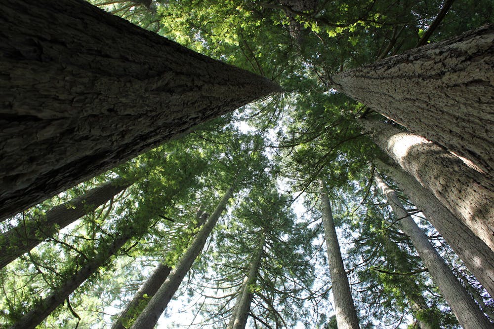
Cross the main Muir Woods parking lot, and then Redwood Creek on a plank footbridge. When the creek is flowing high you won’t be able to cross, so in winter and spring you may have to detour on Frank Valley Road and Deer Park Fire Road. From here the trail enters more natural scenery on the undeveloped slopes of Mount Tam’s southeast ridges and begins a long and grueling uphill.
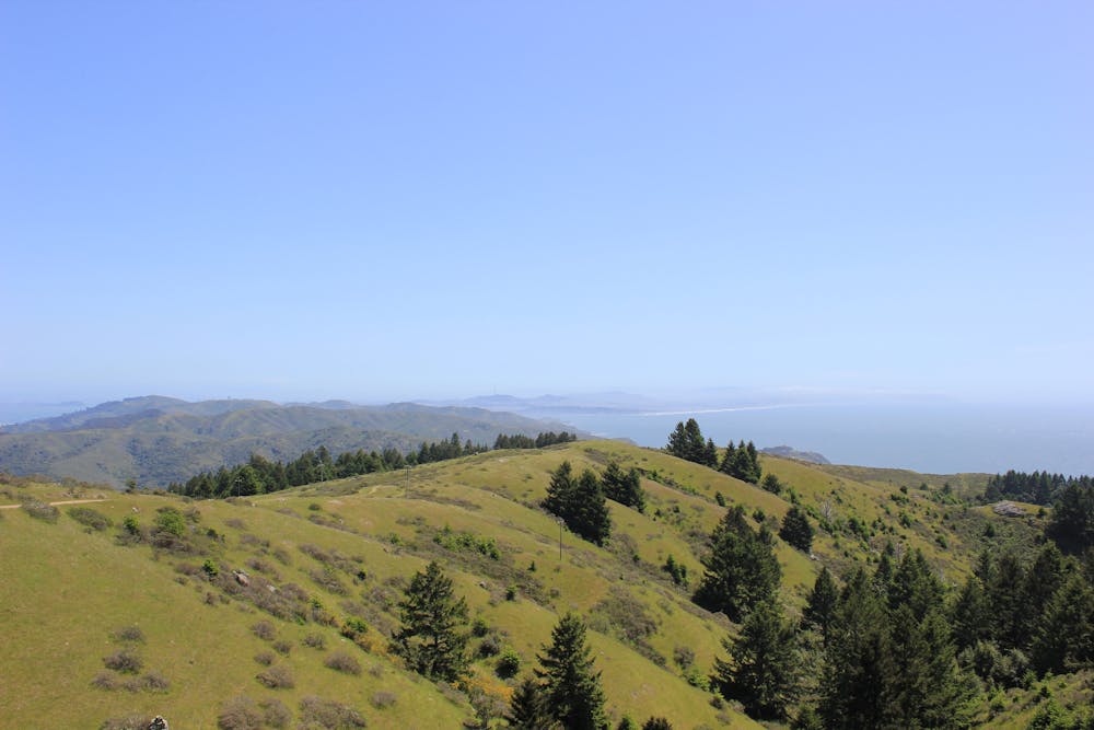
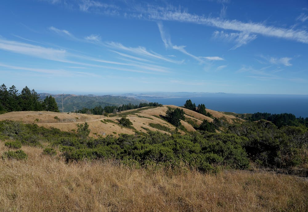
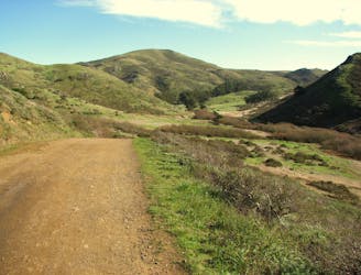
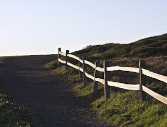
Climb out of the lush redwood and douglas fir groves of Muir Woods to meet the fire road on a ridgeline. Dipsea Trail follows a separate but similar path to the road along this ridge, as they both dip in and out of pine groves and grassy meadows. In clear weather, you’ll enjoy views over surrounding hills toward the Pacific Ocean. This climb ends at the trail’s high point, called Cardiac Hill. There is a water fountain and bench here if you need a rest. Next comes a glorious downhill and return to shady forest.
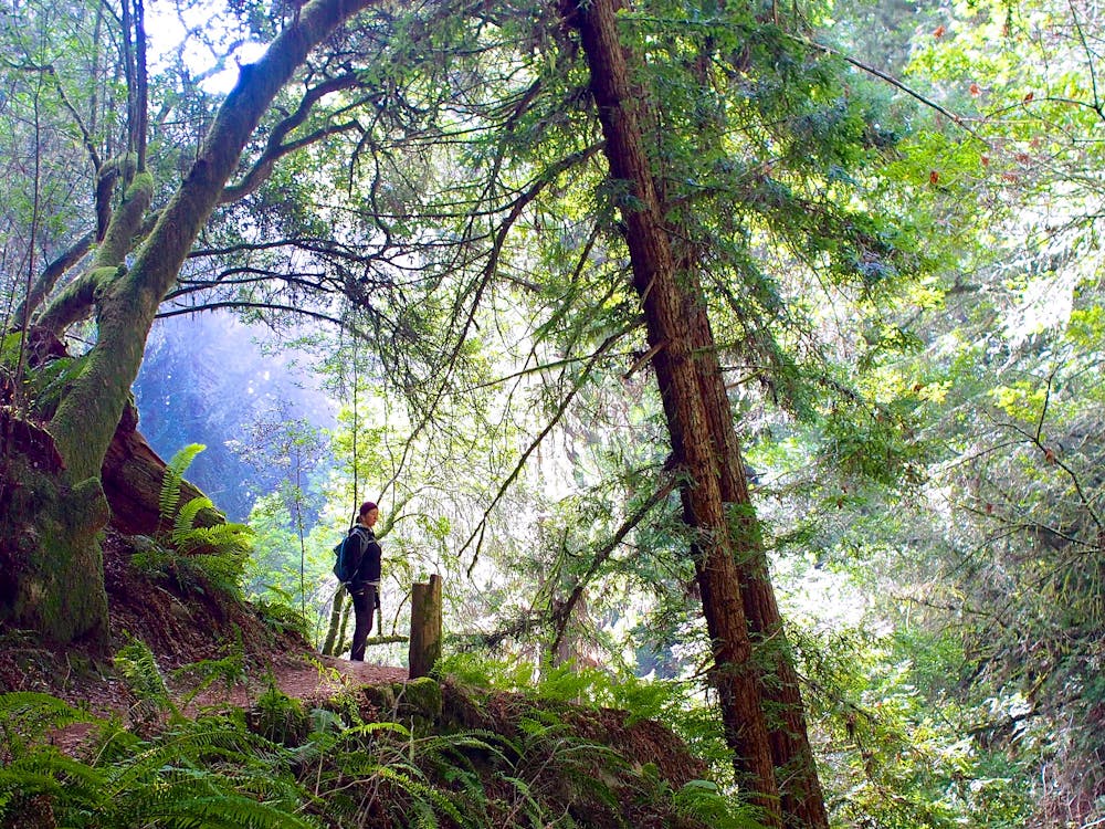
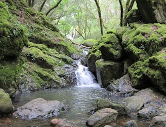
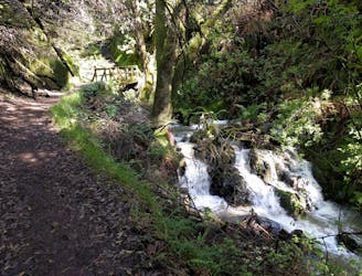
The trail rolls along an open hillside for a bit longer before dropping into Steep Ravine via switchbacks and a lot of stairs. The forest here is even denser than Muir Woods. Bushes and ferns fringe the path and the canopy closes tightly overhead. It can be muddy in spots and quite steep, so use caution. Cross the cascades of Webb Creek on a footbridge, then take on one final uphill to emerge from the forest once again, with the beach coming into view.
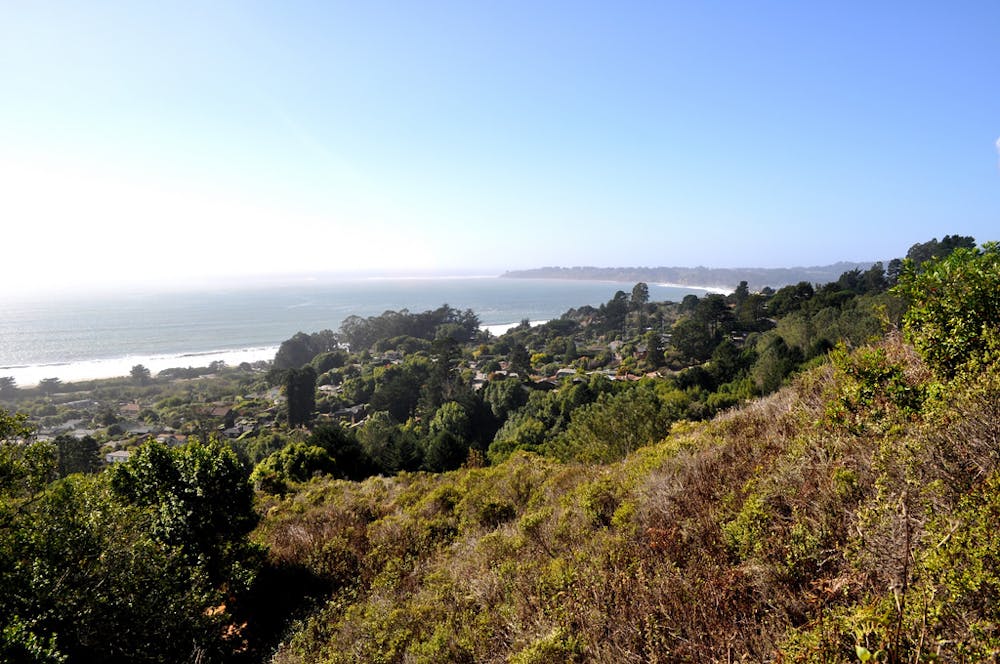
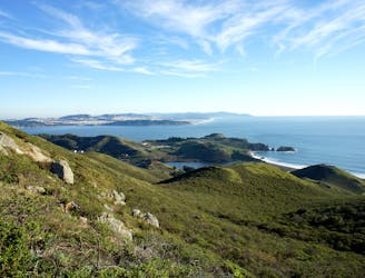
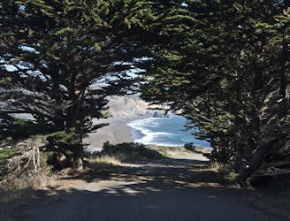
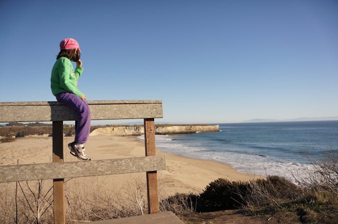
A final downhill traverse of the nearly treeless hillside with ocean views leads to the streets of Stinson Beach. Cross Shoreline Highway and a public parking lot to reach the sand, the waves, and the rewarding finish to Dipsea Trail. To return to the start, you can retrace your steps, use other trails through the state park, or take transportation back to Mill Valley.
Sources: https://www.dipsea.org/course.php https://www.parks.ca.gov/pages/471/files/MountTamalpaisSPFinalWebLayout110816.pdf
Difficult
Hiking trails where obstacles such as rocks or roots are prevalent. Some obstacles can require care to step over or around. At times, the trail can be worn and eroded. The grade of the trail is generally quite steep, and can often lead to strenuous hiking.

The trail contains some obstacles such as outcroppings and rock which could cause injury.

Close to help in case of emergency.
2 km away
A beautiful loop connecting some of the best trails among the towering redwood trees in Muir Woods National Monument.
Moderate Hiking
3.3 km away
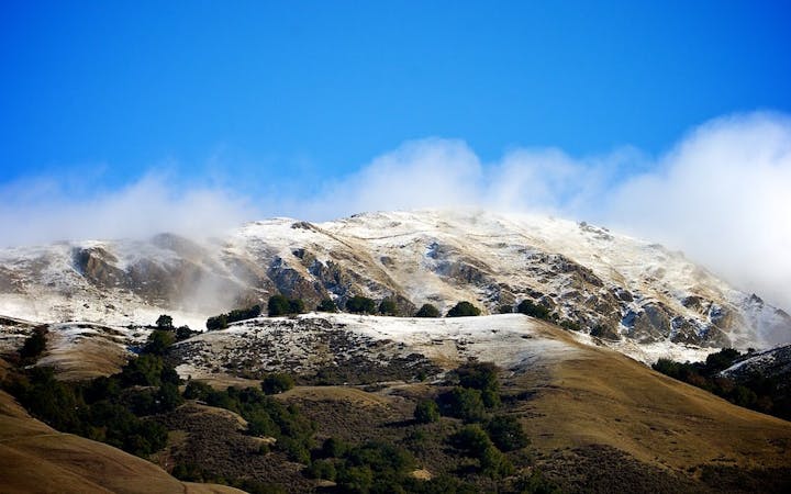
Short hike to the panoramic summit of Mount Tamalpais.
Moderate Hiking
3.4 km away
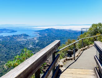
A short, easy loop around the East Peak of Mount Tamalpais that offers panoramic views of the Bay Area and its landmarks.
Easy Hiking
5.2 km away
Popular hike through a verdant valley to a beach in a cliff-lined beach.
Easy Hiking
5.2 km away
Lesser-traveled loop with spectacular and varied scenery—lush forest, open hillsides, and a cascading creek.
Moderate Hiking
7.5 km away
An excellent bang-for-your-buck loop with a variety of terrain and scenery.
Difficult Hiking
8.1 km away
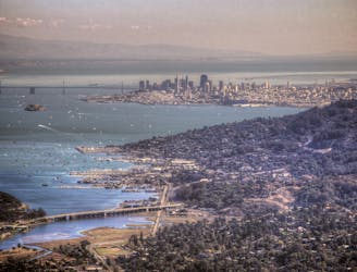
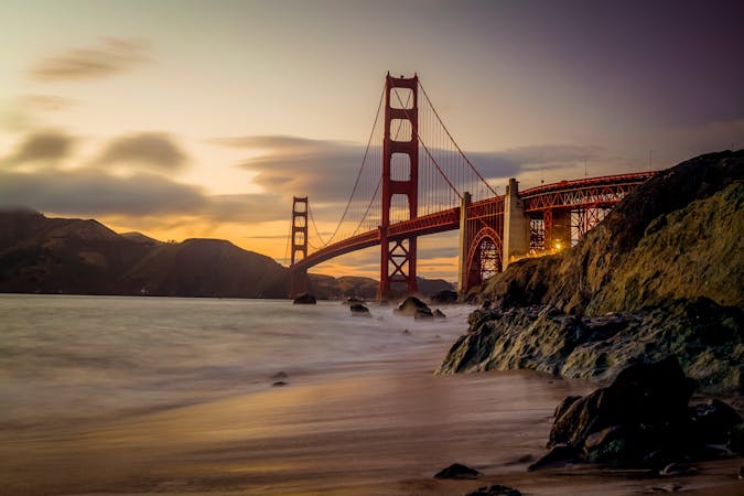
Amazing views of San Francisco and some interesting war relics near the Golden Gate Bridge.
Moderate Hiking
8.2 km away
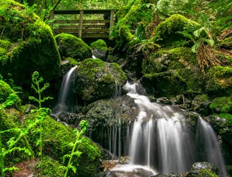
A bounty of waterfalls and a peaceful picnic area on Cataract Creek.
Difficult Hiking
8.2 km away
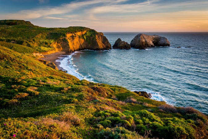
Hike from Rodeo Beach to a more secluded viewpoint along coastal cliffs.
Easy Hiking
8.2 km away
Travel up and down panoramic hills above the sea, in between two of Marin County's best beaches
Difficult Hiking
12 routes · Hiking
8 routes · Hiking
7 routes · Hiking
5 routes · Hiking
7 routes · Hiking

13 routes · Hiking · Trail Running
8 routes · Hiking · Road Biking

14 routes · Hiking