25 m away
Panorama Trail
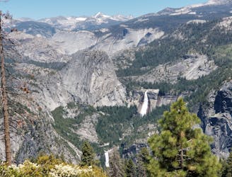
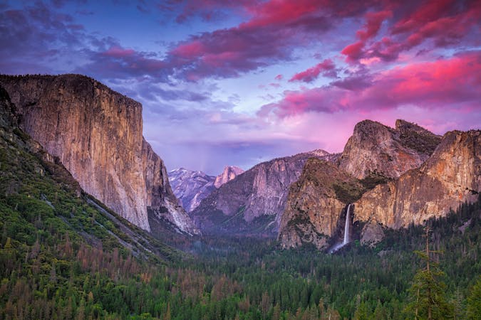
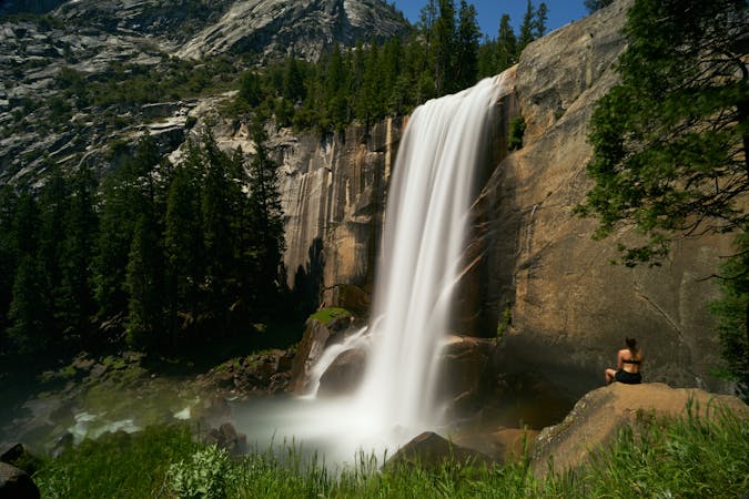
Hike at the brink of a huge waterfall and along the precipitous rim of Yosemite Valley.
Difficult Hiking
- Distance
- 15 km
- Ascent
- 283 m
- Descent
- 1.3 km
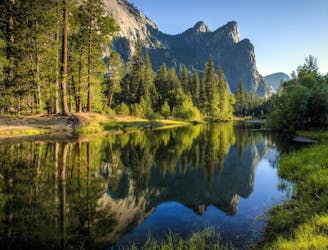
A leisurely loop taking you to a stunning lookout point.
Hiking Easy

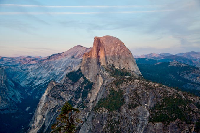
For most of the way the path is flat and paved, so there’s no problem for strollers and wheelchairs. The route leads you to an exhilarating lookout point above Curry Village, which sits on the ground of Yosemite Valley, a staggering 3,214 feet below! The 270-degree panorama is spectacular, Half Dome and the High Sierra lie to the east, and there’s waterfalls, dozens of peaks and of course, glacial deposits to admire.
Start the walk from the Glacier Point carpark, and follow the signed path to the lookout. There’s conveniently also a small shop at the trailhead if you need to stock up on supplies.
Easy
Walking along a well-kept trail that’s mostly flat. No obstacles are present.

Close to help in case of emergency.
25 m away
Hike at the brink of a huge waterfall and along the precipitous rim of Yosemite Valley.
Difficult Hiking
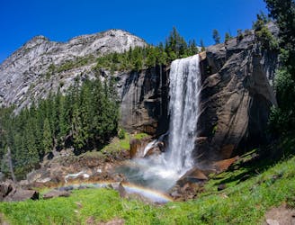
1.1 km away
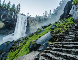
A stunning hike up steep climbs, passing close to Vernal and Nevada Falls.
Difficult Hiking
1.1 km away
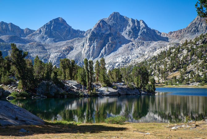
Thru hike of the California’s Sierra Nevada, linking the most impressive alpine scenery from Yosemite National Park to Mount Whitney.
Difficult Hiking
1.1 km away
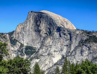
An exciting hike to the summit of one of North America's most iconic peaks.
Extreme Hiking
1.1 km away
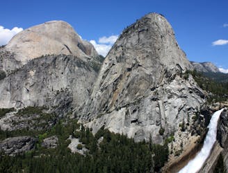
Connect two of Yosemite's great waterfalls in a concise but strenuous loop
Difficult Hiking
2 km away
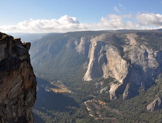
A hike through the forest to a panoramic viewpoint over Yosemite Valley.
Easy Hiking
2 km away
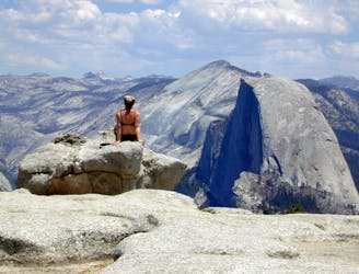
Birds-eye view of the Valley atop one of Yosemite's higher granite domes.
Moderate Hiking
2.9 km away
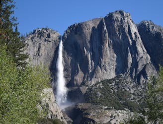
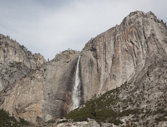
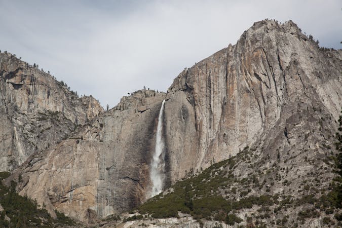
Steep hike to the top of North America's tallest waterfall.
Difficult Hiking
2.9 km away
Make the arduous climb to Upper Yosemite Falls, then go even farther to find the highest point on this side of Yosemite Valley.
Difficult Hiking
6.8 km away
Paved trail to the base of a 620-foot waterfall.
Easy Hiking
13 routes · Hiking
6 routes · Hiking · Road Biking
7 routes · Hiking
9 routes · Hiking

25 routes · Alpine Climbing · Hiking

5 routes · Alpine Climbing · Hiking
7 routes · Hiking

63 routes · Alpine Climbing · Hiking