2 m away
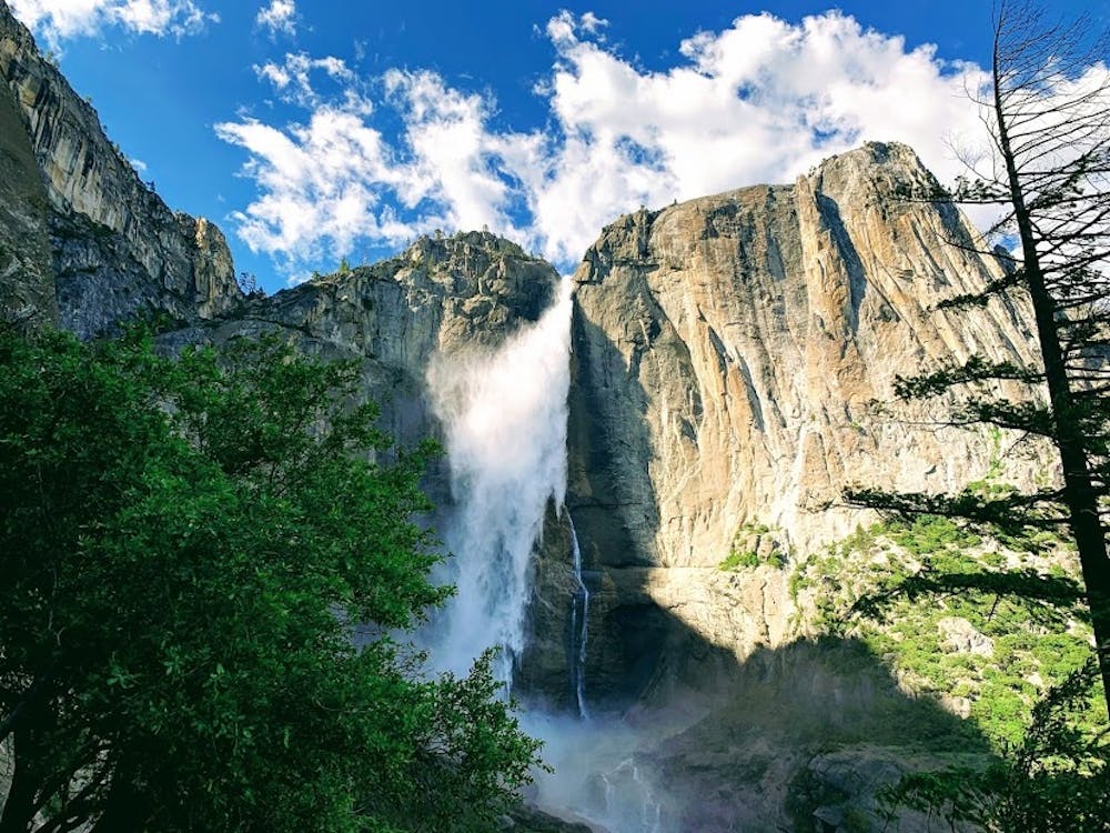
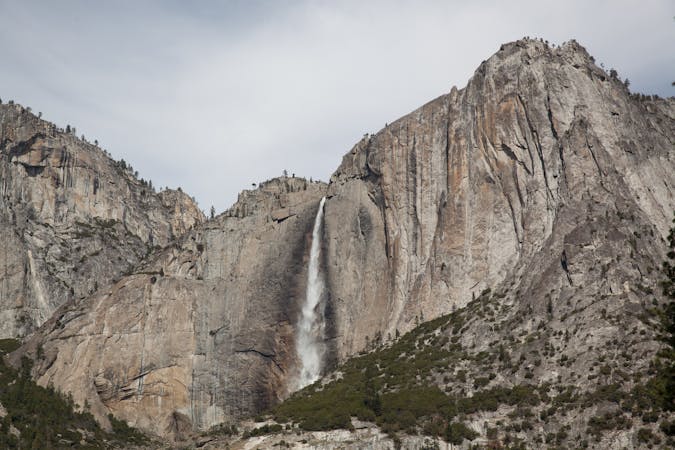
Yosemite Falls Trail
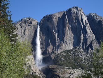
Steep hike to the top of North America's tallest waterfall.
Difficult Hiking
- Distance
- 9.3 km
- Ascent
- 939 m
- Descent
- 939 m
Yosemite Falls to Eagle Peak to El Capitan
Hiking Difficult

This is a popular hiking route which is generally considered to be difficult. It's remote, it features medium exposure and is typically done in February, April, May, June, July, August, September, October and November. From a low point of 1.2 km to the maximum altitude of 2.4 km, the route covers 14 km, 1474 vertical metres of ascent and 384 vertical metres of descent.
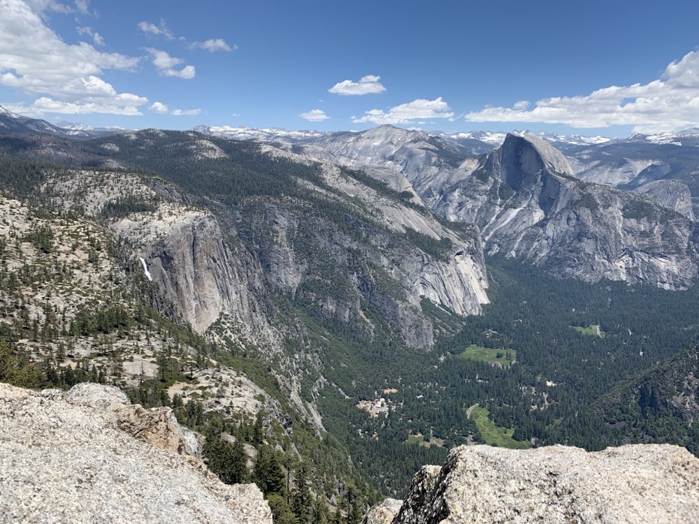
Yosemite Falls to Eagle Peak to El Capitan
Difficult
Hiking trails where obstacles such as rocks or roots are prevalent. Some obstacles can require care to step over or around. At times, the trail can be worn and eroded. The grade of the trail is generally quite steep, and can often lead to strenuous hiking.

The trail contains some obstacles such as outcroppings and rock which could cause injury.
Away from help but easily accessed.
2 m away
Steep hike to the top of North America's tallest waterfall.
Difficult Hiking
6 m away
Make the arduous climb to Upper Yosemite Falls, then go even farther to find the highest point on this side of Yosemite Valley.
Difficult Hiking
3 km away
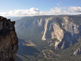
Hike at the brink of a huge waterfall and along the precipitous rim of Yosemite Valley.
Difficult Hiking
3.2 km away
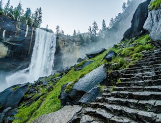
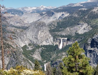
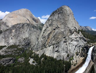
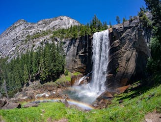
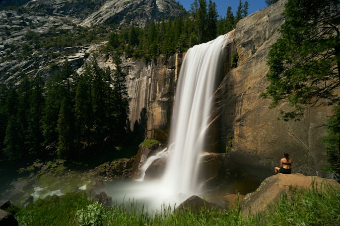
A stunning hike up steep climbs, passing close to Vernal and Nevada Falls.
Difficult Hiking
3.2 km away
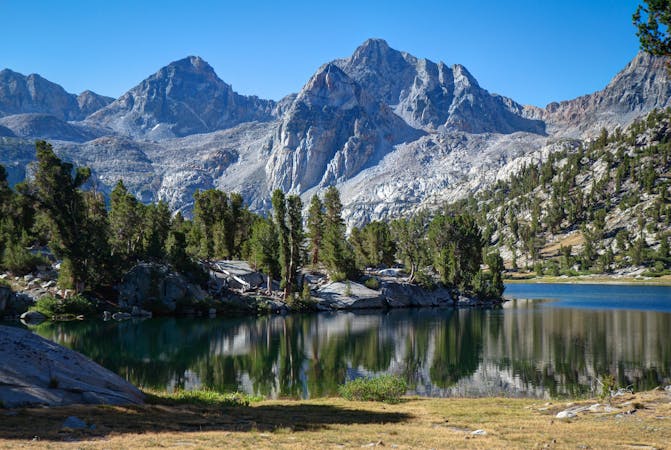
Thru hike of the California’s Sierra Nevada, linking the most impressive alpine scenery from Yosemite National Park to Mount Whitney.
Difficult Hiking
3.2 km away
An exciting hike to the summit of one of North America's most iconic peaks.
Extreme Hiking
3.2 km away
Connect two of Yosemite's great waterfalls in a concise but strenuous loop
Difficult Hiking
3.6 km away
A hike through the forest to a panoramic viewpoint over Yosemite Valley.
Easy Hiking
3.6 km away
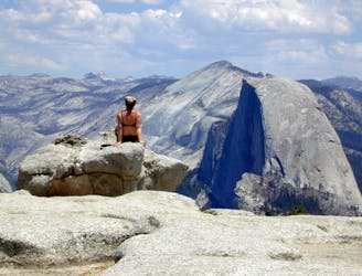
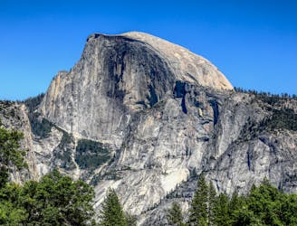
Birds-eye view of the Valley atop one of Yosemite's higher granite domes.
Moderate Hiking
5.2 km away
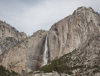
Paved trail to the base of a 620-foot waterfall.
Easy Hiking
13 routes · Hiking
6 routes · Hiking · Road Biking
7 routes · Hiking
9 routes · Hiking

25 routes · Alpine Climbing · Hiking

5 routes · Alpine Climbing · Hiking
7 routes · Hiking

63 routes · Alpine Climbing · Hiking