697 m away
Jausenstation Brunntal via Ehnbach gorge
An varied hike through a gorge to a traditional hut.
Moderate Hiking
- Distance
- 7 km
- Ascent
- 519 m
- Descent
- 521 m
A nice loop to a hut at the bottom of the Solstein peaks.
Hiking Difficult
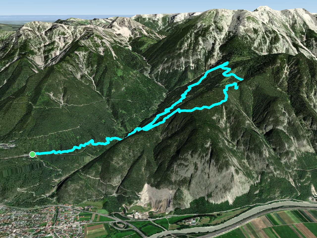
The hike to the Neue Magdeburger hut starts from the train station Hochzirl, which you can get to by car or with the S6 train from Innsbruck or Garmisch-Partenkirchen. More experienced hikers can also start at the entrance of the Ehnbachklamm.
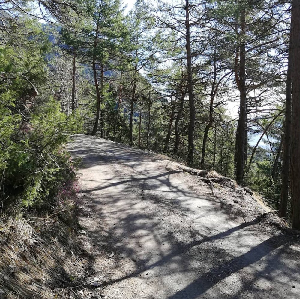
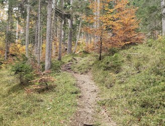
From the train station you follow the hiking trail eastwards down in to the Ehnbachklamm gorge.
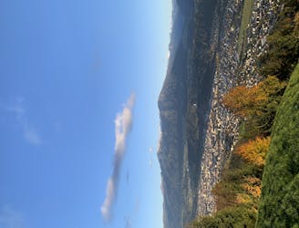
As the trail gets crossed by another trail for the third time, the trail continues going straight in direction of the gorge. You then get to a viewpoint with a nice vista down into the Ehnbachklamm.
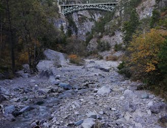
The route then reaches the bottom of the gorge, where you may refill your bottle. Be aware that this part may be closed after heavy rainfall due to flooding risks at the Ehnbachklamm.
As the trail gets narrower and narrower the uphill begins.
The route turns left (east), following the Brunntal trail for a few meters, until it turns to the right (south-east) again through an open forest with some weekender huts.
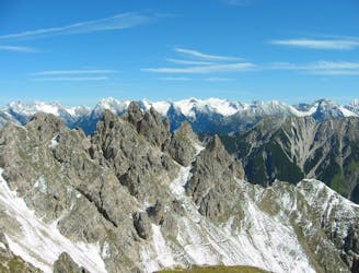
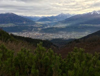
Keep on following the trail uphill in the direction of the Möslkopf, until it reaches the ridge of the Hochwandkopf. As you reach the ridge overlooking the Inn valley, follow it eastwards around the Hochwandkopf. This little peak offers an easy opportunity to get a great view of the surrounding area.
From the crossroad near the Hochwandkopf the Pletzensteig trail gently gains height, going straight (north) to the Neue Magdeburger hut. On the way to the hut, you will traverse some smaller ridges, which will be more tiring than they initially appear.
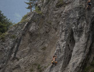
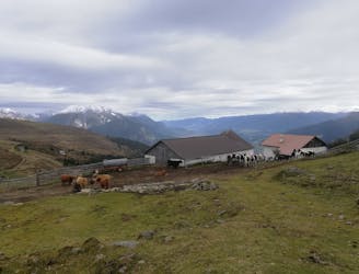
The Neue Magdeburger hut then is reached, sitting above the Kranebitter gorge, at the bottom of the Solstein peaks. While taking a break and refilling your energy and water bottles at the hut you'll eventually spot some hikers on the Sollstein peaks.
The descent route follows a steeper trail downhill from the hut. It crosses a gravel road a few times until it reaches a little picnic place.
From this resting point onwards, the trail follows the Brunntal trail until the pathway down into the Ehnbach gorge is reached.
The route then continues west with a last uphill section out of the gorge to the parking lot, where this nice loop route ends!
Difficult
Hiking trails where obstacles such as rocks or roots are prevalent. Some obstacles can require care to step over or around. At times, the trail can be worn and eroded. The grade of the trail is generally quite steep, and can often lead to strenuous hiking.

The path is on completely flat land and potential injury is limited to falling over.

Away from help but easily accessed.
697 m away
An varied hike through a gorge to a traditional hut.
Moderate Hiking
2.3 km away
A lovely - but at times steep - trip through a deep, high gorge.
Difficult Hiking
5.4 km away
An incredibly wild-feeling trip through some wonderful scenery.
Difficult Hiking
5.6 km away
A high and wild day through some epic mountain scenery.
Severe Hiking
6.3 km away

An easy hike with a picturesque lake and mountain view.
Moderate Hiking
7.2 km away
Enjoy huge views across some of Austria and Germany's wildest mountains
Moderate Hiking
7.4 km away
A classic mellow hike through peaceful forests and between a series of lakes.
Moderate Hiking
9.6 km away
A beautiful easy hike to a sunny vantage point above Innsbruck.
Easy Hiking
9.8 km away
A steep and strenuous hike to one of the best situated huts in Tirol.
Difficult Hiking
3 routes · Hiking

7 routes · Alpine Climbing · Mountain Biking · Hiking · Trail Running

8 routes · Hiking

9 routes · Hiking

25 routes · Hiking