4.9 km away
Täschhorn-Dom Traverse
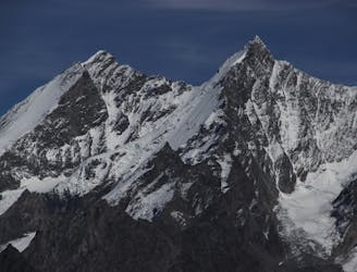
A famous and committing high altitude traverse between two mighty peaks
Severe Alpine Climbing
- Distance
- 7.8 km
- Ascent
- 894 m
- Descent
- 1.8 km
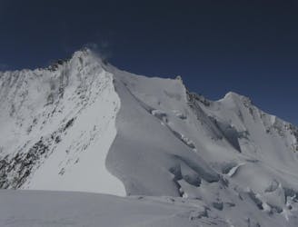
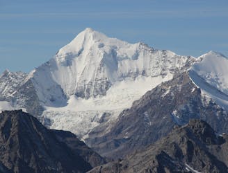
A long and impressive glacial journey to a remote summit, after a big hut approach the day before
Alpine Climbing Moderate

Despite the Dom’s huge height this is a relatively non-technical route, which is frequently done on skis as well.

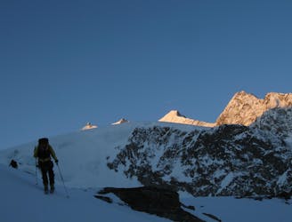
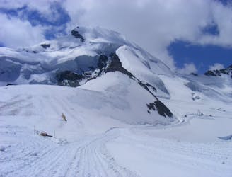
From the Dom Hut (with a very early start) follow the cairned path up the lateral moraine which merges into the Festi Glacier at about 3220m. Keep to the left side of this glacier in ascent which climbs up towards the obvious Festijoch col. Look out for the path that takes to the rocks and follows them, over ledges, with fixed ropes and moves of UIAA 2, before gaining the ridge on more fixed ropes to the col at 3723m. Hopefully you will be in the sun by then and can take a break, to admire the imposing wall of the Nadelgrat which has come into view on the far side of the col.
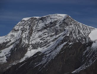
The route then takes a circuitous loop to avoid steep and threatened ground, initially to the NE then E, staying well clear of menacing seracs. Pass under the summits of the Nadelhorn and Lenzspitze, before turning to the S then SW to gain the final steeper slopes of the N Flank. The route normally continues up and right to join the NW Ridge, at the col left of point 4479m, then turning left to the summit. An alternative but popular route goes straight up to the summit from the Festijoch, along the ridge above, known as the Festigrat. This is harder but very satisfying to do the round trip, down the route described above. It shouldn’t take any longer if you are good on your feet.
The summit is a great reward as it reveals the other half of the staggering panorama, including the crazy ridge that links to its’ near neighbour, the Täschhorn, as well as Monte Rosa and the rest of the Saas Fee 4000ers.
The descent is the reverse of the ascent.
Moderate
May involve slightly more complex glacier hikes, easy but possibly long rock ridges and steep snow up to 45 degrees. Equivalent to PD, PD+

The route features some exposed and/or difficult to protect sections.

In the high mountains or remote conditions, all individuals must be completely autonomous in every situation.
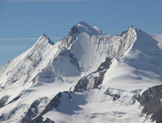
4.9 km away
A famous and committing high altitude traverse between two mighty peaks
Severe Alpine Climbing
5 km away

A very big day from Täschalp which can be split with a night in the Täsch Hut
Moderate Alpine Climbing
5.3 km away
A classic 4000m voyage ticking off 4 summits in day, each one higher than the previous
Difficult Alpine Climbing
5.6 km away
A great route traversing two 4000m peaks, with excellent rock towards the summit of the Nadelhorn
Difficult Alpine Climbing
5.8 km away
A fantastic, classic mountain ridge climb on one of the most demanding Alpine 4000ers
Difficult Alpine Climbing
6 km away
This is without doubt one of the finest ridges on one of the finest peaks in the Alps.
Difficult Alpine Climbing
6.4 km away
A long glacial journey up a complicated glacier to a remote summit.
Moderate Alpine Climbing
8.4 km away
A remote walk into a small hut, crossing a dry glacier
Easy Alpine Climbing
8.4 km away
Possibly the easiest 4000er in the Alps which enjoys spectacular views
Easy Alpine Climbing

9 routes · Alpine Climbing · Hiking

11 routes · Alpine Climbing · Hiking

10 routes · Alpine Climbing · Hiking

6 routes · Alpine Climbing · Hiking

10 routes · Alpine Climbing · Hiking

9 routes · Alpine Climbing · Hiking

20 routes · Alpine Climbing · Hiking