2.4 km away
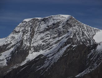
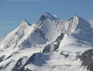
Allalinhorn Hohlaubgrat
A classic route and an aesthetic line.
Moderate Alpine Climbing
- Distance
- 6.1 km
- Ascent
- 1.1 km
- Descent
- 674 m
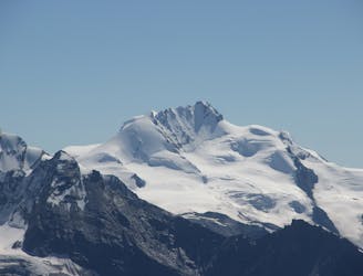
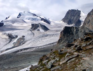
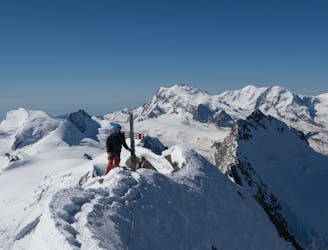
Possibly the easiest 4000er in the Alps which enjoys spectacular views
Alpine Climbing Easy

For those looking to begin their 4000er climbing career or gain some easy acclimatisation for bigger challenges, the Allalinhorn is a great peak. It's accessed from a lift and is almost always done as a day trip from Saas Fee village.
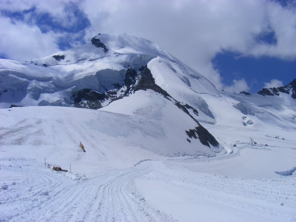
Start by riding the fabulous Saas Fee lift system all the way to the Mittel Allalin station - the access point both for this mountain and the Saas Fee summer ski area. Once you walk out of the Mittelallalin lift and onto the Feegletscher glacier the Allalinhorn is pretty unmissable as it dominates the view to the south. It's not as far as it initially looks!
Head south-southwest from the station and climb gently towards the broad and vague col which separates the Feechopf from the Allalinhorn. Shortly before reaching the col begin to curve left (east-southeast) up a hanging shelf of glacier to the south of the Allalinhorn's summit.
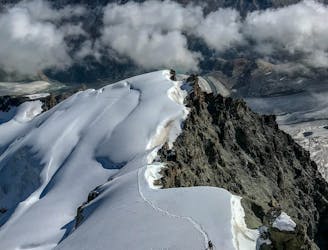
Climb the shelf and then swing left again head up to the peak's West ridge. Follow this (easy but slightly exposed) to the summit cross. The view is wonderful and for those making their first forays into climbing 4000ers, enjoy adding another one to your list! Descend the same way back down to the Mittel Allalin.
Easy
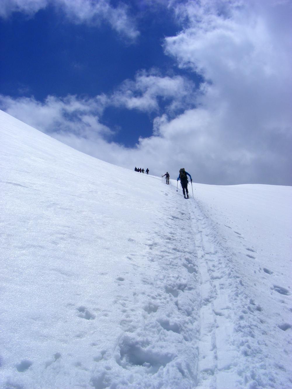
The ascent involves simple glacier hiking and/or short, straightforward rock scrambles. Equivalent to Alpine F, F+

The route is well protected or easy enough that protection is not required.

Little chance of being seen or helped in case of an accident.
2.4 km away
A classic route and an aesthetic line.
Moderate Alpine Climbing
2.4 km away
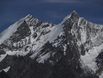
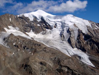
A beautiful summit with a characteristic sawtooth N Ridge, here climbed most easily from the opposite side.
Moderate Alpine Climbing
2.4 km away
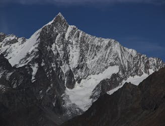
A long journey up a relatively straightforward snowy peak, popular in the spring too.
Moderate Alpine Climbing
2.9 km away
A long glacial journey up a complicated glacier to a remote summit.
Moderate Alpine Climbing
3.5 km away
A famous and committing high altitude traverse between two mighty peaks
Severe Alpine Climbing
5.8 km away
A fantastic, classic mountain ridge climb on one of the most demanding Alpine 4000ers
Difficult Alpine Climbing
5.9 km away
A great route traversing two 4000m peaks, with excellent rock towards the summit of the Nadelhorn
Difficult Alpine Climbing
7.2 km away

A very big day from Täschalp which can be split with a night in the Täsch Hut
Moderate Alpine Climbing
8.4 km away
A long and impressive glacial journey to a remote summit, after a big hut approach the day before
Moderate Alpine Climbing
9.7 km away
A fantastic traverse of a popular peak, starting from a remote hut.
Moderate Alpine Climbing

9 routes · Alpine Climbing · Hiking

11 routes · Alpine Climbing · Hiking

10 routes · Alpine Climbing · Hiking

6 routes · Alpine Climbing · Hiking

10 routes · Alpine Climbing · Hiking

9 routes · Alpine Climbing · Hiking

20 routes · Alpine Climbing · Hiking