16 m away
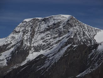
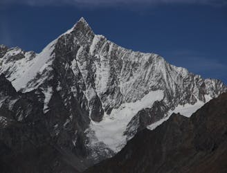
Rimpfischhorn, 4199m, from Britannia Hut
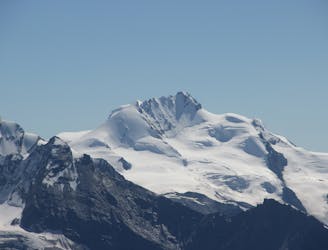
A beautiful summit with a characteristic sawtooth N Ridge, here climbed most easily from the opposite side.
Moderate Alpine Climbing
- Distance
- 15 km
- Ascent
- 1.4 km
- Descent
- 1.4 km
A classic route and an aesthetic line.
Alpine Climbing Moderate

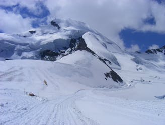
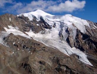
The Allalinhorn is an understandably popular peak and this is the best route on it. Largely a snow route, it does involve a rocky step close to the summit, and therefore taking a few pieces of mid-sized rock climbing protection hardware (as well as a few slings) is well advised.
The route starts at the Britannia Hut, which is easily approached in just over an hour from the Saas Fee cable car network. Get an early start from the hut to give you the best chance of finding frozen snow on this route, which will make life considerably easier than if conditions are poor.
Descend from the hut to the toe of the Hohlaub Glacier and cross this in the pre-dawn darkness. Follow the blunt lower section of the Hohlaubgrat ridge to where it narrows at around 3500 metres, just after a snowy dome.
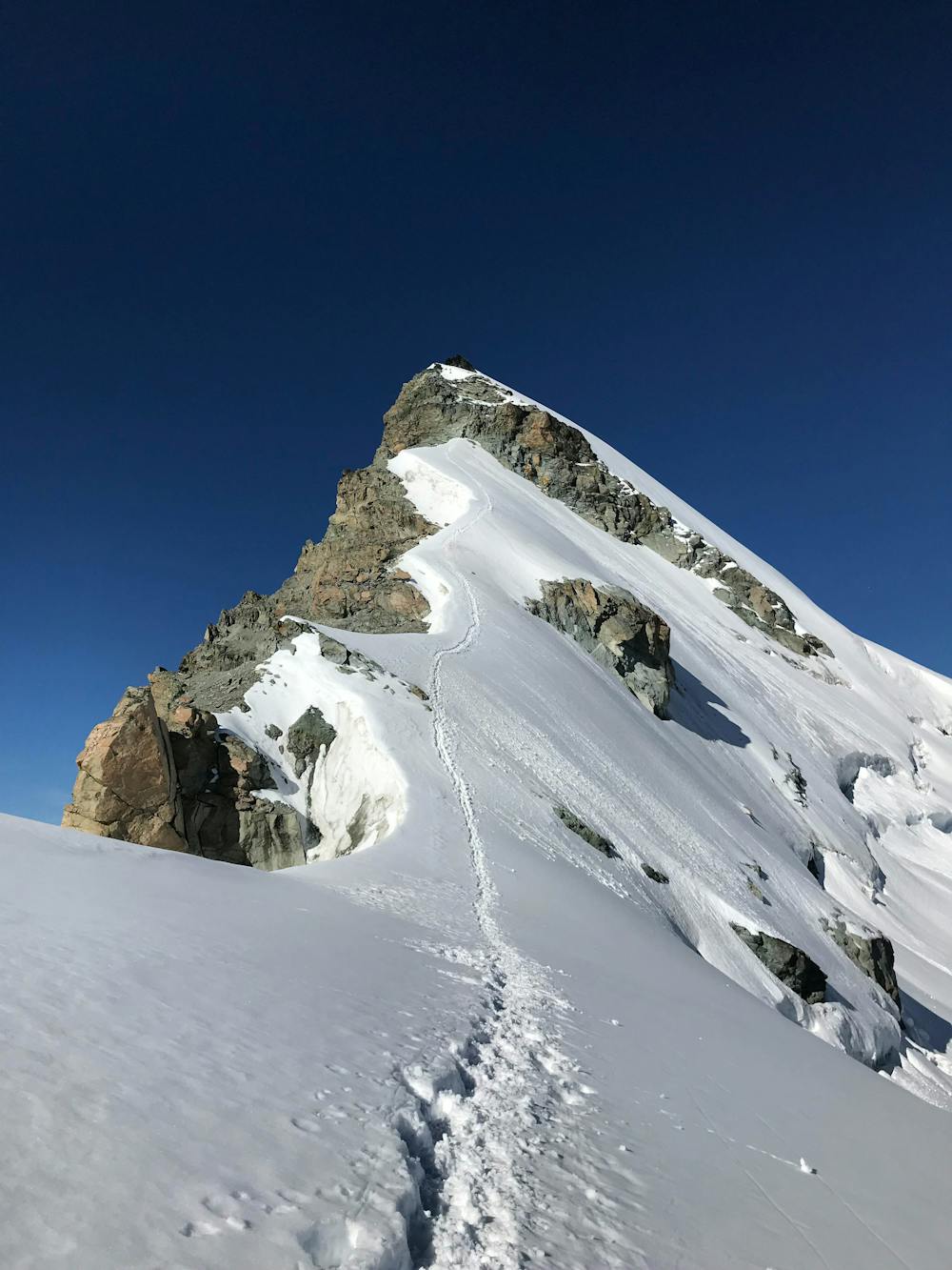
Follow the crest of the ridge via some exposed (but never difficult) snow slopes to the foot of a 50 metre rock band. Climb up and diagonally right through this, clipping some metal stanchions for protection en route. The rock step is, when dry, pretty straightforward (around UIAA Grade II), but it feels a little awkward and is more time consuming when snow covered. As such, this route is best done after a day or 2 of good weather has removed any recent snowfall.
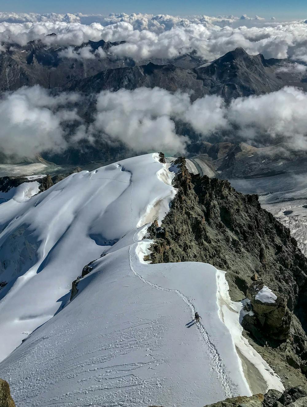
Once above the rockband, follow a short and stunning ridge onto the summit of the Allalinhorn.
Either descend the Allalinhorn's Normal Route (as drawn here) down to the Mittelallalin station or descend this line, abseiling the rock step using the metal stanchions. The majority of teams descend the normal route so as to complete an aesthetic traverse of the mountain.
Moderate
May involve slightly more complex glacier hikes, easy but possibly long rock ridges and steep snow up to 45 degrees. Equivalent to PD, PD+

The route features some exposed and/or difficult to protect sections.
Away from help but easily accessed.
16 m away
A beautiful summit with a characteristic sawtooth N Ridge, here climbed most easily from the opposite side.
Moderate Alpine Climbing
16 m away
A long journey up a relatively straightforward snowy peak, popular in the spring too.
Moderate Alpine Climbing
2.4 km away
Possibly the easiest 4000er in the Alps which enjoys spectacular views
Easy Alpine Climbing
4 km away
A long glacial journey up a complicated glacier to a remote summit.
Moderate Alpine Climbing
5.6 km away
A famous and committing high altitude traverse between two mighty peaks
Severe Alpine Climbing
6.5 km away
A great route traversing two 4000m peaks, with excellent rock towards the summit of the Nadelhorn
Difficult Alpine Climbing
7.7 km away

A fantastic traverse of a popular peak, starting from a remote hut.
Moderate Alpine Climbing
8.2 km away
A fantastic, classic mountain ridge climb on one of the most demanding Alpine 4000ers
Difficult Alpine Climbing
9.6 km away

A very big day from Täschalp which can be split with a night in the Täsch Hut
Moderate Alpine Climbing
9.8 km away
A very popular route to a relatively easy 4000m peak, also commonly climbed in the spring as a ski tour
Moderate Alpine Climbing

9 routes · Alpine Climbing · Hiking

11 routes · Alpine Climbing · Hiking

10 routes · Alpine Climbing · Hiking

6 routes · Alpine Climbing · Hiking

10 routes · Alpine Climbing · Hiking

20 routes · Alpine Climbing · Hiking