PCT: Barlow Pass to Lolo Pass
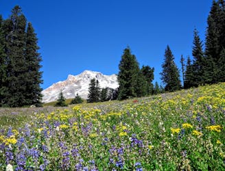
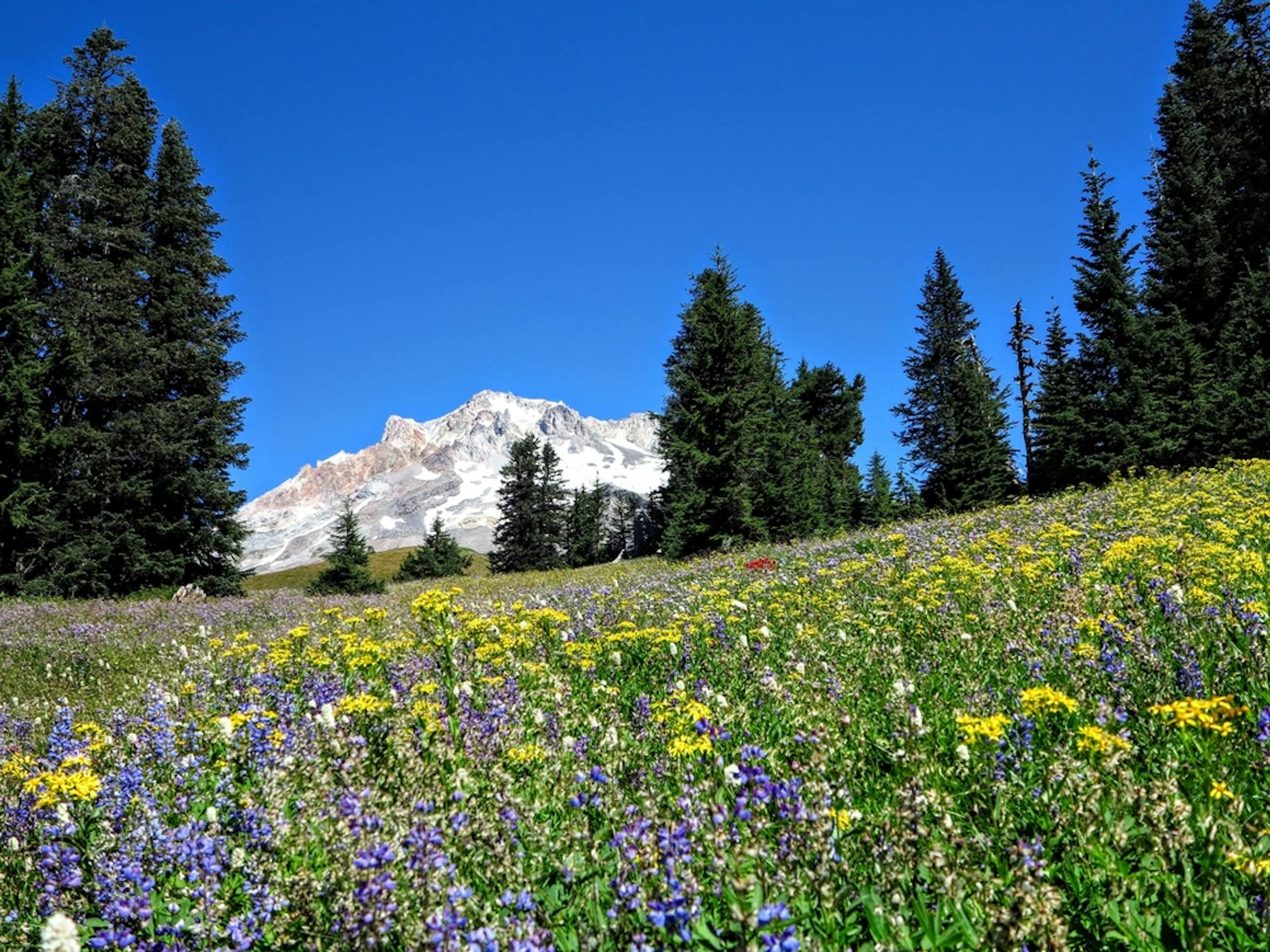
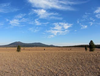
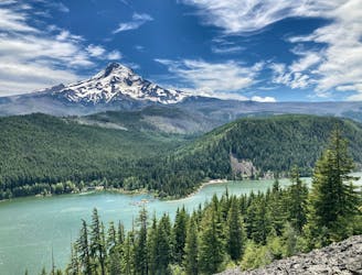
Miles 2091.7-2114.2 of the northbound PCT: Climbing on the flanks of Mount Hood, to sweeping views over Oregon and up to the mountain’s icy crown.
Difficult Hiking
- Distance
- 34 km
- Ascent
- 1.5 km
- Descent
- 1.7 km
Go hiking in Oregon with curated guides of the best hikes across the region. With over 301 3D trail maps in FATMAP, you can easily discover and navigate the best trails in Oregon.
No matter what your next adventure has in store, you can find a guide on FATMAP to help you plan your next epic trip.
Get a top hiking trail recommendation in Oregon from one of our 57 guidebooks, or get inspired by the 301 local adventures uploaded by the FATMAP community. Start exploring now!
Miles 2091.7-2114.2 of the northbound PCT: Climbing on the flanks of Mount Hood, to sweeping views over Oregon and up to the mountain’s icy crown.
Difficult Hiking
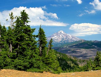
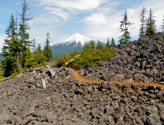
Miles 2045.6-2091.7 of the northbound PCT: Moving along the Cascade Crest from the shadow of Mount Jefferson to the foot of Mount Hood, the highest of Oregon’s volcanoes.
Moderate Hiking
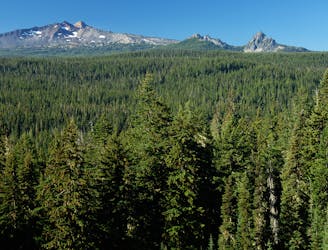
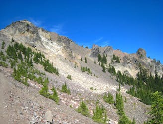
Miles 2000.9-2045.6 of the northbound PCT: Traversing the rugged slopes of Mount Jefferson and other volcanoes, through a wilderness shaped by ancient glaciers and recent wildfires.
Moderate Hiking
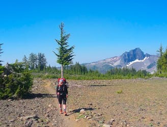
Miles 1983.8-2000.9 of the northbound PCT: Crossing plains of hardened lava plus a patchwork of forest near the base of Mount Washington, and surpassing Mile 2000 of the walk from Mexico to Canada.
Moderate Hiking
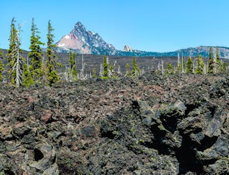
Miles 1952.6-1983.8 of the northbound PCT: Out of the woods and into a mosaic of black and green, crossing volcanic plateaus and lava flows at the feet of the Three Sisters.
Moderate Hiking
Miles 1907.9-1952.6 of the northbound PCT: Traveling expansive old-growth forest on a land of ancient volcanism, entering the Three Sisters Wilderness.
Moderate Hiking
Miles 1890.7-1907.9 of the northbound PCT: Continuing Oregon Section D around the base of Diamond Peak, through a wilderness of deep woods and hidden lakes.
Moderate Hiking
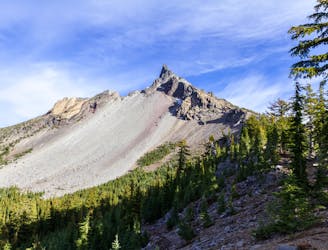
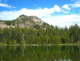
Miles 1847.8-1890.7 of the northbound PCT: Beginning OR Section D in the Mount Thielsen Wilderness, and cresting the highest point of the PCT in Oregon and Washington.
Moderate Hiking
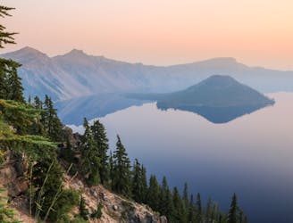
A popular detour from the PCT in Crater Lake National Park, tracing the edge of the caldera for astounding views over the lake.
Moderate Hiking
An alternative that skips some of the “Oregon Desert” expanse of the PCT, where water is scarce for nearly 20 miles.
Moderate Hiking
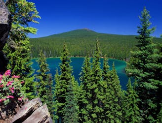
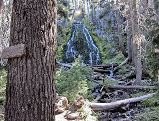
A very tempting deviation from the PCT to camp beside forest lakes, for a change in scenery and reliable water in late summer.
Moderate Hiking
Miles 1820.9-1847.8 of the northbound PCT: Weaving through the volcanic landscape of Crater Lake National Park, but bypassing the namesake attraction itself.
Moderate Hiking
Miles 1773.4-1820.9 of the northbound PCT: Threading between wooded lakes among volcanic hills, then crossing a long expanse of dry forest on the way into Crater Lake National Park.
Moderate Hiking
Miles 1742.7-1773.4 of the northbound PCT: Following the Cascade Crest farther into Oregon, through deep conifer forest and over beds of ancient lava.
Moderate Hiking
Miles 1718.9-1742.7 of the northbound PCT: Beginning the ranges of Oregon with a climb and a ridgewalk, among fragrant forest and meadows plus a giant tower of basalt.
Moderate Hiking
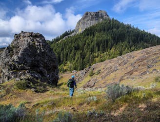
Gain otherworldly views of Mount Hood from this ridge above Laurance Lake.
Difficult Hiking